
This roundup covers the main updates delivered between May and July 2026 across NextGIS Web, NextGIS Connect, NextGIS Mobile, NextGIS Collector, NextGIS GeoServices, and NextGIS Toolbox.
NextGIS Web is a powerful server for storing, managing, and publishing geospatial data. It includes built-in web maps, permission management, a data version control system, QGIS team work infrastructure and many other features.
Web maps can now be modified without leaving the viewer.
A new configuration panel allows users with the necessary permissions to adjust a map directly in display mode. You can add layers, change the basemap, enable editing, and modify other map settings while seeing the result immediately.
This removes the repeated switch between the public-facing map and its administration page. It is particularly useful when preparing a map interactively, testing different layer combinations, or making small adjustments during a meeting or demonstration.
Individual layers can also be managed through their context menu. Depending on the layer and the user’s permissions, it is possible to remove it from the map, edit its properties, update its style, configure filtering, or open its attribute table.
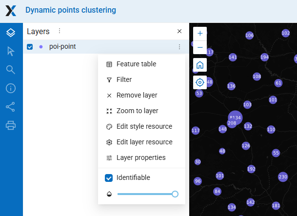
The result is a more direct workflow: open the map, make the required adjustment, and continue working in the same interface.
As a Web GIS grows, finding the right resource becomes just as important as publishing it.
The resource search page supports combinations of several properties, including:
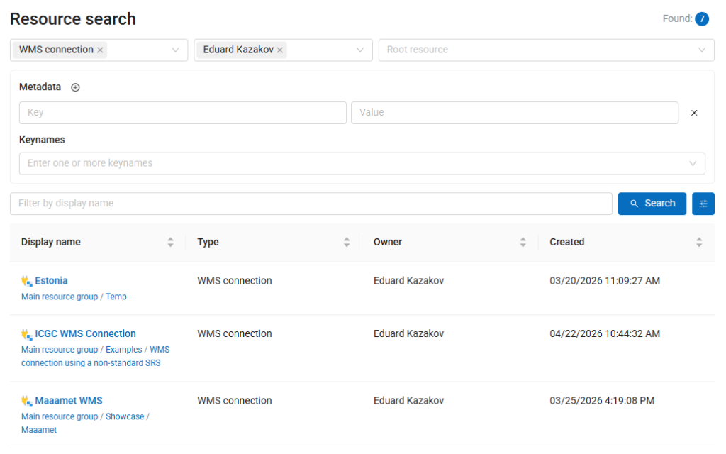
Search parameters are preserved in the URL. This means that a configured search can be bookmarked, sent to a colleague, inserted into documentation, or used as a card in a Gallery.
NextGIS Web cloud instances now include an AI assistant in the feature filter builder.
Users can describe the required features in natural language:
- Residential buildings constructed before 1980 with more than five floors.
- Roads inspected more than three years ago and marked as being in poor condition.
- Features without a name or inspection date.
The assistant converts the request into a regular NextGIS Web filter composed of fields, operators, values, and condition groups.
Previously, creating an empty vector layer and configuring its attribute structure were separate operations.
Users can now define fields directly in the vector layer creation dialog. For each field, you can specify its name, display name, and data type before the layer is created.
This makes the workflow more natural:
There is no longer a need to create an incomplete layer first and then open another page to configure its structure.
Vector layer fields can now be marked as required.
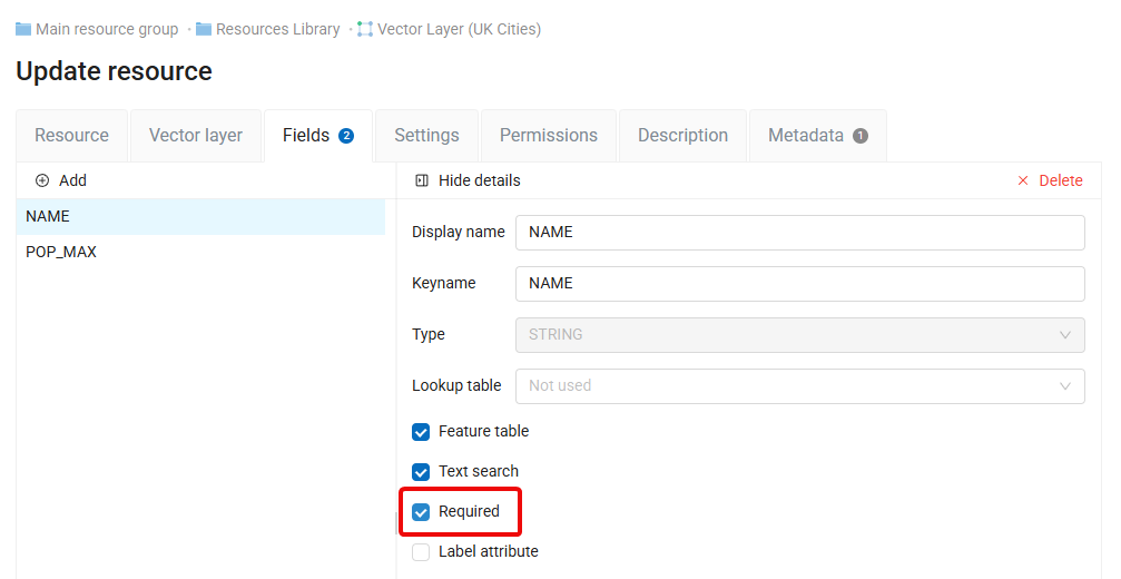
When a required field is enabled, users cannot create a feature without entering a value. This helps enforce basic data quality rules directly at the layer level.
NextGIS Web can now create, store, and edit vector layers without geometry.
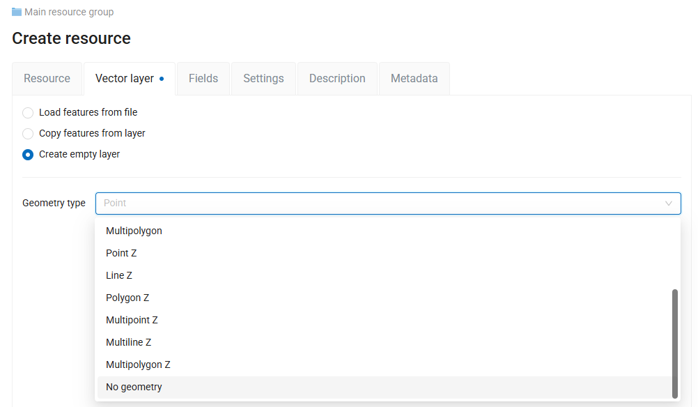
Despite the resource name, these layers function as non-spatial tables. They contain attributes and records but no point, line, or polygon geometry.
This is useful for information that belongs in the same managed data environment as spatial layers but does not itself have a geographic location, including:
No-geometry layers can be managed through the familiar resource, permission, table, and API mechanisms of NextGIS Web. This reduces the need to maintain supporting tables in separate spreadsheets or external systems.
Importing lookup tables from CSV now includes a preview and column-mapping step.
Before completing the import, users can inspect how the file has been interpreted and specify which columns should be used for lookup keys and displayed values.
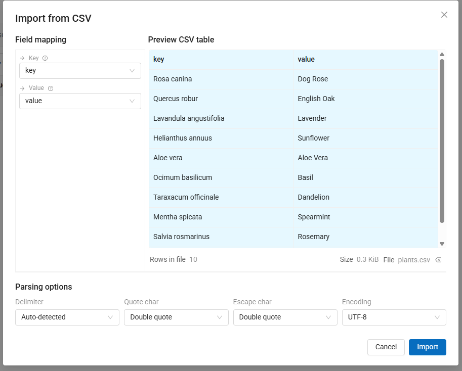
This makes CSV imports more predictable and reduces errors caused by unexpected column order, headings, separators, or automatically detected data structures.
NextGIS Connect is the QGIS plugin that connects desktop projects to NextGIS Web. It allows users to publish QGIS projects, open Web Maps as QGIS projects, edit server-hosted layers, synchronize changes, and manage Web GIS resources without leaving QGIS.
The summer updates focus on making these workflows clearer and easier to control.
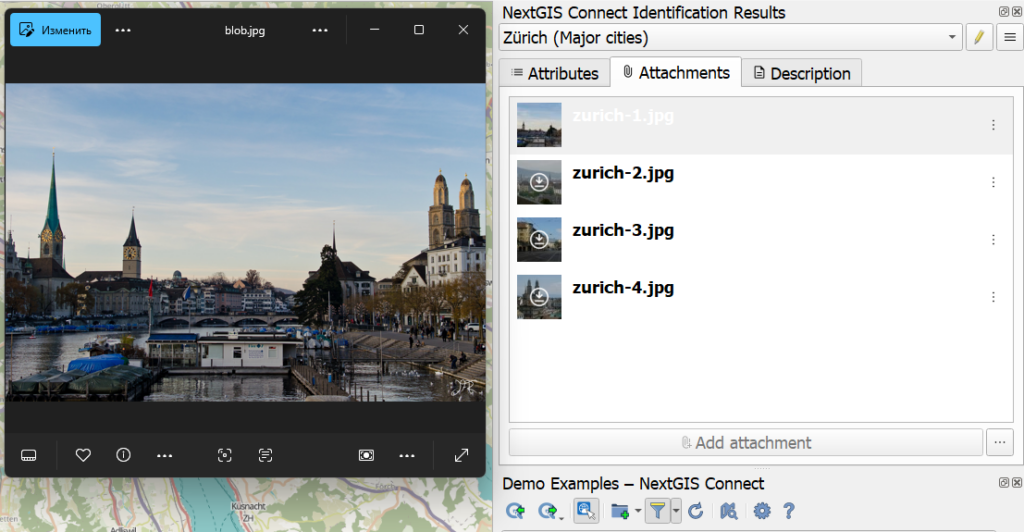
Users can now identify features from layers connected to NextGIS Web using the built-in NextGIS Connect tool. It provides full access to feature attachments, allowing users to add new files, delete existing ones, and download them for local use. This enables complete management of files associated with geospatial features directly from QGIS.
The objective is to keep attachments associated with their features when data moves between QGIS and NextGIS Web, regardless of whether the file was originally added through a desktop, browser, or mobile workflow.
This is particularly important for inspection and field-data projects, where the geometry and attributes alone do not represent the complete record.
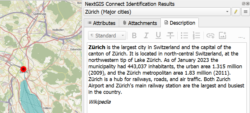
Feature descriptions management is also now available directly from QGIS.
The connection-management dialog has been redesigned to make existing Web GIS connections easier to understand and configure.
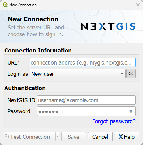
Creating the first connection is also more direct: it can be initiated from the main NextGIS Connect panel instead of requiring users to find the full settings dialog first.
Clearer authentication messages and a direct password-reset link help users resolve common sign-in problems.
Operations that connect large Web Maps or resource groups may involve many layers, styles, and supporting resources.
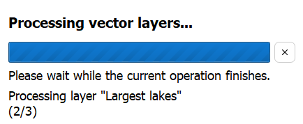
These tasks can now be cancelled while they are running. Users are no longer forced to wait for an unnecessary or mistakenly started operation to finish before continuing their work.
Before deleting resources, NextGIS Connect now presents a confirmation dialog showing what will be removed.
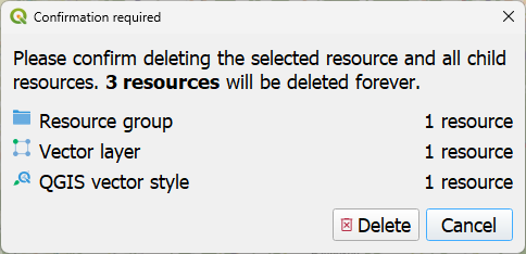
This is especially important in NextGIS Web’s hierarchical resource model, where deleting a group or parent resource may also affect layers, styles, services, forms, and Web Maps stored below it.
The additional confirmation makes destructive operations more transparent and helps prevent accidental deletion of related resources.
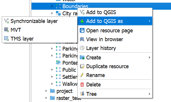
It is now possible to choose how a resource is added to QGIS.
We have officially released NextGIS GeoServices – on-premise basemap server that lets you publish raster and vector tile maps from OpenStreetMap data, data stored in NextGIS Web, or by proxying third-party tile services.
Read the blog: https://nextgis.com/blog/nextgis-geoservices/
NextGIS Mobile is an Android application integrated with NextGIS Web, allowing users to create, collect, and edit spatial data in the field.
Users can now add layers from NextGIS Web instances by pasting a direct link to the resource, without creating a connection or navigating through the resource tree.
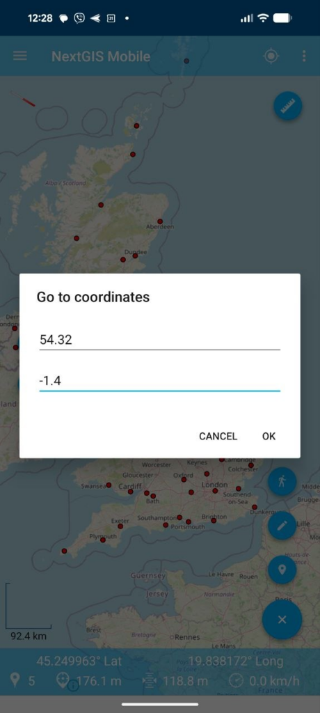
Users can now enter coordinates manually and zoom directly to the specified location. They can also create a new feature at the entered coordinates.
Local tilesets can now be stored in MBTiles format, in addition to NGRC.
NextGIS Collector is a mobile application integrated with NextGIS Web helping to organize field data collection with big teams
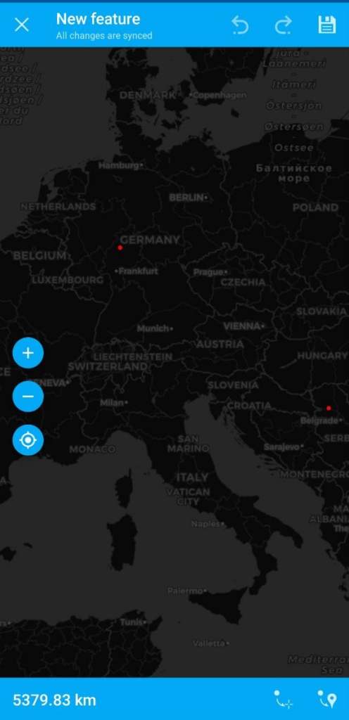
Map view is now runs much smoother and stable
NextGIS Toolbox is the ever-growing collection of tools for online geodata processing. Tools can be launched in a browser via a form or via an API.
Toolbox is available in the cloud for all users and can be deployed as an on-premise server.
New tools:


