
Artificial intelligence is rapidly entering geospatial software. It can classify imagery, extract objects, generate code, summarize documents, suggest processing workflows, and help analysts investigate unfamiliar datasets.
At the same time, spatial data infrastructures often support processes where transparency and accountability are essential.
Organizations need to understand which data is being used, where it came from, how it is stored, who can access it, how it is processed, how the resulting information is published. These questions should not disappear behind an AI interface.
NextGIS Web is an open-source Web GIS server designed for building reliable and sustainable spatial data infrastructures. It provides tools for storing geospatial data, publishing web maps and services, managing permissions, maintaining data history, and organizing collaborative work with QGIS.
The system is deliberately built around explicit data models, configurable permissions, inspectable operations, and human control. Our approach to AI follows the same principle: use it where it can make work easier, but keep the underlying operation visible and understandable.
We have added an AI assistant to the filter builder in NextGIS Web. The feature is now available in NextGIS Web cloud instances. Users now can describe the required selection in natural language.
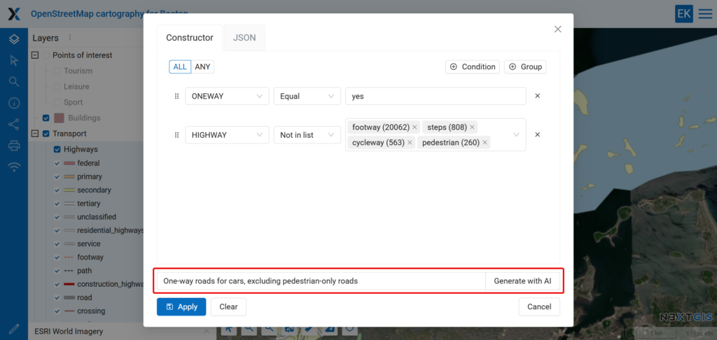
For example:
> One-way roads for cars, excluding pedestrian-only roads
The assistant examines the available layer fields and converts the request into a formal filter using the appropriate conditions.
Depending on the dataset, the resulting logic might be equivalent to:
(ONEWAY Equal YES) AND (HIGHWAY Not in list [footway, steps, cycleway, pedestrian])
The AI helps formulate the query, while NextGIS Web performs the actual filtering.
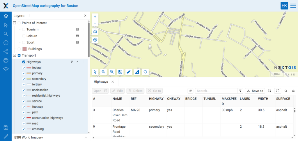
Building a simple filter manually is usually straightforward, but building a complex one can require significantly more attention.
Consider a request such as:
> Show large electronics stores or supermarkets that are open 24 hours and have parking.
This query contains several types of logic:
Creating this filter manually requires selecting the correct attributes, choosing operators, creating condition groups, and configuring the relationships between them.
The AI assistant can generate this initial structure from a single sentence. The user can then verify whether the selected fields and values match the dataset.
This is especially useful when:
AND and OR conditions must be combinedThere are predictable requests that directly correspond to layer attributes:
> Buildings constructed before 1950.
> Roads longer than five kilometres.
> Settlements with more than 100,000 residents.
> Features where the inspection date is missing.
These queries have relatively clear interpretations if the necessary fields exist.
More interesting results appear when the request is less formal.
Imagine a POI layer containing categories such as restaurants, cafes, bars, theatres, museums, parks, sports facilities, and shops.
You might start with:
> Places to go out with my wife.
Then change the request to:
> Places to go out with a GIS software developer friend.
The assistant now has to interpret what kinds of places might fit each situation and connect those interpretations to the categories available in the dataset.
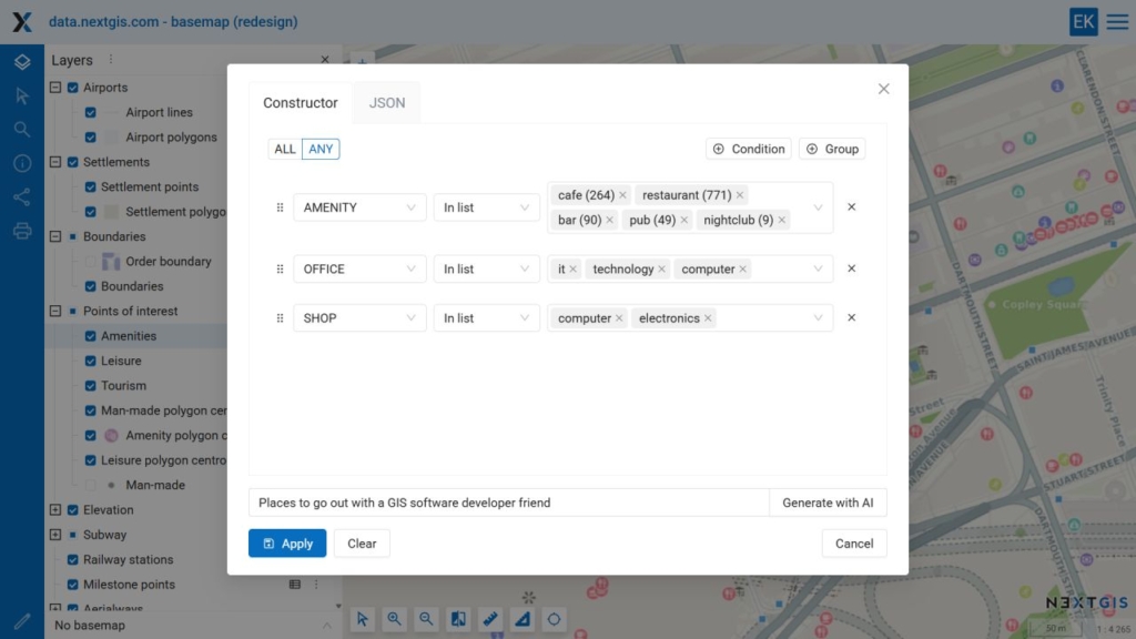
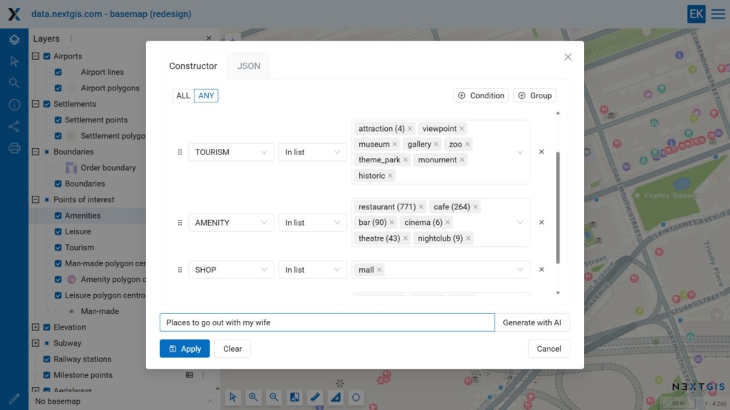
A restaurant, theatre, or park might be selected for the first query. A map shop, science museum, technology centre, or perhaps a bar might appear in the second.
These results should not be treated as objective classifications, but they reflect probabilistic associations learned by the language model and the way those associations correspond to the available data fields.
Here are several ideas for testing the assistant with your own layers.
> Features without a name or classification.
> Records that have coordinates but no inspection date.
> Buildings where the construction year is missing.
> Residential buildings constructed before 1980 with more than five floors.
> Large cities that are not regional capitals.
> Public transport stops near educational institutions.
> Roads inspected more than three years ago and marked as being in poor condition.
> Facilities requiring maintenance this year.
> Pipelines with an unknown installation date.
> Protected areas larger than 1,000 hectares.
> Monitoring stations with missing observations from the current year.
> Sites where pollution levels exceed the permitted value.
> Places suitable for working with a laptop.
> Family-friendly activities for a rainy day.
> Places a visiting cartographer might find interesting.
> Somewhere to celebrate the successful deployment of a Web GIS.
The AI filter assistant performs a relatively narrow task: it translates a natural-language request into a structured filter. It removes some of the routine work involved in dataset exploration while preserving the existing NextGIS Web data model and keeping the result under user control.
At the same time, the feature creates an interesting environment for experimentation. Users can investigate not only their spatial data, but also how a language model understands categories, relationships, context, and ambiguous human requests.
We see this as a practical way to introduce AI into Web GIS: start with a clearly defined task, expose the result, let users verify it, and avoid replacing transparent operations with an opaque automated process.
The assistant is available now in NextGIS Web cloud instances.


