
GIS technologies simplify the energy company’s job. With the help of GIS, specialists decide where it’s best to place new poles or substations and in which way it’s more convenient to connect a new facility. GIS is also used to monitor the condition of networks and determine the location of a power facility’s damage in order to reduce the time to restore power supply to consumers in emergency situations. Quick access to complete information about the territory saves time – employees don’t need to assess the area repeatedly.
The Siberian-Ural Energy Company (SUENСO) merged with JSC Kurganenergo in 2017. Prior to the merger, the companies used different software to work with geodata. After the merge, a decision was made to use a unified geographic information system – NextGIS.
The single ecosystem includes components for collecting, processing, publishing and reading geodata. SUENCO identified the following advantages of NextGIS:
The geographic information system for SUENCO was set up using NextGIS Web server. To import geodata from other GIS, companies mostly use the MIF/MID exchange format. In this format, the data is exported from GIS InGeo, MapInfo, ZuluGIS for further processing and uploading into Web GIS.
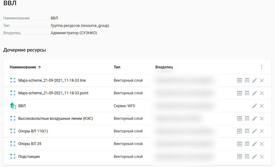
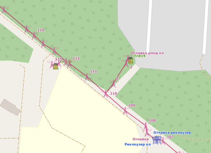
Overhead and cable power lines and poles are inserted into the SUENCO cloud GIS. Distribution networks and substations have also been added. Communication lines that are located at SUENCO facilities are displayed.
SUENCO’s departments that need quick access to geodata work with NextGIS Web:
Some employees need geodata only for viewing. Since the GIS for SUENCO operates on the server, it can be operated through a browser. That is, to view the map, employees do not need to install special software.
When SUENCO receives a request for information on the placement of fiber-optic communication lines, the company is obliged to provide it. Thanks to the web interface, information can be displayed on a web map, and a link can be sent in response to a request.
To create and edit geodata in SUENCO, desktop NextGIS QGIS is used. The program has all the necessary tools for working with geodata.
NextGIS QGIS is used by the company’s IT service. Department employees process geodata before uploading it to NextGIS Web. If the data, published in Web GIS, needs to be edited, it’s first imported into the desktop GIS. This is done through the Connect module in NextGIS QGIS. When the data is edited, the operator publishes the edits to Web GIS via Connect.
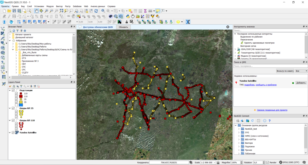
Data imported into NextGIS QGIS can be saved locally in any common GIS format. This allows you to export data to other systems.
With the help of a multifunctional layout designer in the desktop program, the company’s employees prepare maps for printing.
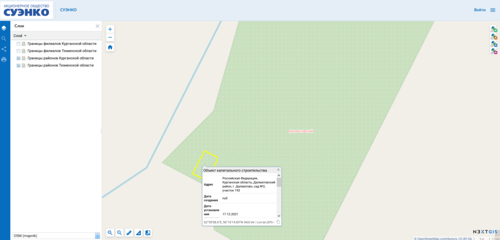
Tasks related to cadastre (Rosreestr) data are solved using Rosreestr Tools. The Rosreestr Tools module in SUENCO is used in the technological connection department, when they plan to lay new networks. Using the module, employees receive cadastral data on land plots and apply them on their own geodata regarding energy infrastructure facilities. This makes it possible to find the best options for connecting new subscribers.
“Thanks to the work of NextGIS, our employees now can immediately see on the map where the object that needs to be connected is located. They look at what land plots are there, what restrictions are there, where the nearest connection points are and how loaded they are. They decide whether it is still possible to connect subscribers there or whether it will have to be reconstructed, ” says Evgeny Ivshin, head of the specialized systems support department at SUENCO JSC.
The integration of the NextGIS platform and 1C allows to give access to cartographic information directly from 1C. Integration speeds up the processing of applications for technological connection to networks, since specialized departments can receive cadastral data on land plots directly from subscriber’s information cards.
Thus, specialists can immediately find the nearest connection points and work out the route for line laying. This makes it possible to quickly estimate the cost and timing of connection work.
Any mention of the cadastral number of the plot in the 1C card turns into a hyperlink. The hyperlink allows you to immediately switch to a map that includes the contour of this section and full information about SUENCO’s own infrastructure.
NextGIS Mobile is a mobile application for Android. SUENСO will start using it in the summer of 2022. Previously, in test mode, employees have already tried to collect data using smartphones. When bypassing substations, transformers, lines and power transmission line supports, it is convenient for experts to record the state of objects in real time.
The integration of all NextGIS components and programs into a single platform has a positive effect on the internal logistics of an enterprise. Working within a single complex optimizes work processes, saves time for employees and customers of the company.
The company’s 10 years of experience in developing its software ensures a high quality of technical support capable of solving the most complex problems.
Another key selection criteria for NextGIS is the ability to completely replace analogues such as ESRI ArcGIS, Mapinfo. NextGIS has been successfully implemented in state, commercial and non-profit organizations and local governments.
Contact us for details
Contact


