
Release date: 2026-07-27
NextGIS Web Community Edition is an open source, officially supported Docker image that lets any team deploy a fully functional NextGIS Web instance on their own infrastructure.
Version 26.07.0 has been released. Check out the visual changelog.
Editing map configuration is now much easier. If a user has sufficient permissions, an Edit button appears in the web map’s left panel. Map settings open in a modal window, and changes are applied seamlessly.
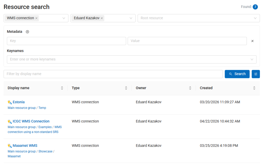
Advanced Search is now available, making it easier to explore your Web GIS resources. Filter resources by type, name, owner, location, and metadata values to quickly find exactly what you need. Search results can be saved and shared as URLs, including links from resource galleries or documentation pages. The feature helps large teams discover existing data faster and reduce manual browsing through the resource tree.
Read the blog | Watch the video
You can now use AI assistant to create complex filters based on natural language queries. To activate this functionality, administrator should set the following environment variables for NGW CE:
Users can now define the field structure when creating a new vector layer, rather than configuring it separately afterwards.
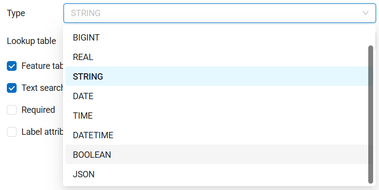
Vector layers now support a new Boolean field type for storing True/False values, and JSON field type for storing complex data structures.
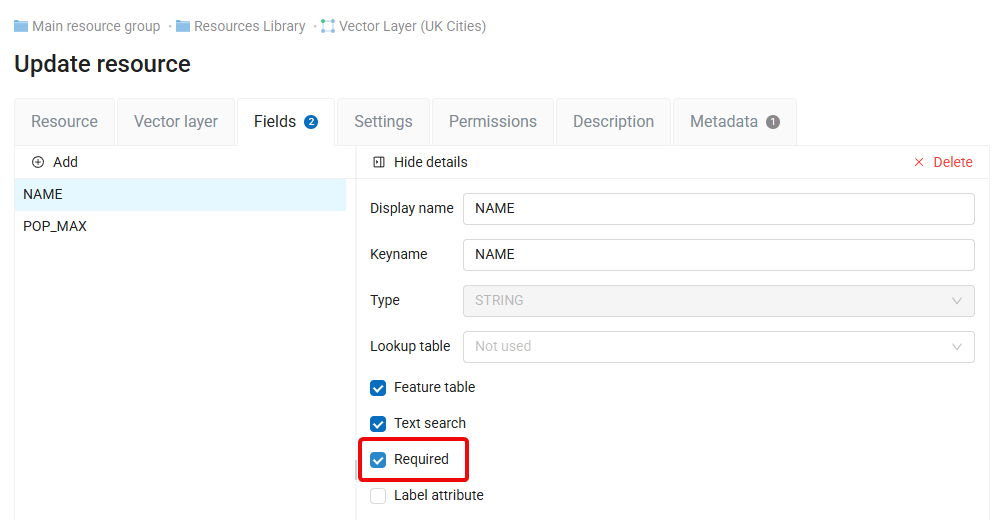
Fields marked as “Required” prevent users from creating new features without entering a value in the corresponding field.
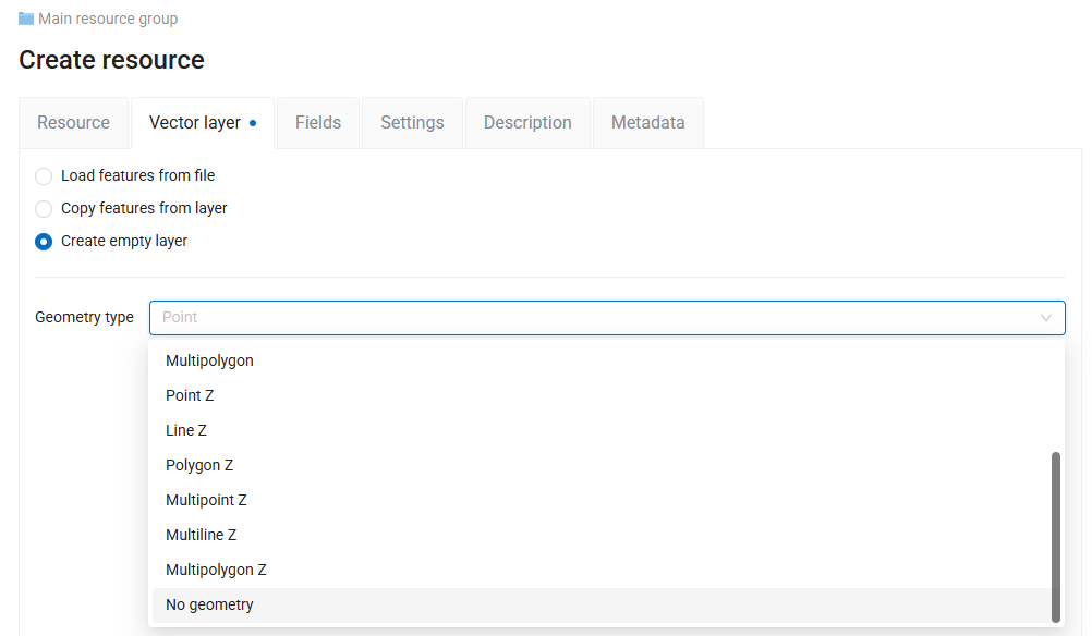
You can now create, store, and edit vector layers without geometry, making it possible to manage non-spatial tables for various purposes in NextGIS Web.
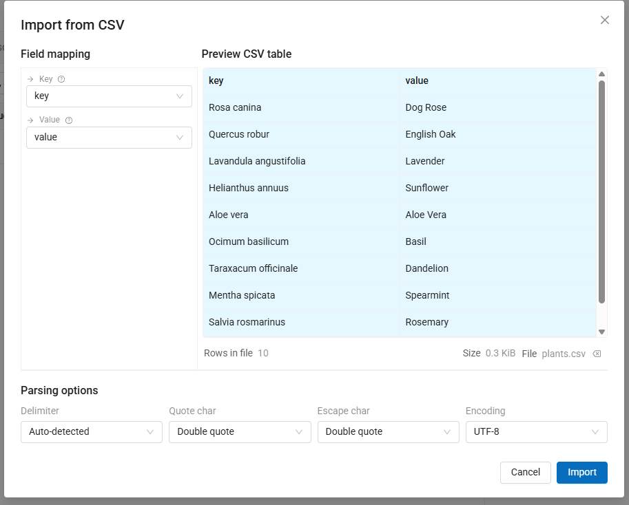
When importing CSV files (for example, to create lookup tables), an advanced import dialog is now available, allowing users to configure the process in detail.
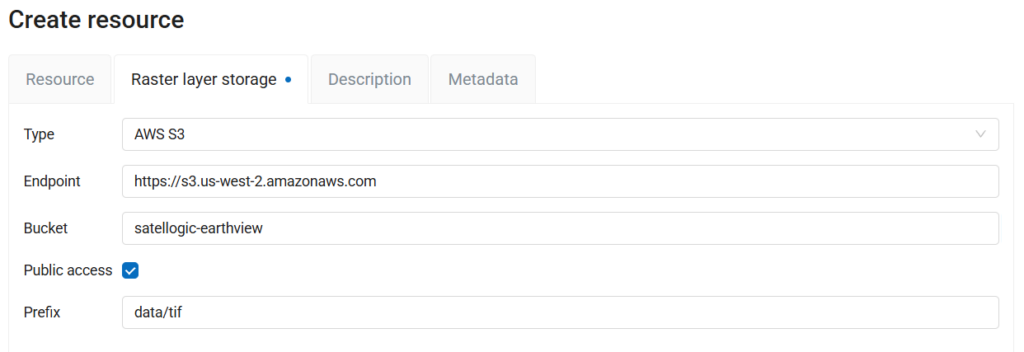
It is now possible to use rasters from public S3 buckets without need to specify access and secret keys.
When previewing raster layer resources, users can now configure band behaviour or select a specific band for non-RGB(A) datasets.
Need advanced features, professional deployment assistance, or technical support for NextGIS Web?
Consider our cloud or on-premises solutions.


