
QGIS grows through the work of a worldwide community of developers, users, researchers, and companies. NextGIS has been part of that community for many years. Our team started as a group of QGIS enthusiasts, and that connection continues to shape what we build: contributions to QGIS itself, widely used plugins, and open-source infrastructure that helps organizations work together around QGIS.
Plugin development is one of the most visible ways NextGIS contributes to QGIS. With more than 30 plugins, our work spans everyday mapping tasks, specialized analysis, and tools for developers.
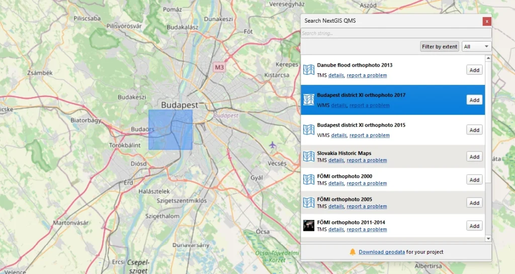
The best-known example is QuickMapServices, with more than 12 million downloads. For many users, adding a basemap through QMS is one of their first steps in QGIS. Behind that simple action is an open catalog of geospatial services, maintained by NextGIS and enriched by community contributions. The plugin connects users to this shared resource directly from their desktop.
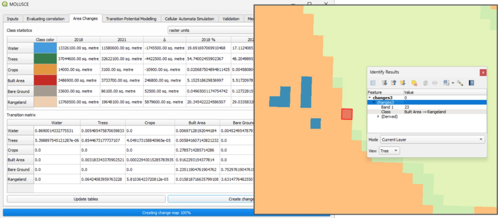
MOLUSCE serves a different purpose: analyzing and modeling land-use change. It brings methods for exploring landscape changes and simulating future scenarios into QGIS, supporting research and practical planning.
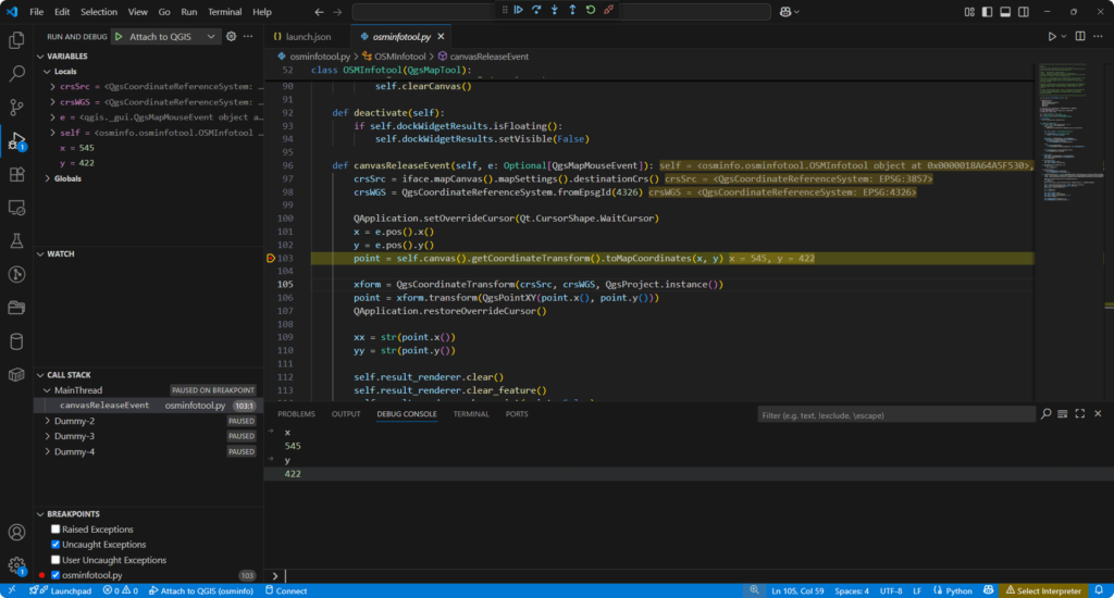
We also build tools for fellow developers. QGIS DevTools connects QGIS to development environments such as Visual Studio Code, allowing plugin authors to set breakpoints, inspect variables, and step through Python code while it runs inside QGIS. Learn more in the article QGIS 4 is Here. Plugin Developers Have Two Things to Fix.
Together, these plugins illustrate the range of contributions possible within the QGIS ecosystem, from making routine tasks easier to opening up specialized analytical workflows and streamlining plugin development.
Our involvement also extends to QGIS core development. NextGIS developers have contributed directly to the software, with work that becomes available to the wider QGIS community. These contributions are less immediately associated with our name than a plugin, but they are an important part of our relationship with the project.
For many years, NextGIS also supported QGIS financially as a project donor and sustaining member. Financial support complements development work: it helps the project maintain infrastructure, fund development, and bring contributors together. A healthy open-source project needs both code and the resources to sustain the people and processes behind it.
QGIS is also central to the ecosystem we build at NextGIS. As organizations move from individual desktop projects to shared workflows, they need a place to store data, manage access, coordinate edits, and publish results.
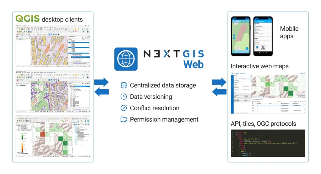
NextGIS Web, our open-source Web GIS server, provides that shared environment. NextGIS Connect links it directly to QGIS, allowing users to publish projects, access shared layers, edit data with familiar QGIS tools, synchronize changes, and resolve editing conflicts. This lets teams keep QGIS at the center of their work while adding the server infrastructure needed for collaboration.
Organizations can deploy NextGIS Web on their own infrastructure or use a hosted instance. That flexibility gives QGIS teams a practical path from local desktop work to a shared GIS environment.
Cloud | On-premise | Community Edition
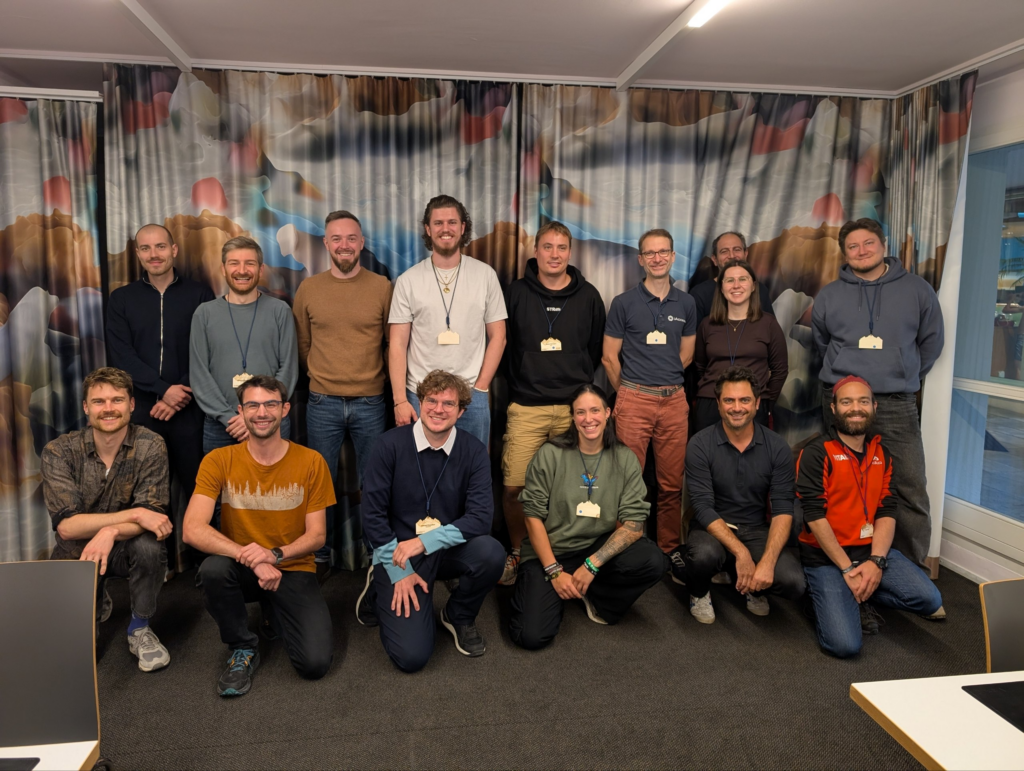
Community events are another important part of this relationship. At the QGIS User Conference 2026 in LAAX, Switzerland, we presented collaborative QGIS workflows and ran a practical workshop with 27 participants from 11 countries.
Participants worked through setting up NextGIS Web, connecting it to QGIS, and editing shared data. Their questions and experiences gave us valuable feedback on how these workflows fit into different organizations. We also made the workshop materials publicly available so others could explore the same approach.
We contribute resources as well, including maps shared through the QGIS Resource Hub. Sharing finished maps helps demonstrate QGIS’s cartographic capabilities and gives other users ideas for their own work.
Our role in the QGIS community connects all these activities: contributing to the software, maintaining useful plugins, supporting the project, sharing knowledge, and building tools that help more people adopt QGIS. As our own platform develops, QGIS remains central to that work, and contributing back remains part of how we build.
Contact us if you work with QGIS and want more.


