Our Web GIS server NextGIS Web has received dozens of updates over the last month and we’d like highlight the most exciting ones! All of these are already available in the cloud, where you can start using Web GIS right away or on-premise.
Quickly find the resource you need by its name: just start typing the part of the name (not necessarily the first letters)! The search is case-insensitive.
See layer data or style without creating a web map. All vector layers and styles for vector and raster layers now have a “Preview” button. Helps overview your data and quickly share direct links to the visualizations of a separate layer.
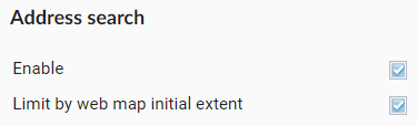
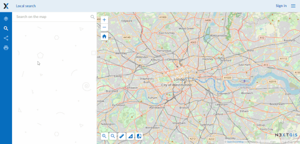
Address search works on all NextGIS Web maps, adding found addresses to the search results. This functionality may however get in the way: addresses that are not associated with user data may not be needed at all, or they may be needed only within the scope of the web map.
Both of these scenarios are now under your control: in the control panel you can disable address search or limit it to the initial coverage of a specific web map.
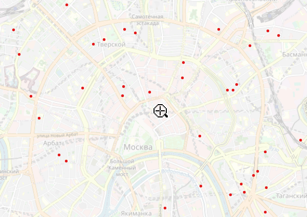
As an example, search for Spencer street without constraints. There are way too many hits, and many of them may not be relevant to out current work at all:
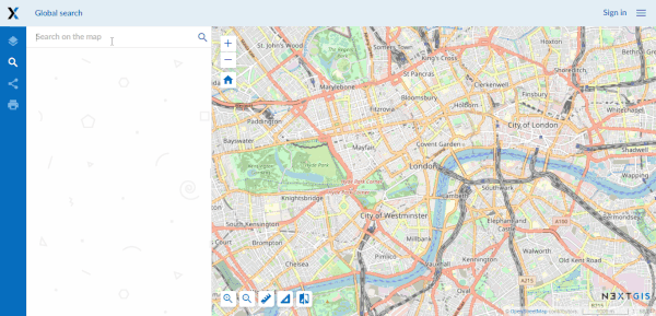
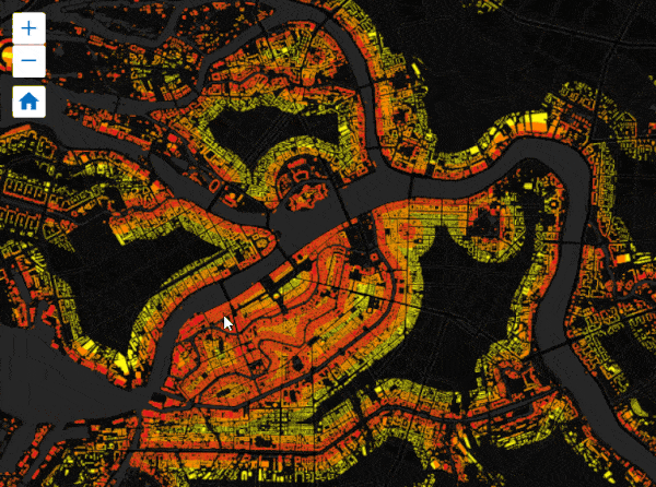
Turn on initial extent constraint and have no problems finding the street that we actually need:
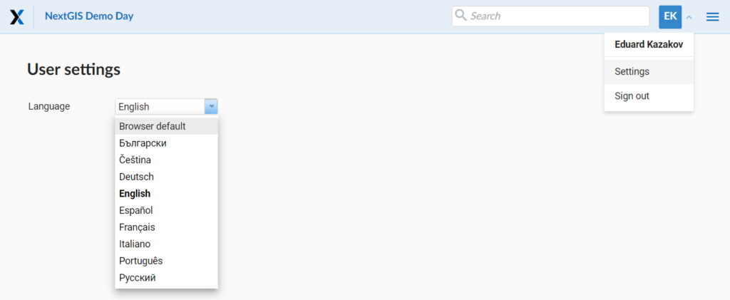
There are now 9 interface languages available in NextGIS Web, and their number is growing (thanks to the new translation mechanism). If it didn’t happen automatically you can select the interface language at the user settings panel. The default setting is to use the user’s browser language.
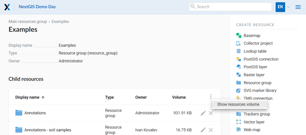
Now you can explore how much disk space is occupied by individual resources and their groups, as well as assess the overall state of the storage. To get information about the disk space occupied by resources, click on the “Show resources volume” button:
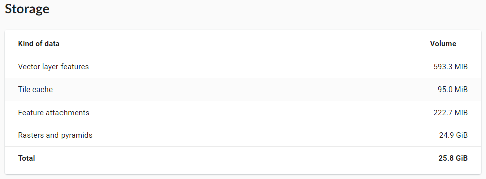
To assess the overall storage you need to go to the Control Panel, the “Storage” section:
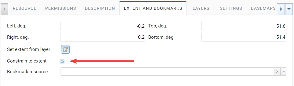
When creating a map, you can prevent users to go outside of the default extent. With this feature users will be able to move and scale only inside the map. This setting is managed on the “Extent and Bookmarks” tab of the web map resource:
Select more units of length and area measurement at “Web map settings” section of the control panel. When selecting a auto-mode (for example “Sq. meters/kilometers (auto), the units of measurement will be selected automatically based on the length or area of the object being measured.
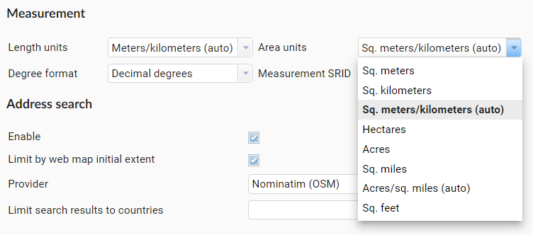 Here is an example of map behavior when choosing “Acres/sq. miles (auto)”. For small areas, acres are selected, and sq. miles for large ones:
The tile cache, configurable in NextGIS Web for any layers, has become faster, which allows you to efficiently display even complex data from tens of thousands to millions of features. You can manage the tile cache settings in the properties of any style resource.
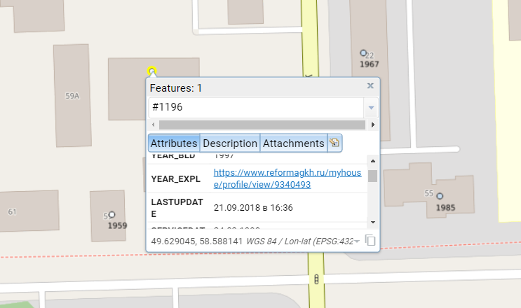
Hyperlinks and very long words without spaces in the feature attributes are now displayed correctly, with smooth hyphenation:
Zoom to a better extent from address search and bookmark panel, what improves the experience of using automatically selected extents.
Language auto-detection, now the Web GIS (by default) will adapt to the language of the user’s system.
User login now is case insensitive when logging in, and there will be no more confusion with user and User.
Automatic downsampling of a social preview image to 1600×630 pixels will help to avoid accidental loading of huge images.
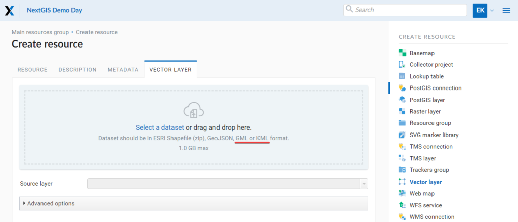
Better support for KML: LIBKML GDAL driver is used when available. LIBKML allows to preserve source data structure better.
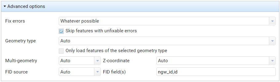
Layers with an “id” field can be loaded if the field has an integer type. Now there are fewer scenarios in which special preprocessing is required to load data via the web interface..
Information about available updates in the control panel – an indication of available updates has been added to the Web GIS on-premise. You can find it in the control panel, “System information” section.
Filtering features by ID in feature REST API – when working with Web GIS via the API, it is now possible to filter objects by their ID, which may be in demand by developers when building special interfaces on top of NextGIS Web.
We hope that you will enjoy the new features of NextGIS Web! We will continue to work on improving performance, developing functionality and fixing bugs.
You can start using NextGIS Web right now: in the cloud or on your own server.


