Our Web GIS had export functionality since the beginning and was capable to output vector data to CSV (Comma-separated values) and GeoJSON formats without any settings. Today we release new significantly improved export functionality. It is now available for all users of nextgis.com and NextGIS Web.
New formats and helpful extension files
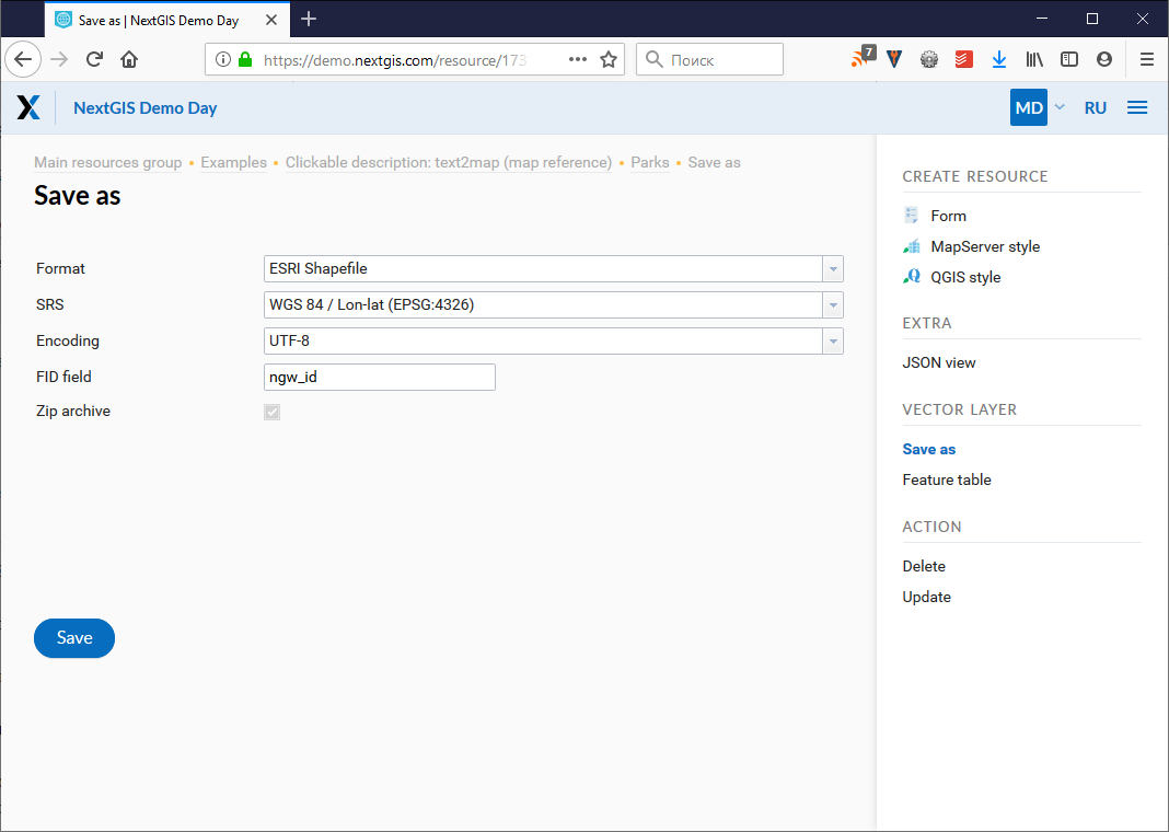
Besides CSV and GeoJSON you can now export to ESRI Shapefile, AutoCAD DXF and MapInfo TAB.
Depending on a format, additional file components are exported making further use of exported data more convenient. For example CSVT (field structure description) and PRJ (coordinate system description) are added to CSV and CPG (codepage) to ESRI Shape.
Choose output coordinate system
We’ve added a choice of output coordinate system. It is finally possible to output to 4326, not only 3857 as before.
Choose output id field name
New “FID field” is used for setting a field name to be added to a exported data where the object identifiers will be placed (the default is “ngw_id”).
Output encoding
You can choose among UTF-8, Windows-1251, Windows-1252 encoding for your data.
Export as compressed file
When output is ESRI Shapefile or MapInfo TAB the result will be a Zip file. For single-file formats (like GeoJSON or CSV) you can choose: download “as is” or compress to zip.
HTTP API
All export options are available through HTTP API.
For example, this will get you data in CSV format, EPSG:4326, UTF-8 encoding, zipped:
How to use new export
To use these new options simply go to a resource page (Vector or PostGIS layer) and choose “Save as” in the right panel.