The ability to create and manage custom spatial reference systems (SRS) is an important feature of GIS software. Until today, NextGIS Web and nextgis.com were using only Latitude-Longitude (EPSG: 4326) and Mercator (EPSG: 3857). Recent update makes it possible for a user to add other SRS.
How does it work
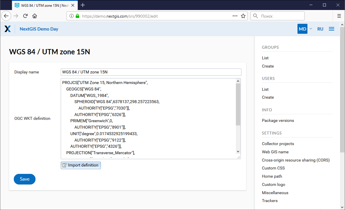
To add new SRS open Control panel of your Web GIS and click Create under Spatial reference systems section. Here you can set up the name and definition of SRS in OGC WKT format. Import definition from common formats such as PROJ, MapInfo or EPSG-code is also supported. While imported, definitions will get converted to OGC WKT. To be able to add and modify definitions user must have administrative privileges.
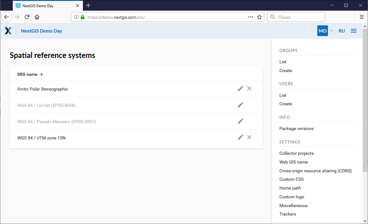
A list of available SRS is available under Control panel -> List. Two SRS in this list available by default are: “WGS 84 / Lon-lat (EPSG:4326)” and “WGS 84 / Pseudo-Mercator (EPSG:3857)”. These can’t be removed or edited (except name).
Using added SRS
The added SRS can be used for various purposes.
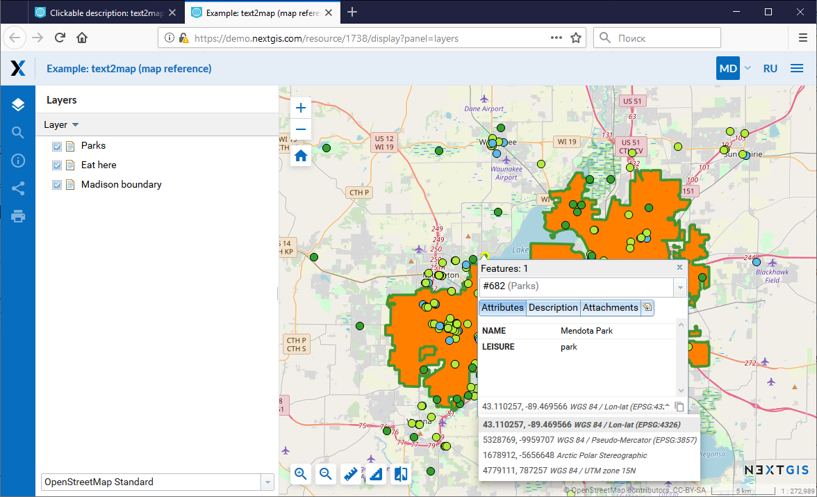
Capture coordinates on Web maps
If you have set up additional SRS (one or several), you can now conveniently capture coordinates in this SRS from anywhere on the map.
Measure length and area
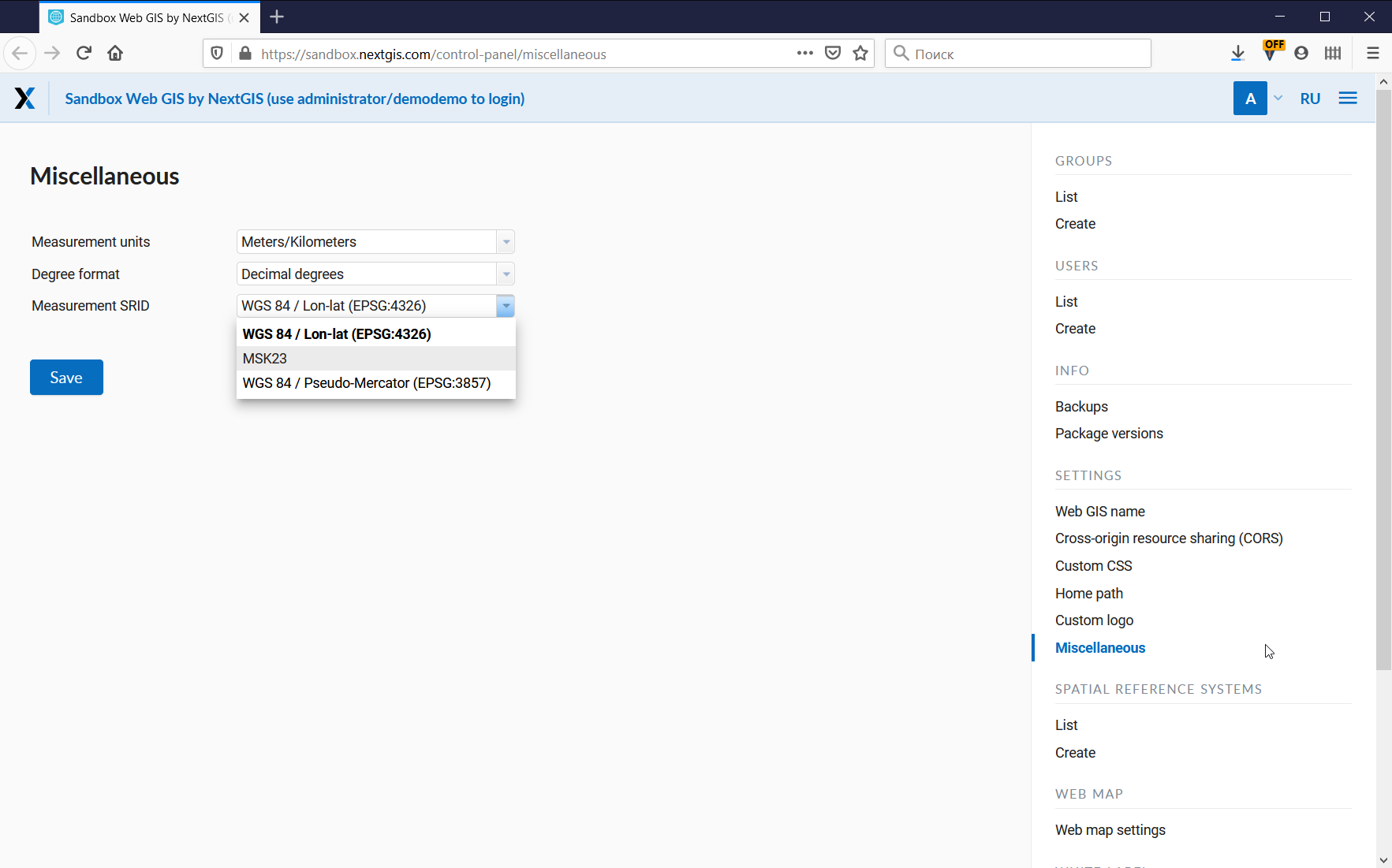
You can measure length and area using already set up SRS.
Choose existing SRS under: Control panel – Miscellaneous – Measurement SRID
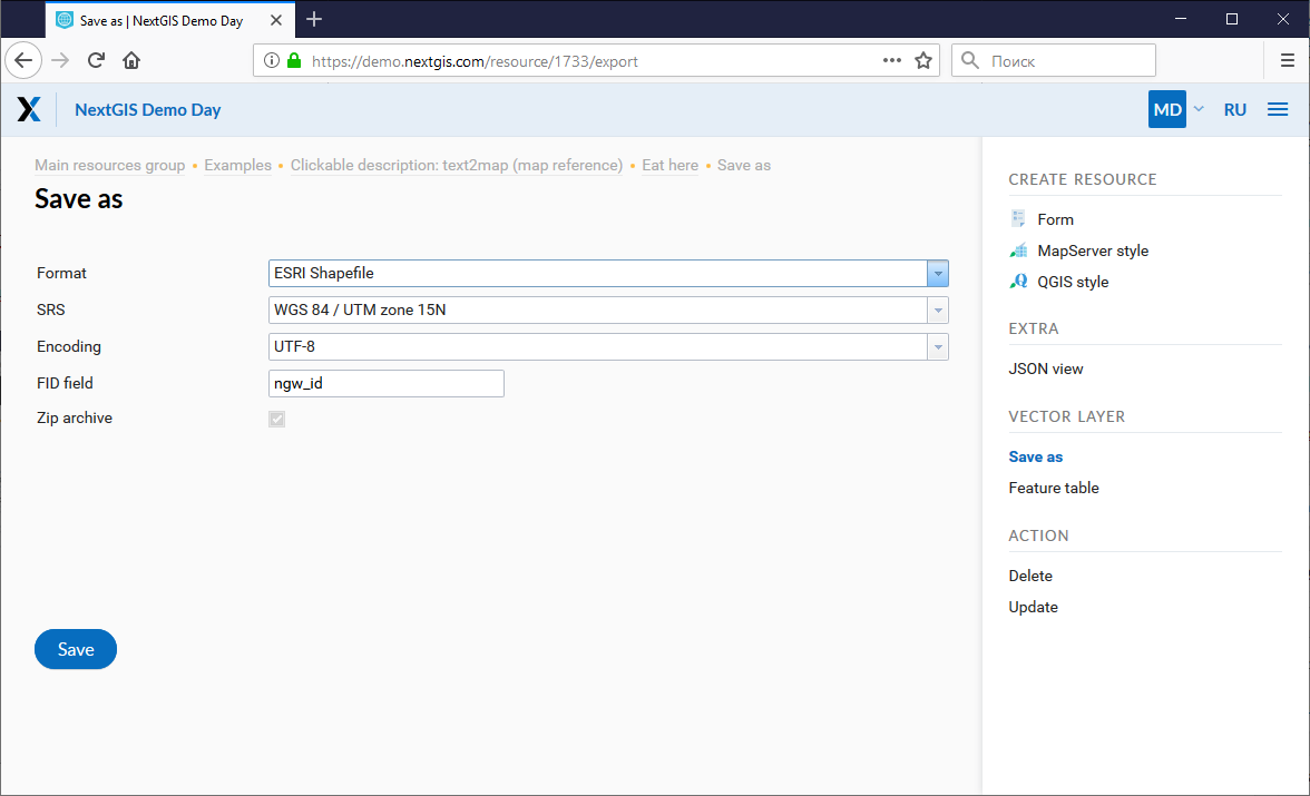
Export vector layers
All custom SRS are also available for data export.
Extend API requests
Support for custom SRS is gradually added to NextGIS Web API too. For example, this request will return a feature in a required SRS:
/api/resource/{id}/feature/{fid}?srs=990002
Custom SRS identifier (990002 in this example) can be learned by editing a created SRS, for example:
/srs/990002/edit
New custom SRS functionality is available on Premium and for our Corporate users.