If you deal with spatial data on paper sooner or later you will start thinking why don’t I just collect data right into database. We’ve built a highly customizable system that requires very little or no programming exactly for this purpose.
This article describes how this system operates using a specific example. The same steps can be applied and system can be implemented in many other cases that need data collection in the field.
Non-technical summary for our case study
Amur branch of WWF participates in tiger surveys on Russian Far East for many years and it would like to make surveys paperless. Paperless survey means that data are to be collected on smart devices using convenient forms and automatically uploaded to a central database thus reducing filling and digitization errors.
Technical description
Main steps are:
First 3 steps are typically done by project coordinator and the last two – by data collectors.
To get started, project coordinator decides what data needs to be collected. We can collect many datasets simultaneously, but let’s focus on one – tiger tracks – our primary interest for this project.
Next we will decide what attributes we want to be collected. For example, for tiger tracks we might be interested in:
After data structure is defined, we’ll create the template dataset, this can be done in any GIS, we use NextGIS QGIS. Essentially, this is an empty table to which we added fields for every attribute in our structure.
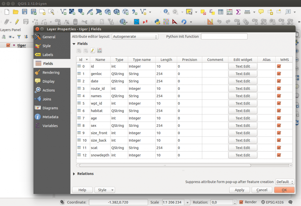
Note that there is no actual data in the dataset in this example. However, there is no problem if there is some. Your initial dataset can come with pre-existing data. You can modify it or leave it as it is.
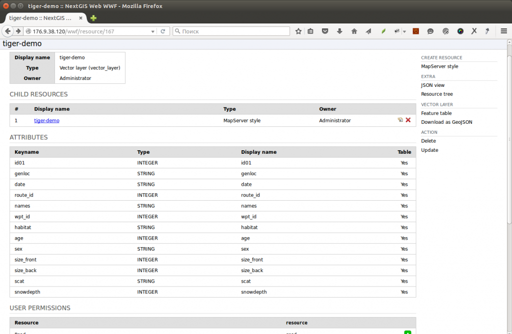
After we have our templates, we load them up into our central database.
We use NextGIS Web as our central database. It has a convenient control interface to upload data. An uploaded dataset automatically turns into a resource that can be collectively edited by many people.
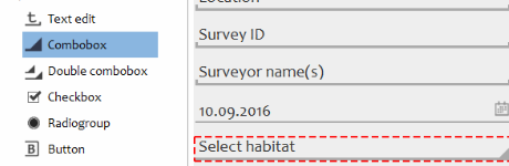
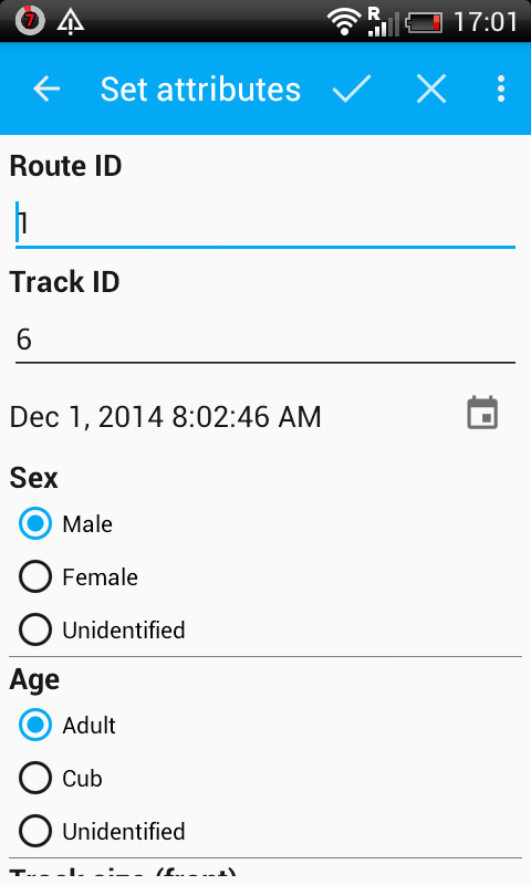
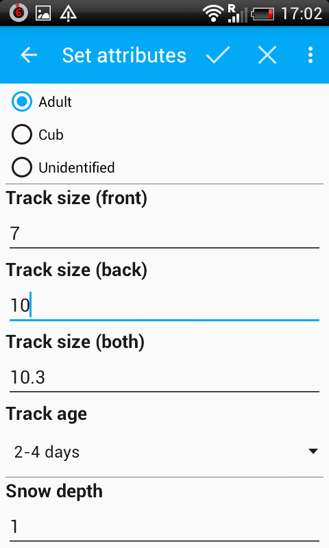
Nobody likes to fill in dull spreasheet, so our next step – create an easy-to-fill, human-readable form for our dataset. We will use NextGIS Formbuilder for this. NextGIS Formbuilder is a piece of software that creates user-friendly forms. Right now there are ten possible controls (text areas to enter to, comboboxes to choose from, buttons etc.).
Formbuilder can connect to the storage and pull down the structure thus having a list of fields to link form controls to. After laying out all the needed controls our form starts looking like this:
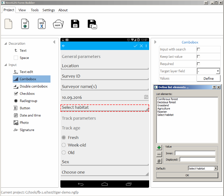
The beauty of our Formbuilder is that it doesn’t require any programming and it lets you preview the form as it will be shown on your smartphone or tablet.
Our next step is quite simple. You need to share your form-dataset with your data collectors. You can do it simply by uploading it to Dropbox or project website.
Finally, the last step is data collection itself. It is done using NextGIS Mobile. Anyone who wants to join data collection just needs to download form to the smarphone/tablet and open it in NextGIS Mobile. This app will recognize the form and show it the way you laid it out. Data collection can be started, collectors will go to the field, create new data points (or lines, or polygons) and populate it with necessary data. NextGIS Mobile will also recognize the credentials needed to upload collected data to the central storage. Even better, you won’t need to be connected to internet to collect data. Collected data will get synced with your storage automatically when internet connection will become available.
 |
 |
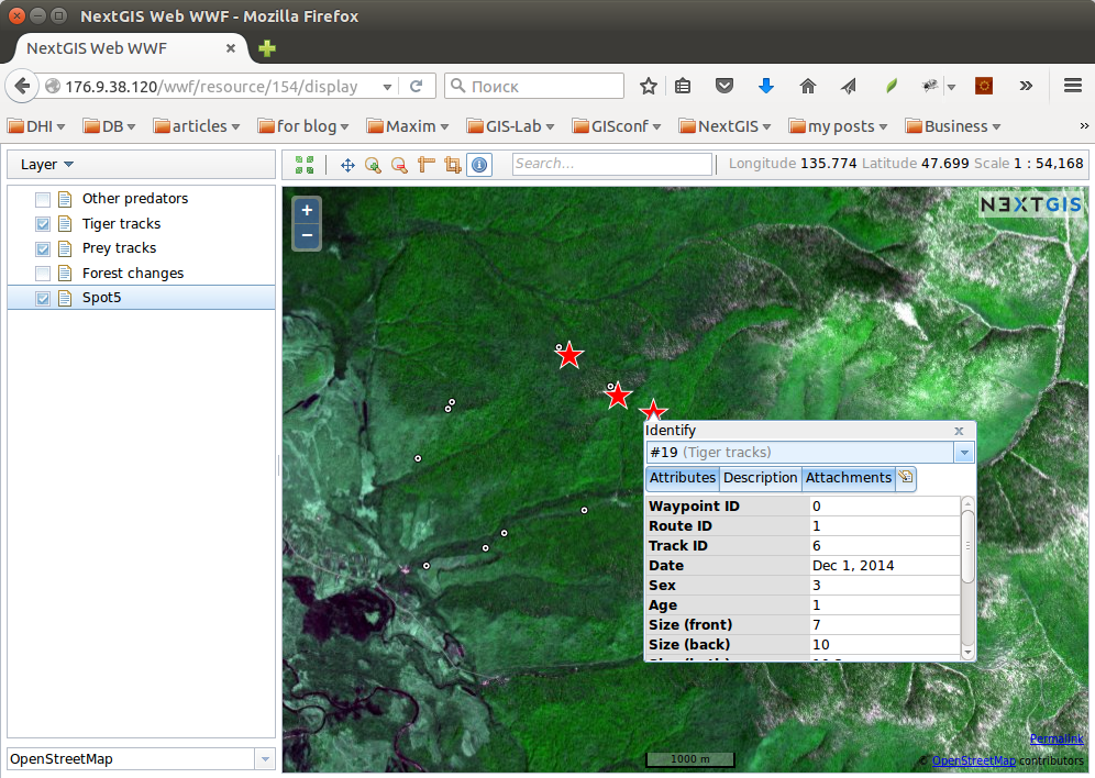
Project coordinator then will be able to download all collected data through NextGIS Web control interface. They can create a web map showing it all, download it as a spreadsheet or plug it into his favorite GIS application.
This project was supported by Amur branch of WWF Far Eastern branch. The experiment was considered successful and developed system will operate full scale during next survey.
Contact us if you need more details or help with getting your data collection project started.


