We’ve compiled a list of updates for NextGIS Web version 4.7.0.
Panoramas are linked to specific features on the Web Map. To upload or view a panorama, click on the object and go to the “Attachments” section in the identification window. Learn more
When working with your Web Maps, not only can you hide layers, but you can choose to hide specific layer elements – that is, legend items. Choosing to hide specific legend items allows you to declutter the map, making it more readable for the intended task.
Setting more precise permissions for team members will allow you to designate a specific person or group to manage user permissions, edit coordinate systems, or adjust CORS settings.
Open the object identification window of the web map. Go to ‘Attachments’. Hold down Ctrl (Cmd) and click on the attachment you want to open in a new tab.
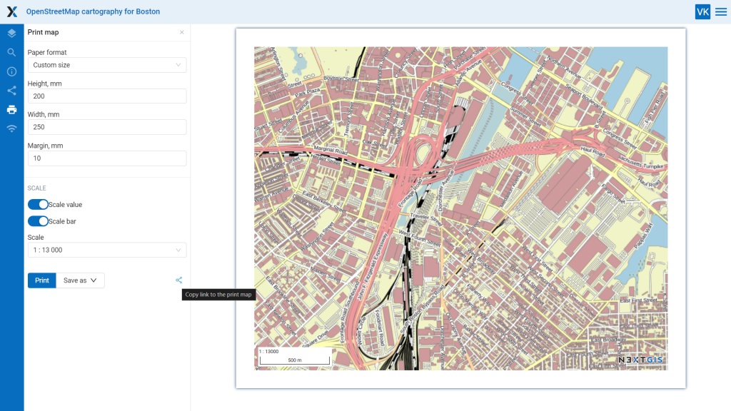
Set up the web map print layout and copy the link to it to the clipboard with just one click. As an example, here is a link to a layout we set up.
With NextGIS Web, you can create a lookup table from scratch. After that, enter values manually or upload a ready-made CSV file – and connect the table to one or more fields in a layer. Learn more
Now you can upload your Web GIS logo not only in PNG format but also in SVG.
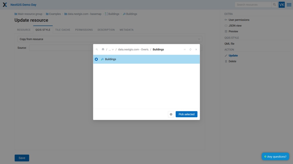
Vector and raster layers in NextGIS Web use QGIS styles to visualize data. New update add an ability to copy an existing style from another layer when creating a style.
The update is now available for all active NextGIS Web users on their own servers. To receive the update, please contact support@nextgis.com
NextGIS Web cloud users receive the update automatically.


