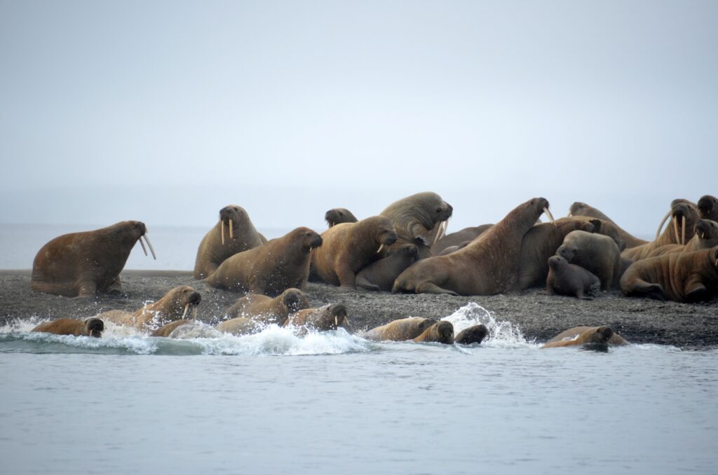
Yury Lebedev / WWF Russia
The Atlantic walrus is a species from Russian Red Book. According to WWF study, arctic shelf development for oil&gas is a key threat for walrus. These animals are one of the most fragile in the face of development expansion and they are important to monitor in and around areas of planned oil&gas extraction. They also suffer from shipping traffic coming near their resting habitats.
Full scale research of walrus migration became possible only lately thanks to new telemetry data in Pechora Sea. These data were obtained by walrus specialists with the financial support of Gazprom Neft Shelf LLC. We’ve analysed these data at NextGIS checking the hypothesis on possible link between shipping traffic and walrus movements.
Together with WWF we’ve also developed an application for specialists to quickly display walrus movements and shipping data together in Pechora Sea.
Let’s see have a look at both research and interactive map in more details.
Walrus researchers got migration data from satellite telemetry. During 5 years experiment, began in 2012, 35 adult Atlantic walruses were fit with satellite transmitters on Vaigach island.
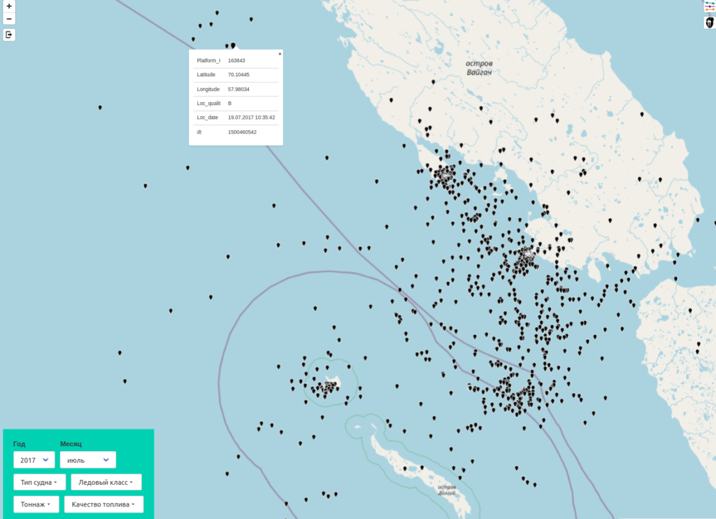
Walrus telemetry data example, July 2017
One of the first problems to overcome was low location accuracy. Aquired data needed extensive cleaning up and filtering to become ready for analysis.
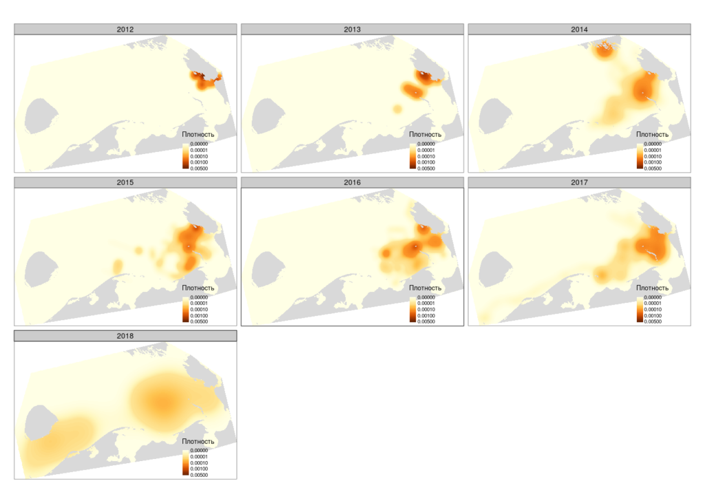
Walrus habitats in different years
Pechora Sea is an Arctic shipping hotspot: the Northern Sea Route passes through its waters, “Prirazlomnaya” offshore oil field and the Varandey marine shipping terminal are located there.
Shipping tracks are recovered using Arctic Ship Traffic Data (ASTD). To collect Arctic shipping data, ASTD uses 20 satellites and 50 stationary sources of ship location data.
Interactive web map we developed allows to dynamically filter shipping data and visually compare it with walrus locations. Parameters are:
Filters can be combined allowing to perform complex queries on multiple parameters.
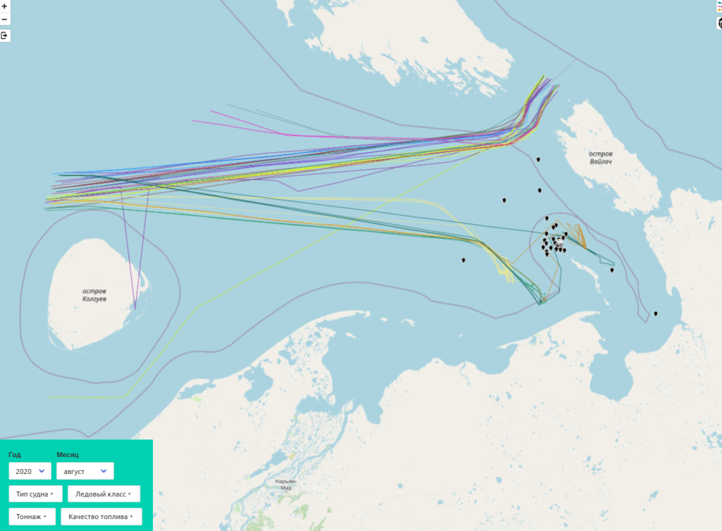
Oil tankers tracks and walrus locations (August 2020)
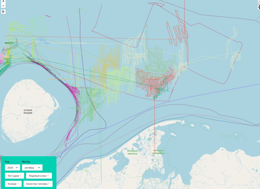
Fishing vessels tracks (October 2020)
Shipping data show that annual sea traffic is seasonal and increase year after year. Start and end of the year see less traffic. Hours of shipping time in the region was about 10 000 in 2015 and doubled in 2020.
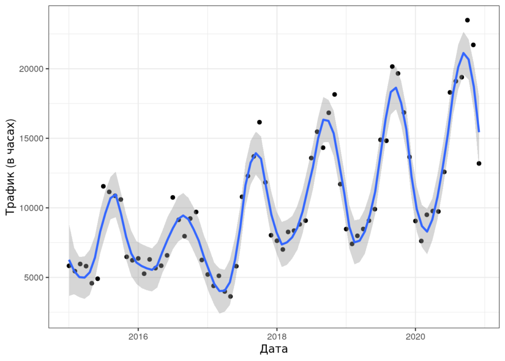
Cumulative shipping traffic in 2015-2020 period.
Research showed the active shipping regions and walrus areas intersect. However the relationship between shipping concentration and walrus locations is indirect. To understand if walrus avoid ships distanse analysis was performed comparing observed and modelled data.
There was no clear evidence that walrus are starting to avoid high shipping activity areas, these are continued to be used. Several zones of concern were identified with one of them located in the south-east of Pechora Sea where “Prirazlomnaya” is situated. More research is needed in these areas.


