Hello and Happy New Year!
As 2024 approaches, we would like to share some exciting news about our activities and platform improvements.
This November was the first time that NextGIS participated in the annual #30DayMapChallenge.
The challenge gives participants a different prompt for every day of the month. Anyone can make a map inspired by the prompt and share it using the #30DayMapChallenge hashtag. You can see all the maps we made for the challenge on our website.
Learn more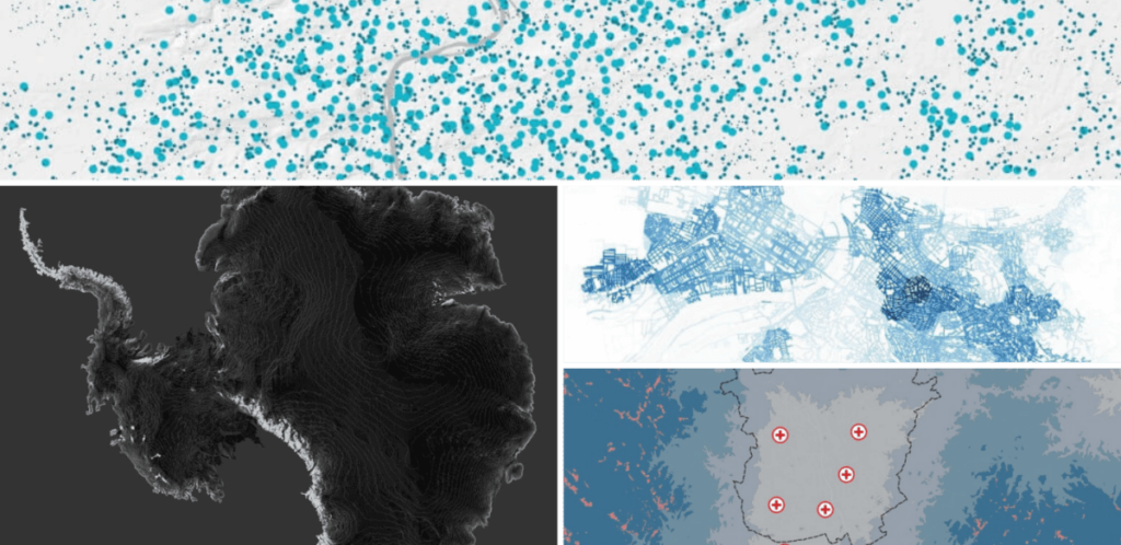
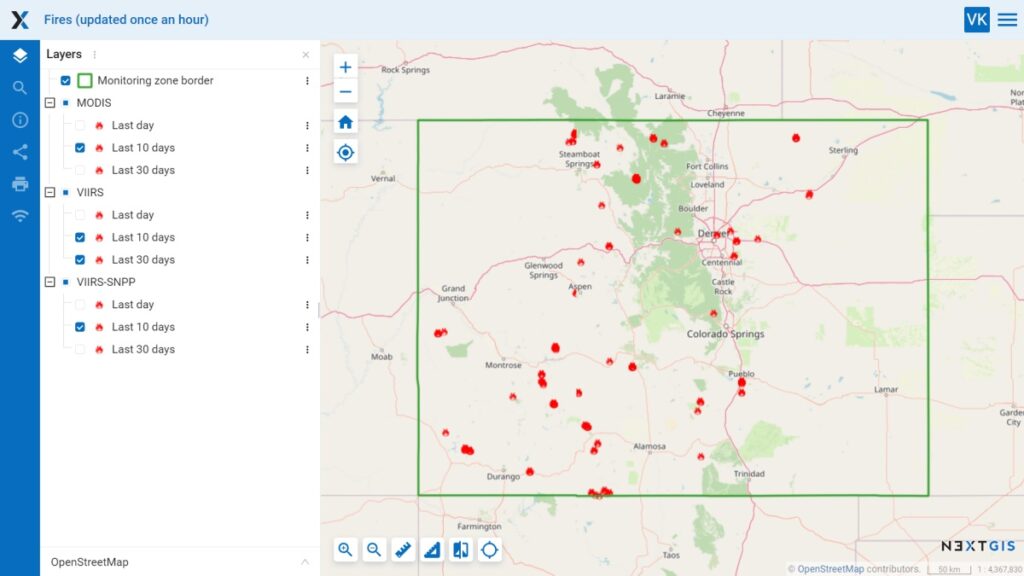
We have updated our automatic fire monitoring data. Thanks to the latest improvements, in addition to MODIS and VIIRS, data from VIIRS-SNPP (NOAA) has become available.
You can now track fires in your area using all three sources and gather data for your projects.
You can now use vector geodata from NextGIS Web as MVT vector tiles in third-party web applications. Learn how to use this in your application.
Learn more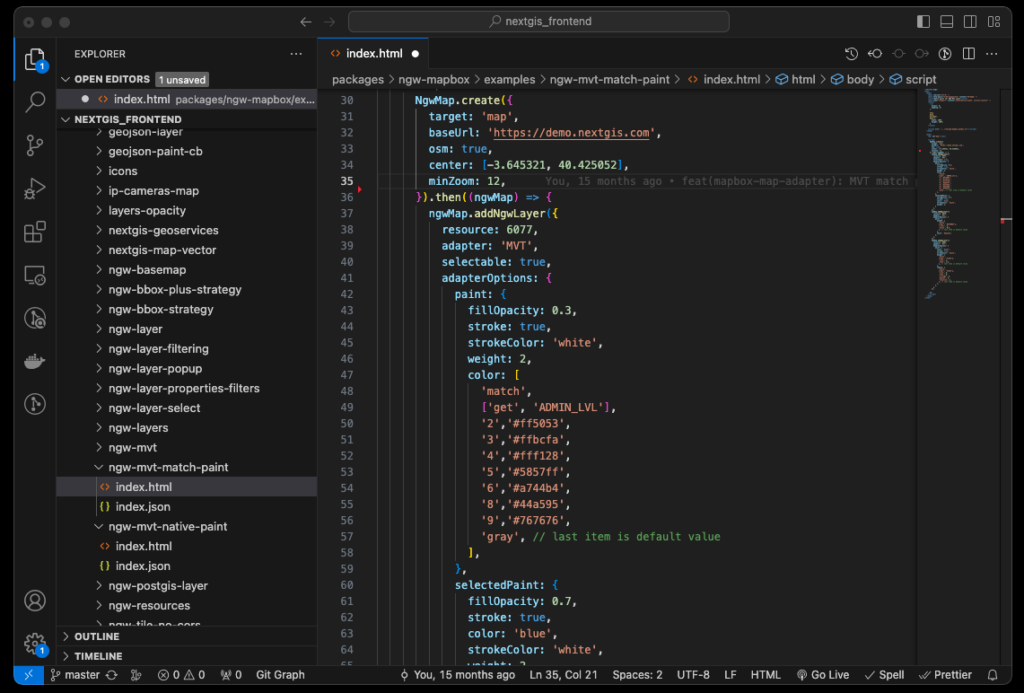
Connecting Google Analytics is now much easier. All you have to do is specify the Google Analytics data flow ID under the Metrics and Analytics tab on your dashboard.
NextGIS Web now supports links to specific Web Map objects.
This new feature makes it easier to integrate NextGIS with other systems. Contact us to learn more.
Contact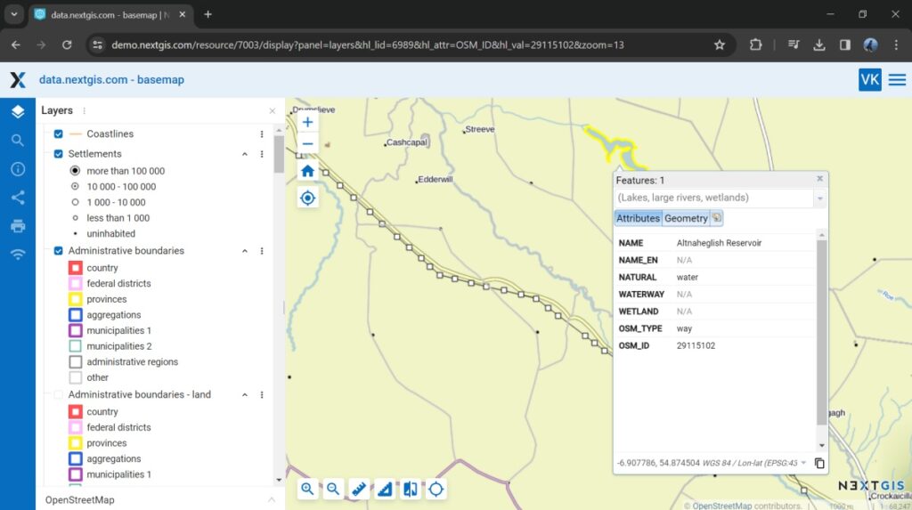
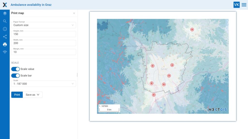
You can now save your Web Map as a PDF. Just click “Print” in the Web Map view.
Choose from A3 or A4 formats, or customize your own size. Adjust margins, turn on or off the scale display, and more. Set the adjust margins, adjust the scale, and enable and disable the scale value and ruler.
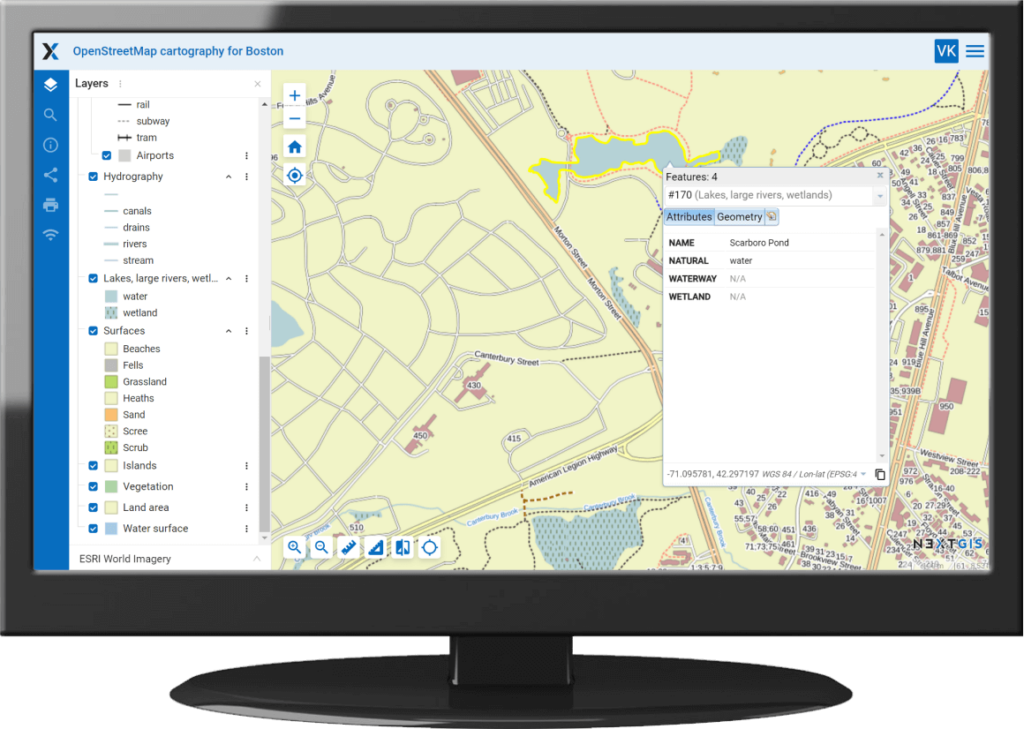
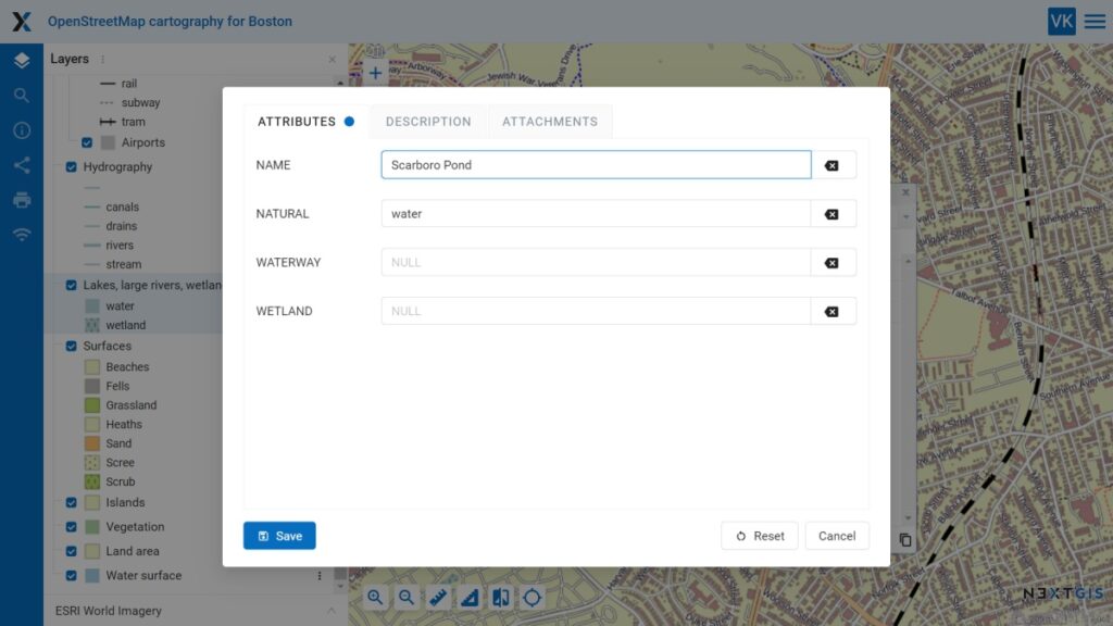
We have updated the object editing tool. Now you can edit the object attribute table in a separate pop-up window. Use the same window to edit descriptions and attachments of layer objects.
Tabs where changes have been made are marked with a blue dot, and a “Reset” button undoes the changes. After saving, the updates are immediately reflected everywhere.
You can open this new editing window on the Web Map when editing attribute values or when identifying an object, or on a separate page of the layer object table.
Earlier, we enabled users to create a default style for layers loaded from their computers. Now this feature enables you to customize the default styles for the layers you upload by setting the color, transparency, outline, and other details to your preference.
You can sync data between NextGIS Mobile and NextGIS Web server without an internet connection if:
With the new versions of the applications, you can log into your locally-hosted Web GIS without the need to connect to the internet. All you need is access to your local Web GIS.
Update to the latest versions of the applications on Google Play.
When you run this new tool, you get a table containing a list of all the resources in your Web GIS. Thus, you can quickly get a list of names and links of all vector layers or Web Maps.
Access the tool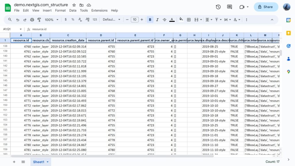
The new version includes a refreshed interface and bulk allocation and addition of resources from NextGIS Web to QGIS. When you import a NextGIS Web resource group into QGIS, all of its vector layers will be added with the same hierarchy and style.
We have enhanced the plugin for integrating OpenStreetMap data into your projects. New functionality enables you to add objects to a current layer and to copy objects and paste them into any editable vector layer.
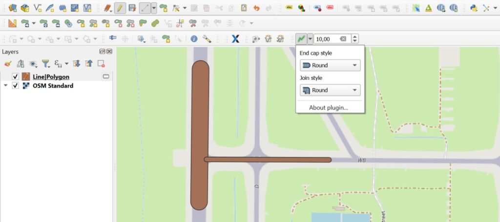
We have updated the plugin for creating lines as polygons. The new version enables you to set the buffer size (line-polygon thickness) and customize the style of ends and joints. Plus, we have fixed some bugs.