In 2023 the NextGIS team for the first time took part in #30DayMapChallenge. It takes place every year in the month of November. For every day of the month there is a prompt. Anyone can make a map inspired by this topic and post it with #30DayMapChallenge hashtag.
The challenge originated in 2019 on Twitter (X), but many participamts post their entries on other social media, such as Instagram. More about the creator of the challenge Topi Tjukanov on his website.
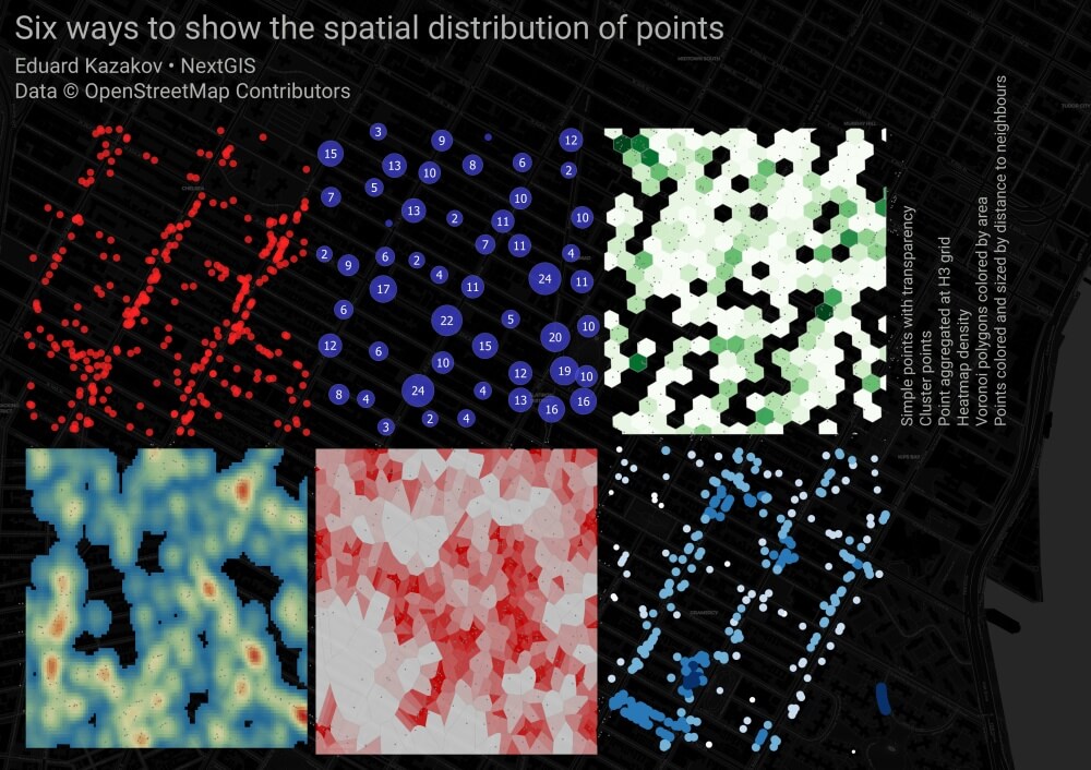
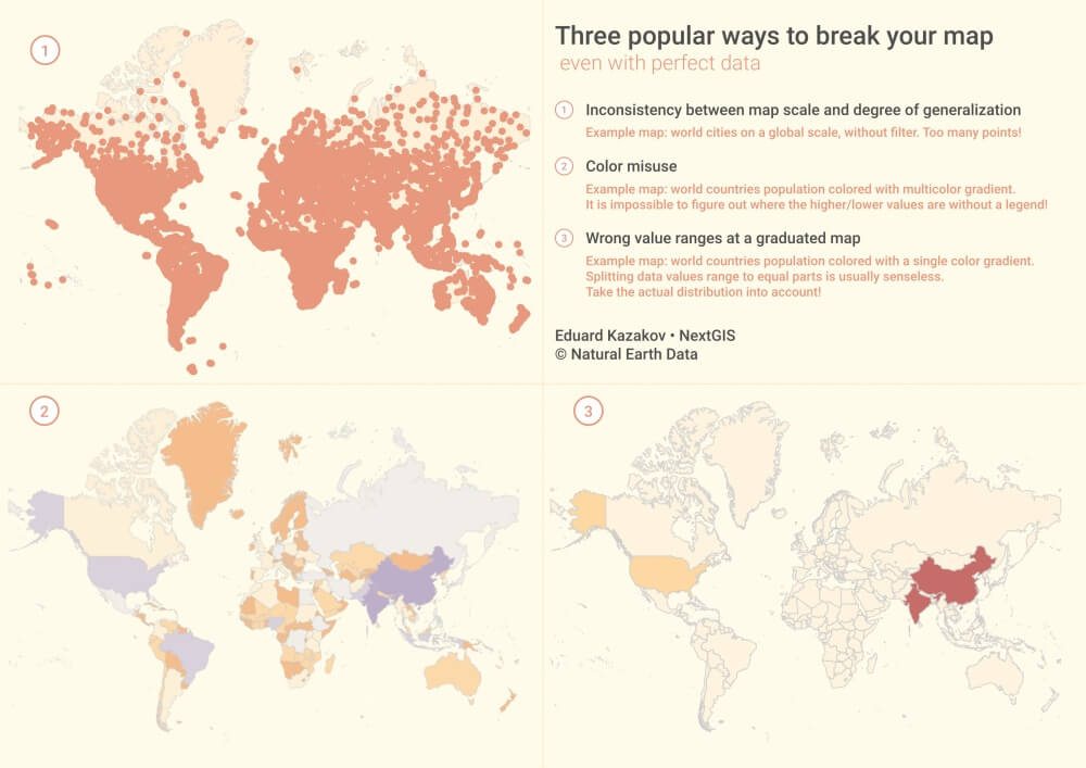
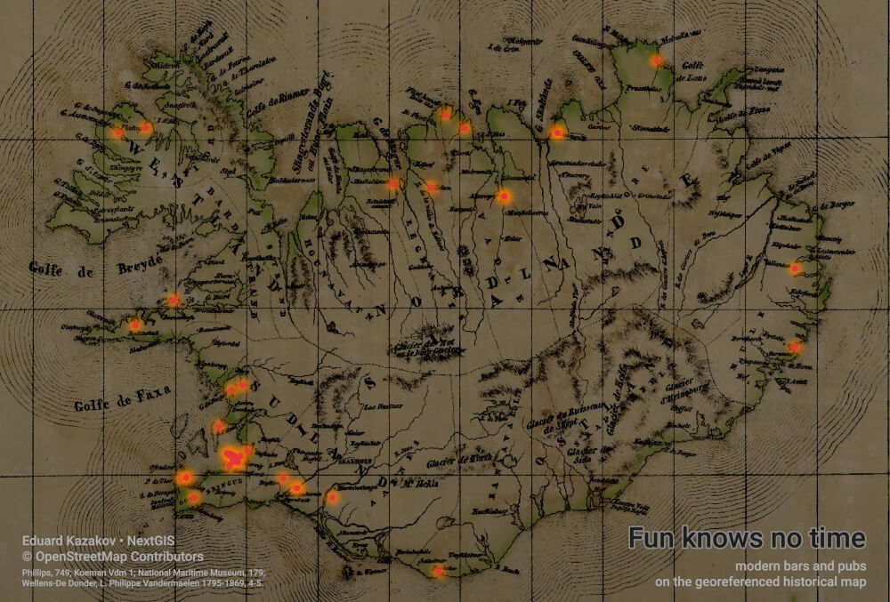
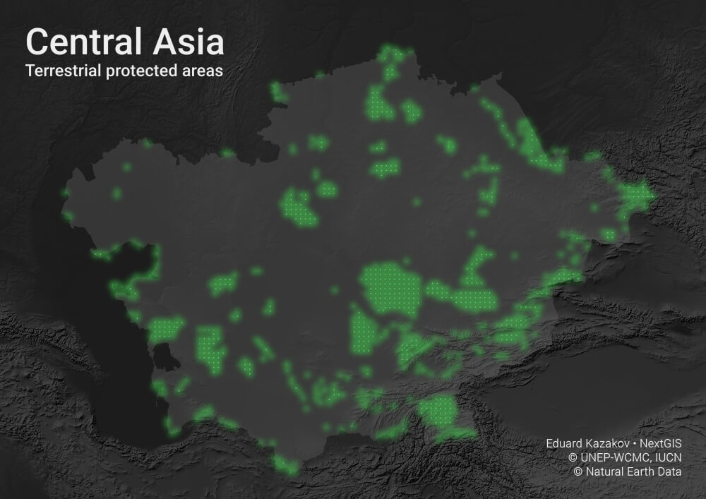
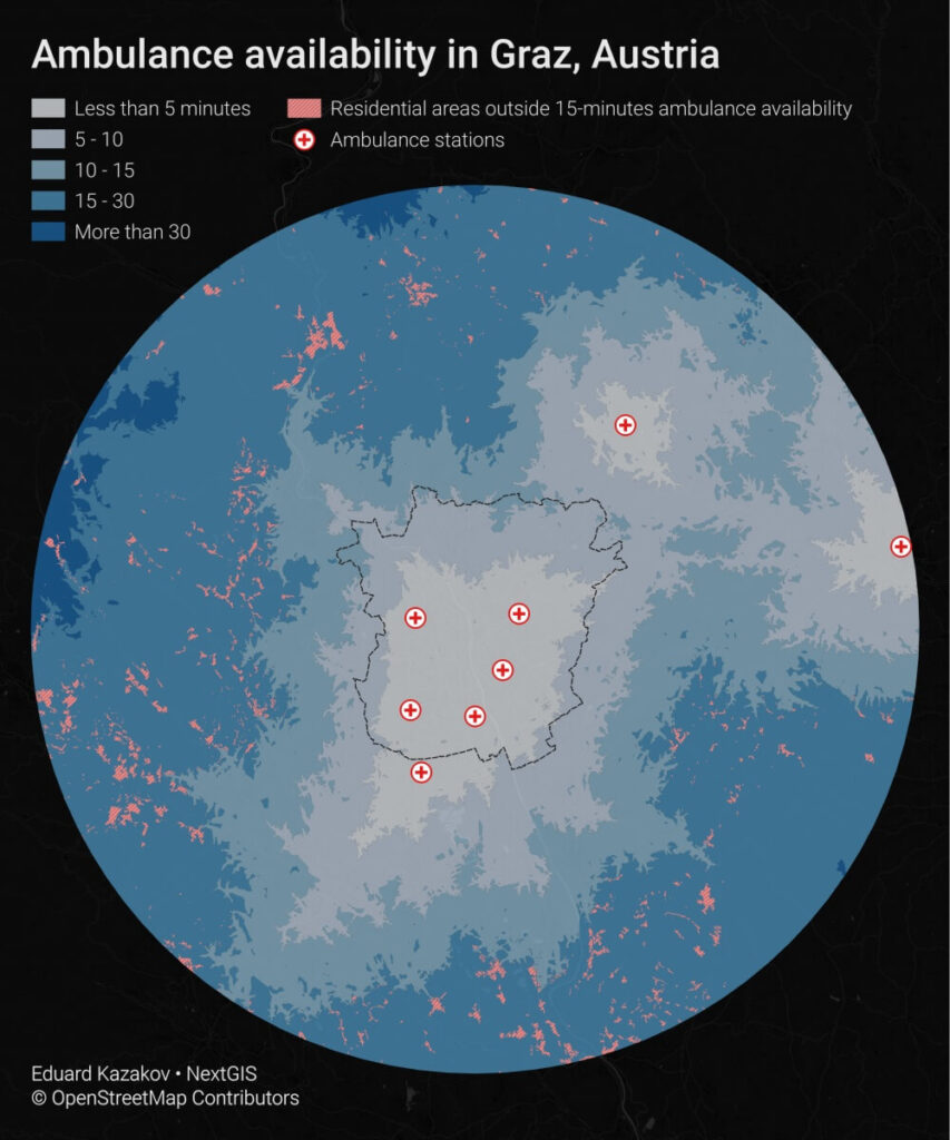
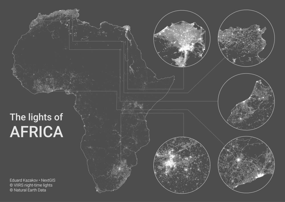
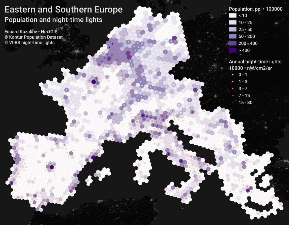
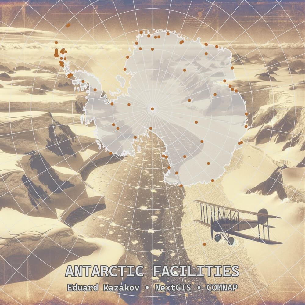
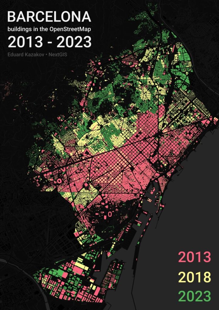
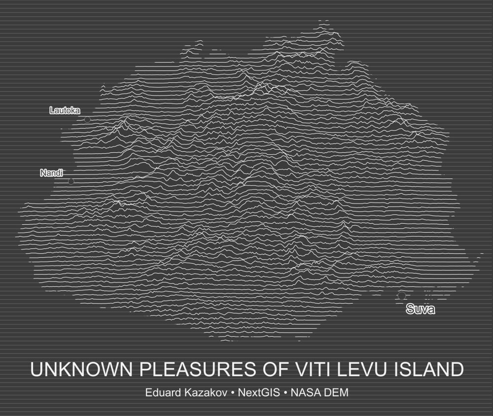
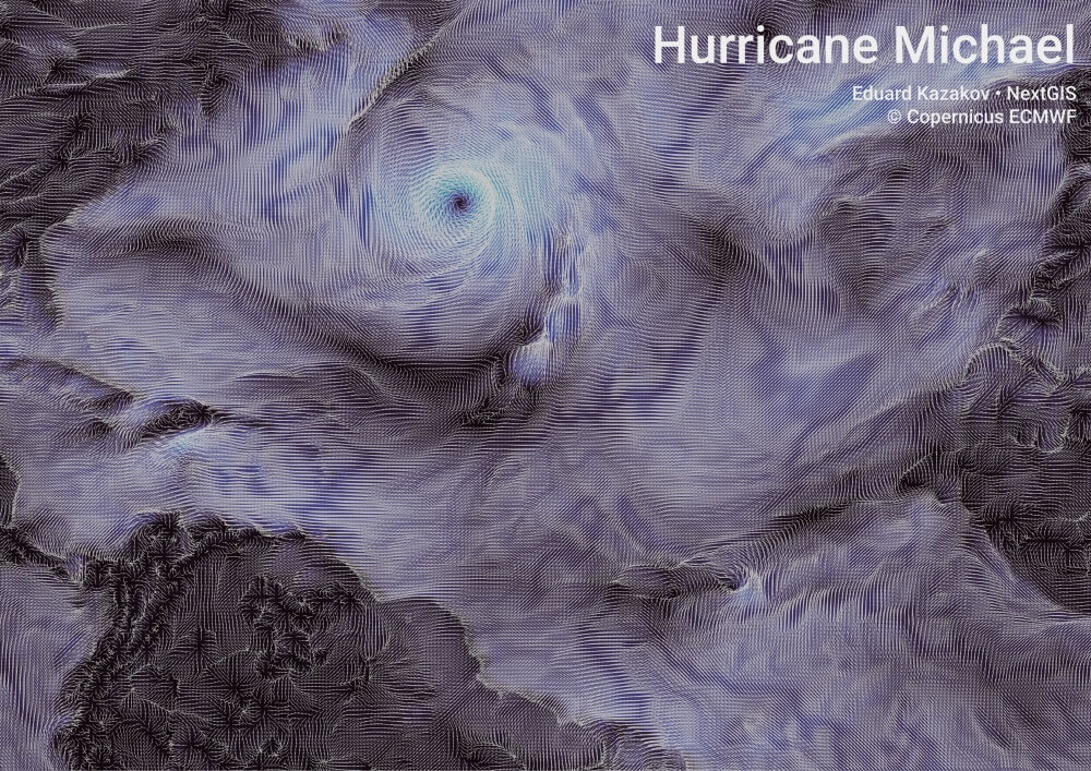
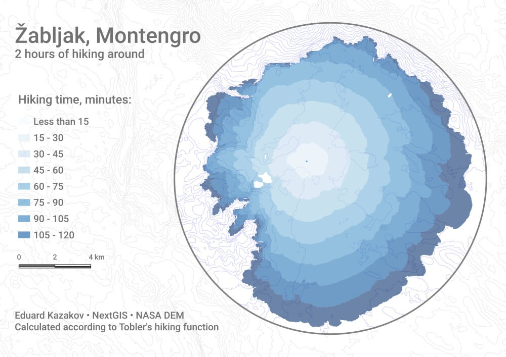
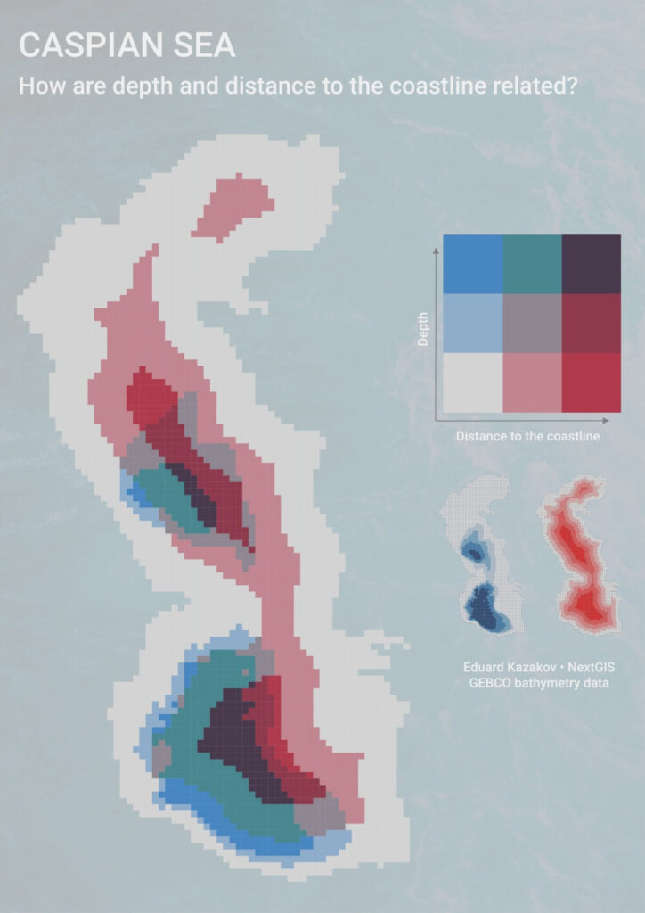
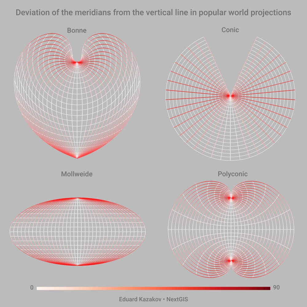
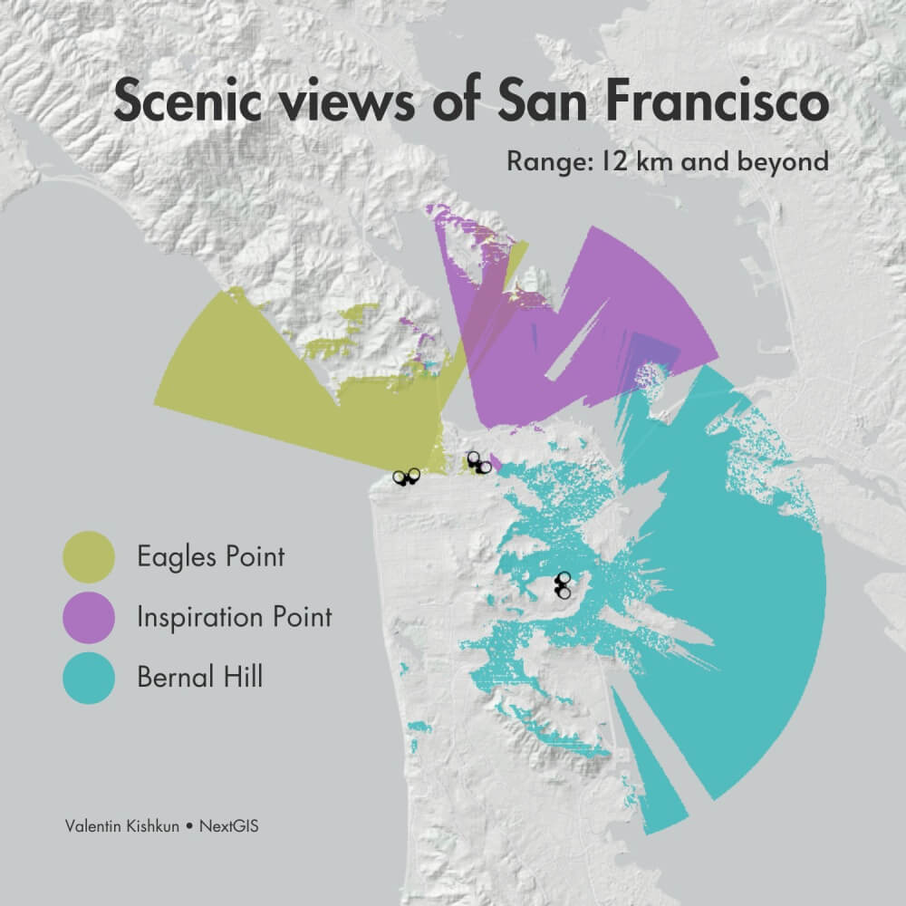
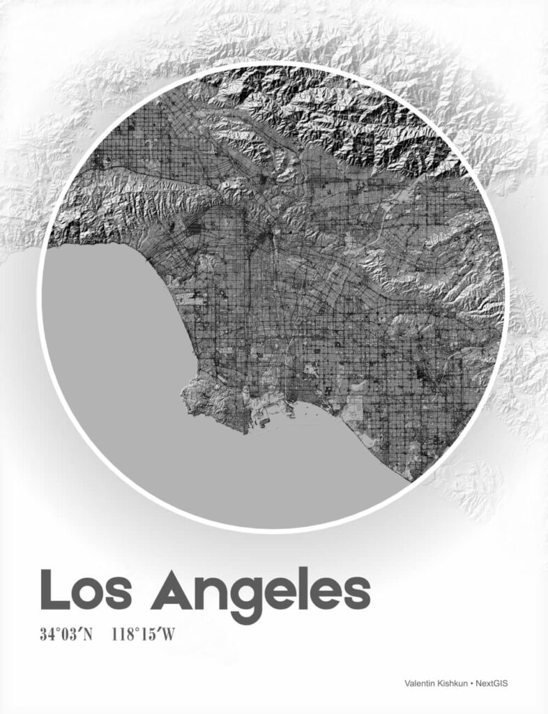
Check out the maps made by the NextGIS team for the challenge and posted on our Twitter and Instagram, all in one place.
Day 1. Points
![](https://nextgis.ru/wp-content/uploads/2023/11/01-11-points.jpg)
Day 2. Lines
![](https://nextgis.ru/wp-content/uploads/2023/11/02-11-belgrade.jpg)
Day 3. Polygons
![](https://nextgis.ru/wp-content/uploads/2023/11/03-11-iceland.jpg)
Day 4. A bad map
![](https://nextgis.ru/wp-content/uploads/2023/11/04-11-badmap.jpg)
Day 5. Analog Map
![](https://nextgis.ru/wp-content/uploads/2023/11/05-11-analog.jpg)
Day 6. Asia
![](https://nextgis.ru/wp-content/uploads/2023/11/06-11-asia.jpg)
Day 7. Navigation
![](https://nextgis.ru/wp-content/uploads/2023/11/07-11-navigation-853x1024.jpg)
Day 8. Africa
![](https://nextgis.ru/wp-content/uploads/2023/11/08-11-africa.jpg)
Day 9. Hexagons
![](https://nextgis.ru/wp-content/uploads/2023/11/09-11-hexagon.jpg)
Day 10. North America
![](https://nextgis.ru/wp-content/uploads/2023/11/10-11-north_america.jpg)
Day 11. Retro
![](https://nextgis.ru/wp-content/uploads/2023/11/11-11-retro.jpg)
Day 12. South America
![](https://nextgis.ru/wp-content/uploads/2023/11/12-11-south_america.jpg)
Day 13. Choropleth
![](https://nextgis.ru/wp-content/uploads/2023/11/13-11-choropleth.jpg)
Day 14. Europe
![](https://nextgis.ru/wp-content/uploads/2023/11/14-11-europe.jpg)
Day 15. OpenStreetMap
![](https://nextgis.ru/wp-content/uploads/2023/11/15-11-openstreetmap-722x1024.jpg)
Day 16. Oceania
![](https://nextgis.ru/wp-content/uploads/2023/11/16-11-oceania.jpg)
Day 17. Flow
Day 18. Atmosphere
![](https://nextgis.ru/wp-content/uploads/2023/11/18-11-atmosphere.jpg)
Day 19. 5 minute map
Day 20. Outdoors
![](https://nextgis.ru/wp-content/uploads/2023/11/20-11-outdoors.jpg)
Day 21. Raster
![](https://nextgis.ru/wp-content/uploads/2023/11/21-11-raster-724x1024.jpg)
Day 22. North is not always up
![](https://nextgis.ru/wp-content/uploads/2023/11/22-11-north.jpg)
Day 23. 3D
![](https://nextgis.ru/wp-content/uploads/2023/11/23-11-3d.jpg)
Day 24. Black & White
![](https://nextgis.ru/wp-content/uploads/2023/11/24-11-la-786x1024.jpg)
Day 25. Antarctica
![](https://nextgis.ru/wp-content/uploads/2023/11/25-11-antarctica.jpg)
Day 26. Minimal
![](https://nextgis.ru/wp-content/uploads/2023/11/26-11-minimal.jpg)
Day 27. Dot
![](https://nextgis.ru/wp-content/uploads/2023/11/27-11-dots.jpg)
Day 28. Is this a chart or a map?
![](https://nextgis.ru/wp-content/uploads/2023/11/28-11-eu_demographics.jpg)
Day 29. Population
![](https://nextgis.ru/wp-content/uploads/2023/11/29-11-population.jpg)
Day 30. Our favourite – NextGIS Data
![](https://nextgis.ru/wp-content/uploads/2023/11/30-11-ngdata-819x1024.jpg)