
NextGIS together with Center for information technologies of Volgograd region (CIT VR) has developed the Spatial Data Infrastructure for Volgograd region (VR SDI). The goal of VR SDI is to provide operational access to regional spatial data to its users including access from external information systems.
The rationale for VR SDI development is the need to provide a uniform spatial data framework used by branches of the local government. The system is supposed to be fully autonomous, even when there is no internet access, VR SDI continues to provide full access to spatial data and all services continue to work.
Initially VR SDI was started on ESRI software. In 2020 it was fully migrated to the NextGIS platform.
VR SDI is under continued development since 2019. The main development phases, each is one year long, are the following:
Whole VR SDI is based on NextGIS technologies and consists of four main components:
Server GIS (Web GIS) is implemented on top of NextGIS Web. Its main purpose is storage and publication of spatial data and creation of Web maps. It also supports:
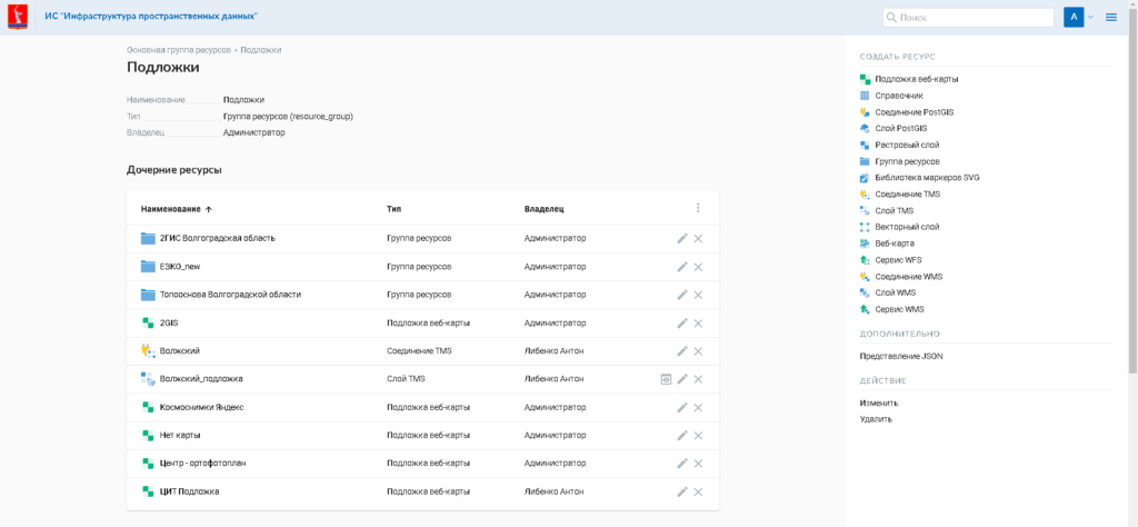
NextGIS Web supports all common geospatial formats: ESRI Shape, GeoPackage, GeoJSON, GeoTIFF and many others. It is possible to import a set up project from a desktop GIS preserving all styles. When a project is published it is turned into an interactive Web map. It is possible to export data from Web GIS in GeoPackage, GeoJSON, CSV, ESRI Shape.
Data uploaded to Web GIS can be served to data users as TMS, WMS or WFS. This makes possible integration with adjacent information systems that understand these protocols. WFS-T is also supported for data editing. An additional integration method is the well developed REST API.
All Web GIS graphical interfaces are accessible via common web-browsers, Google Chrome, Mozilla Firefox and others.
NextGIS QGIS – a desktop application to create and process large amounts of spatial data. We use it to prepare data before uploading it to Web GIS.
NextGIS QGIS can:
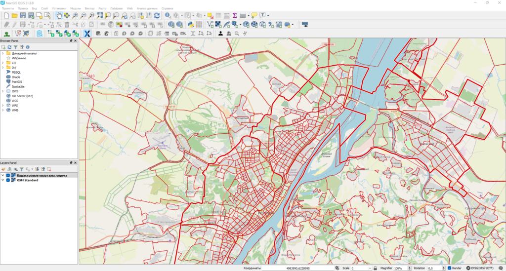
NextGIS QGIS has rich functionality to visualize spatial data based on attributes and types of data. Layouts are used to prepare data for printing or export as an image or a document. One can add a scale bare, north arrow, legend and coordinate grid.
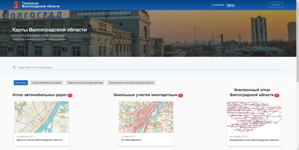
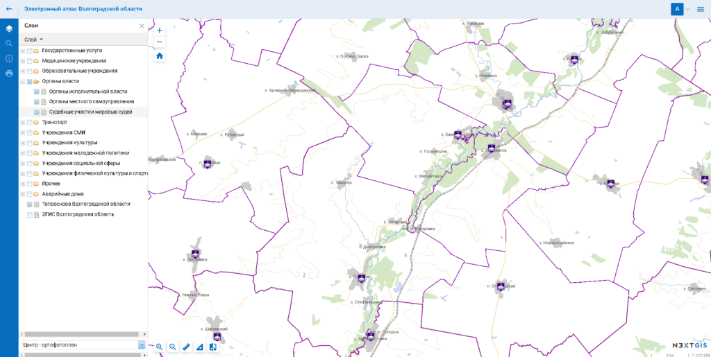
The geoportal is used to show graphical and tabular information of spatial data using Web maps and services. Geoportal is main access point for regional spatial data prepared as maps. The start page of the geoportal is a grid of available Web maps with some description. Maps and descriptions are automatically drawn from the server.
Web maps are a common instrument that can be used to:
It is possible to embed created Web maps into websites using iframes.
At the moment the following maps are created and accessible via geoportal for regional administration teams:
To ensure uninterrupted functioning of the system in intranet (no internet access) we use NextGIS Basemap. NextGIS Basemap uses OpenStreetMap that are stored completely locally and updates with given time interval.
Even if the internet access is cut off the system will continue to be fully functioning in the administrator’s local network (intranet).
OpenStreetMap is great resource of open data, but it doesn’t always meet the requirements of the users. Because of that CIT VR has additionally provided a database for official maps of 1:10 000 and 1:50 000 scale.
To upload it to the server additional processing steps were performed:
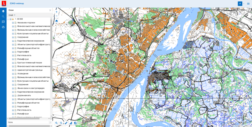
Prepare data were uploaded to the server along side as a alternative basemap. As a result, system users now have a choice to use official basemap or OpenStreetMap.
VR SDI is the base information system to provide spatial data for state run information systems used in state authorities and subsidiaries. The whole information system is run in the intranet of the Volgograd administration network.
Using spatial services geographic data stored in VR SDI are provided to a number of state information systems, such as:
VR SDI not only provides spatial data and services to its users, but it also collects information to update critical data layers. Emergency response (112 system) relies on timely information provided by the system.
All committees of Volgograd region administration are providing CIT VR with their datasets to be included in VR SDI and put on Web maps. Typically this is done using Excel or KML files, but more and more branches are directly connecting to the database to edit their data themselves.
The development of РSpatial Data Infrastructure for Volgograd region project based on NextGIS allows the region to deploy a modern technological platform to work with spatial data. Modular system ensures it’s high adaptability and ability to grow based on growing use and demand.
NextGIS offers mature software solution working under any conditions. Software products by NextGIS together with autonomous basemaps provide protected independent infrastructure made sure to work with no interruptions.
Work to develop VR SDI continues and the system gets all NextGIS upgrades together with official support and maintenance.
Let us know if you need to start with spatial data infrastructure in your region.
Contact


