
The QuickMapServices catalogue continues to evolve. Two major updates make it easier both to discover geospatial services and to contribute new ones: a map-based catalogue view and full support for vector tile services in the web interface.
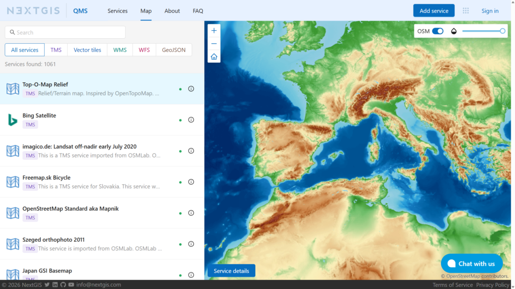
With more than 1000 active services in the catalogue, choosing the right basemap or data source can take time. The new Map view brings search, filtering, and live previews together in a single interface.
You can now:
This is very useful when exploring unfamiliar services. You can quickly move through the results and see how each layer looks and what territory it covers.
The map view complements the traditional catalogue interface: use the service list when you need detailed filtering and metadata, or switch to the map when visual comparison is more important.
The second major update is support for vector tile services across the QMS web interface.
Vector tiles offer several advantages over conventional raster basemaps. Their content is rendered on the client side, providing sharp lines and labels at different zoom levels. Depending on the service and application, their appearance can also be customized to better match a project’s design or emphasize particular features.
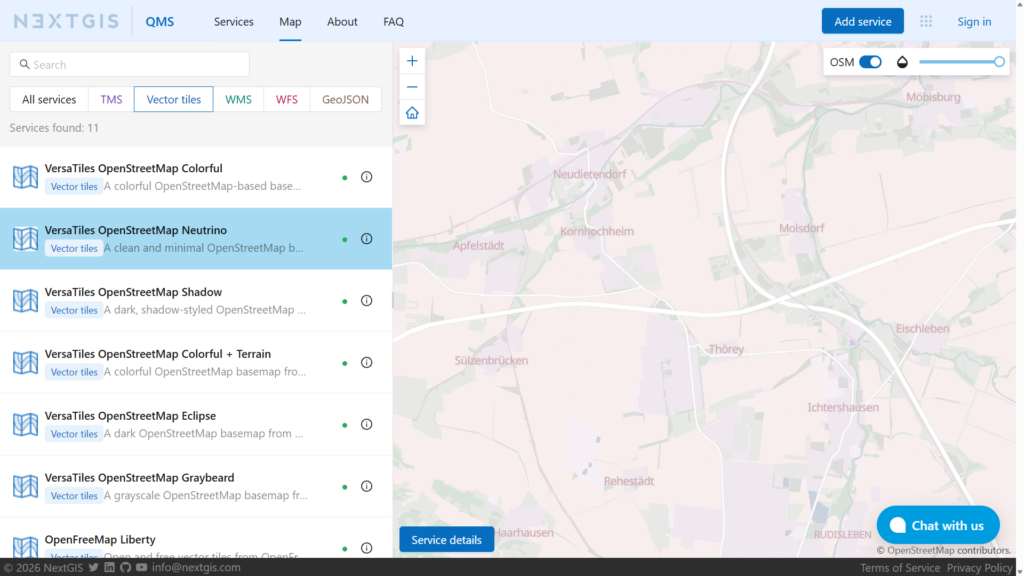
Users can now explore vector tile services directly in the catalogue, preview them in the new map interface, and open their individual pages for more information. The dedicated Vector tiles filter makes it easy to find the available services.
The catalogue already includes a growing collection of vector basemaps, including different light, dark, colorful, and terrain-oriented styles from providers such as OpenFreeMap and VersaTiles.
QMS is a crowdsourced catalogue, and its value comes from the contributions of the geospatial community. Registered users can now add their own vector tile services, just as they can contribute other supported service types.
If you maintain a public vector tile service, or know of a useful one that is missing from the catalogue, you can submit it to QMS. The service becomes discoverable through the QMS website and can be reused in applications connected to the QMS catalogue.
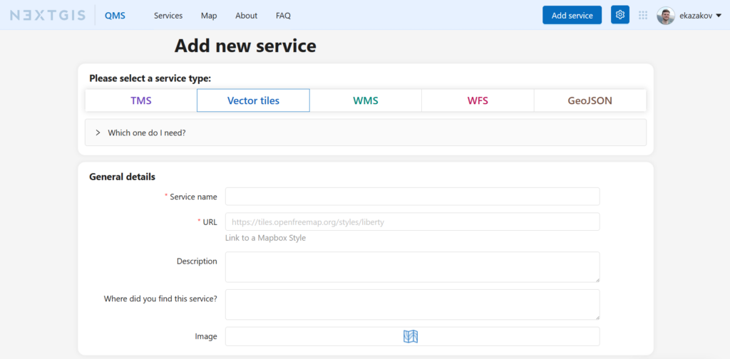
When contributing a service, please provide a clear name and description, specify its coverage, and make sure that its URL and usage terms are correct. Good metadata helps other users understand where and how the service can be used.
QuickMapServices is an open, community-driven catalogue of geospatial services with a public API. The catalogue can be integrated into desktop, web, and mobile GIS applications, providing a shared source of basemaps and other geographic data services.
The new map interface makes the catalogue easier to explore on the web, and vector tile support expands the range of modern mapping services that the community can publish and discover.
Try the new QMS Map view, explore the available vector tile services, and contribute useful services from your region!


