
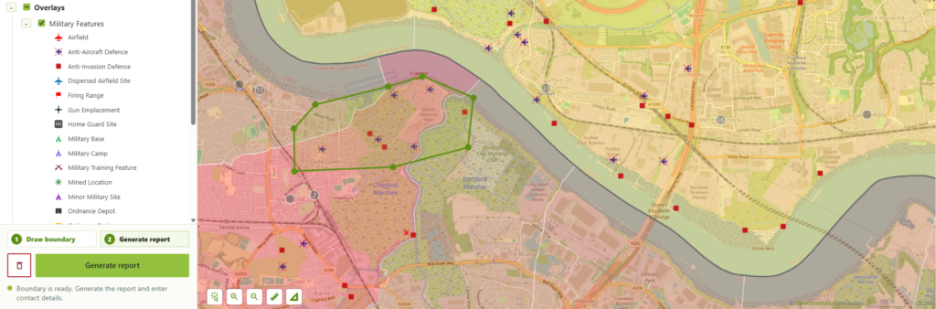
RSK Ordnance Management needed a practical way to turn specialized geospatial datasets into clear, client-ready UXO hazard screening outputs. The goal was not only to publish data on a map, but to guide users through a complete workflow: find a location, define an area of interest, analyse relevant spatial information, and receive a professionally formatted PDF report.
NextGIS developed a custom Online UXO Risk Map and Hazard Screening Report Generator for RSK Ordnance Management, combining an interactive web map, automated geoprocessing, and dynamic PDF report generation.
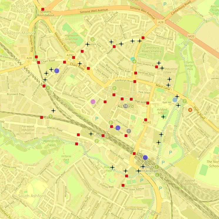
UXO screening is a spatial problem: historical bombing density, recorded military features, local air raid information, previous UXO finds, site boundaries, buffers, and contextual map layers all need to be interpreted geographically.
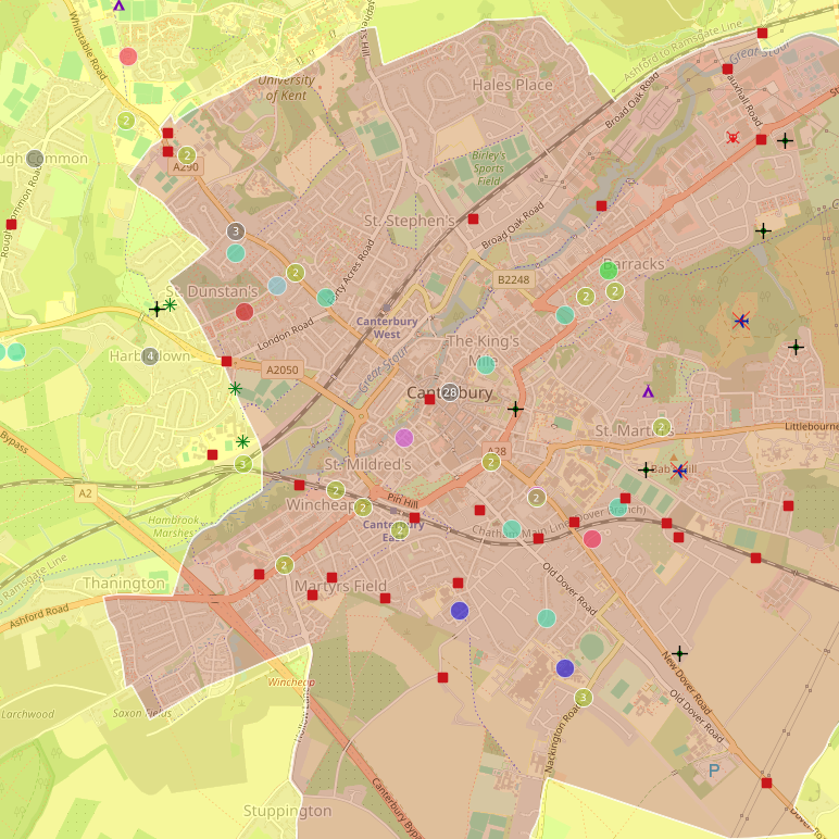
UXO related spatial data
For RSK OM, the challenge was to make this process accessible through a public-facing web interface while keeping the workflow structured and repeatable. The system needed to allow users to:
At the same time, the solution had to remain manageable for the RSK OM team. Layer visibility, report thresholds, searchable layers, area limits, and other settings needed to be configurable without hardcoding.
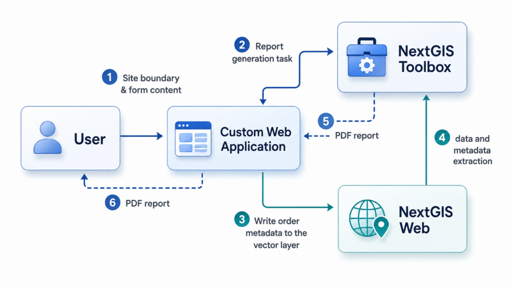
NextGIS delivered a cloud-hosted custom web application built around three components:
NextGIS Web acts as the geospatial data management and configuration layer. It stores datasets, web maps, layer settings, permissions, and metadata-driven configuration.
The custom web application provides the public-facing interface. It is designed to be embedded into the RSK OM website and gives users access to the map, search, layer controls, identification tools, drawing tools, and report generation form. It is built on top of NextGIS Web using the API and NextGIS Frontend libraries.
NextGIS Toolbox performs the backend geospatial processing and produces the final PDF report.
Together, these components form a complete workflow from user input to automated report delivery.
The user opens the Online UXO Risk Map and works with a familiar interactive map interface. They can pan and zoom, switch layers on and off, use measurement tools, identify map features, and search for relevant places.
To request a report, the user draws a single polygon representing the area of interest. The interface validates the geometry and prevents excessively large requests according to limits configured in NextGIS Web.
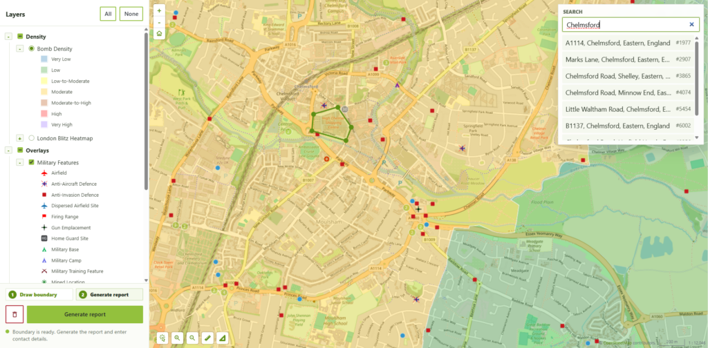
Web application appearance
Once the area is valid, the user completes a short form and submits the request. The system then:
The output is a PDF document branded for RSK Ordnance Management. The first page includes the site details, an automatically generated map, a bomb density key, a dynamic legend, potential UXO risk factors, and recommendations.
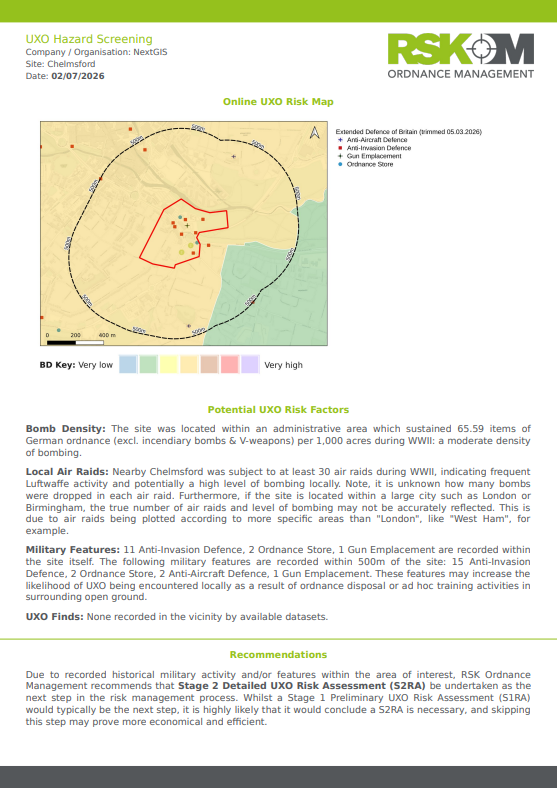
General view of the report
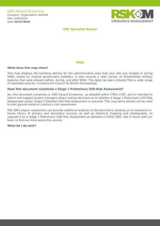
The report text is generated from the datasets found within the analysis area, it includes sections on bombing density, local air raids, military features, UXO finds, and recommended next steps.
The second page contains explanatory FAQ content, including clarification that the document is a UXO Hazard Screening output intended to support decisions on whether further assessment may be required.
A key design principle of the project was flexibility. Wherever possible, system behaviour is controlled through metadata in NextGIS Web rather than hardcoded in the application.
For the client, this means the solution can evolve as datasets, workflows, and reporting requirements change.
The system is deployed on NextGIS infrastructure as a cloud-hosted solution, but it was designed with portability in mind. The architecture allows migration to self-hosted infrastructure if required, including NextGIS Web, NextGIS Toolbox, and the custom application.
This project shows how Web GIS can move beyond data publication and become a full operational workflow.
For RSK Ordnance Management, the Online UXO Risk Map helps transform specialized spatial datasets into structured, repeatable, user-facing screening reports. For end users, it provides a clear way to obtain an initial UXO hazard screening document for a specific site. For the RSK OM team, it creates a configurable platform that can be maintained and adapted through NextGIS Web.
The same approach can be applied to many other domains where users need to draw or select an area, run spatial analysis, and receive a branded report: environmental screening, infrastructure planning, land management, site selection, natural hazard assessment, and compliance workflows.
The RSK OM project demonstrates the strength of the NextGIS platform as a foundation for custom geospatial applications. By combining NextGIS Web, NextGIS Toolbox, and a tailored frontend, we can build systems that connect data management, interactive mapping, automated analysis, and report generation in a single workflow.
For organisations that already manage spatial data, this opens the door to practical tools that help users make decisions.
Start with the NextGIS Platform in the cloud, choose an on-premise deployment for full control, or talk to us about a custom geospatial solution tailored to your workflow.


