
A web map is often where you first notice something that needs correcting: a road ends just short of a building, a feature is in the wrong place, or an inspection point is missing. With expanded vector editing tools in NextGIS Web, you can make these changes directly in the built-in web map.
Enable editing in the web map settings, then activate editing mode for any vector layer you have permission to modify. You can create features and add their attributes, descriptions, and attachments without leaving the map.
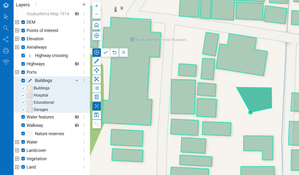
You can also edit existing geometries and attributes, move or delete features, and add rings to polygons. A ring lets you exclude an area, such as a courtyard, from a larger polygon. If you make a mistake, you can undo changes during the editing session.
Snapping helps you place a vertex precisely against existing geometry. You can configure the tool to snap to vertices, edges, intersections, or all three.
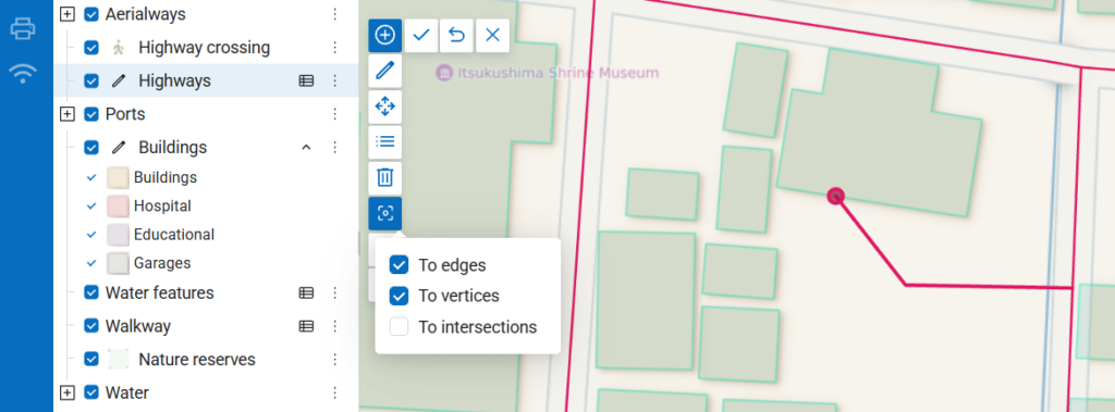
It works across layers with editing mode enabled. For example, you can align a road endpoint with a feature in another editable layer. This helps keep related features aligned as you edit in the browser.
The new tools make everyday updates and quick corrections possible directly on a web map. Layer permissions determine which features each person can modify.
When you need more advanced editing tools, you can connect your NextGIS Web data to QGIS and continue working with the same centrally managed layers.
To try the new tools, open a web map in NextGIS Web, enable editing in its settings, and activate editing mode for a vector layer you can modify.
Use NextGIS Web Sandbox for quick experiments!


