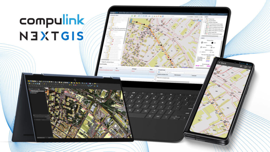
NextGIS has successfully completed a big project to build GIS for operational oversight of fiber optic infrastructure construction for Compulink company. We’ve been developing this system for 2+ years, and this is one the largest and most multi-faceted projects we’ve ever done. Let’s have a closer look at this case study.
Compulink is one of the largest fiber optics construction companies in Russia. Its activities span most of the country. It builds thousands of kilometers of fiber cable infrastructure yearly. One of the company’s most time-consuming activities is managing hundreds of smaller contractors on the ground. On a different level, Compulink is to report construction progress to various project stakeholders (including governmental agencies) which keep control of the situation. Company needs to constantly monitor its progress and compliance with approved timelines, using gigabites of spatial data collected on various levels – from every single drill hole to the regional aggregates and finally to the project as a whole.
NextGIS set out to build a system which will optimize all stages of construction oversight process.
Project Business Goal: To increase efficiency of operational control for fiber optic infrastructure construction and to increase transparency in construction progress for all stakeholders.
Project Summary: To implement a GIS which allows to control all stages of fiber optic infrastructure construction remotely, dramatically reducing number of field trips for monitoring officers.
Project Timeline: Alpha version of the system was up and running in 6 months from the start of the project. After successful tests Compulink has decided to develop additional functionality. This process continued over the next year and a half based on feedback from Compulink specialists.
Key NextGIS features that ensured the success of the project:
3 out of 4 base components of NextGIS software platform were used for the system:
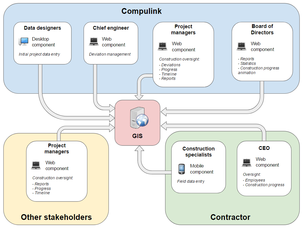
GIS functional structure
Desktop component is designed to prepare project data and upload it to the central database. For this we customized NextGIS QGIS, including:
Resulting desktop GIS allows to:
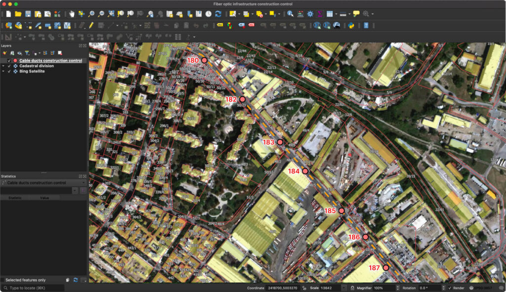
Desktop overview
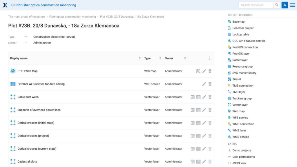
Main component of the system, responsible for data storage, processing, visualizations, user and permissions management and reports creation. All company departments work with this component: receiving data from contractors, setting up access to track work progress and timekeeping. Our main work was centered around this component which was built using NextGIS Web as a framework.
Functionality of NextGIS Web was significantly extended to add:
Let’s have a more detailed look at some of these features.
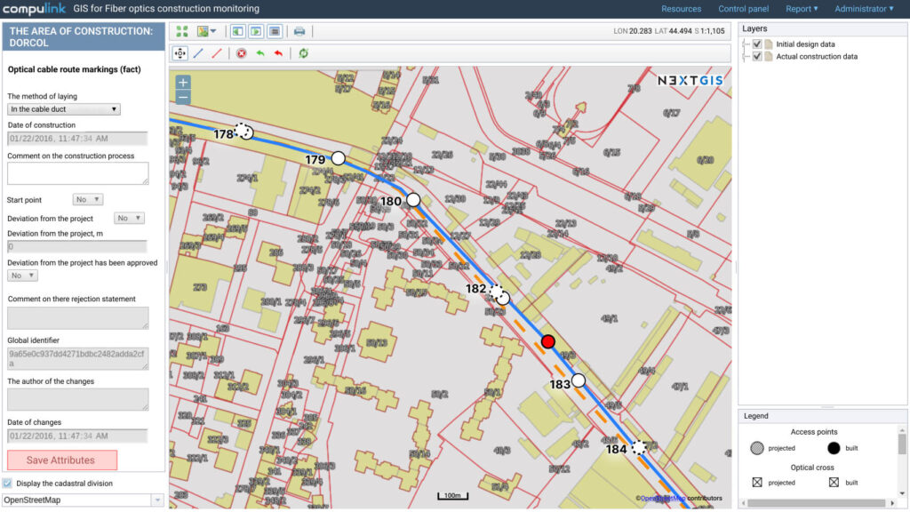
Access management
This extension allows to create users and assign restricted access for specific construction sites.
System operator is simultaneously working with many contractors and stakeholders. Using access management tool system administrator can give employees of a specific contractor permissions only to sites for which this contractor is responsible, while Compulink management and other project stakeholders can see the big picture as well as information from separate sites.
Web component, administrator’s interface
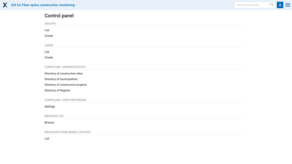
Web component, control panel
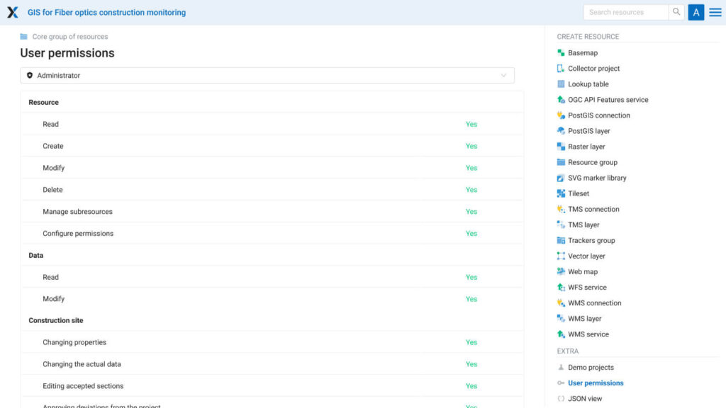
Web component, user permissions
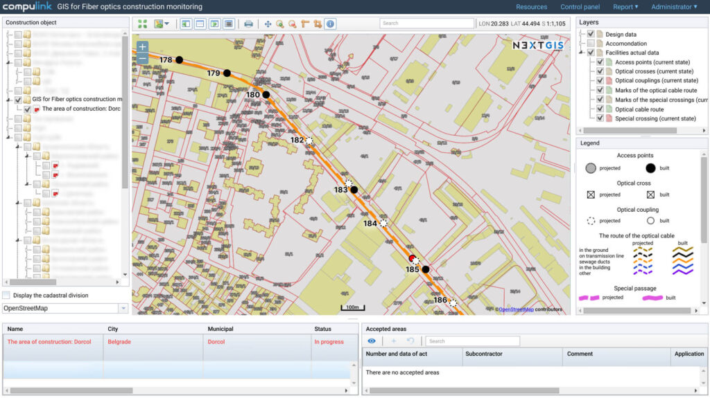
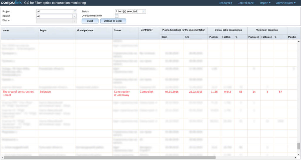
Automatic cable line calculation
Compulink is working on projects throughout Russia with hundreds of contractors constantly sending data from different regions and time zones. Contractors send updated object statuses and those objects should be put together to form an overall line status information.
That is why this system is taught how to:
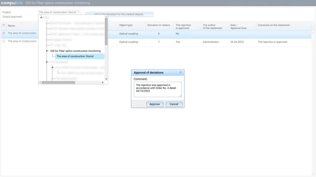
Construction deviation management
Construction plans are not always possible to implement in real life, so deviations happen. Set of special tools is dedicated to:
Online data editing
Lots of data are submitted via mobile devices and sometimes there is a need to make edits. System provides operators with a tool to make these changes directly in a web browser. Before editing it will check user permissions and write down date, time and specialists’ credentials.
Reports
Different stakeholders and project managers constantly require different reports on particular sites, aggregated by types of activities, regional or even countrywide. Reporting allows to set reports up, check, generate and download in XLS format.
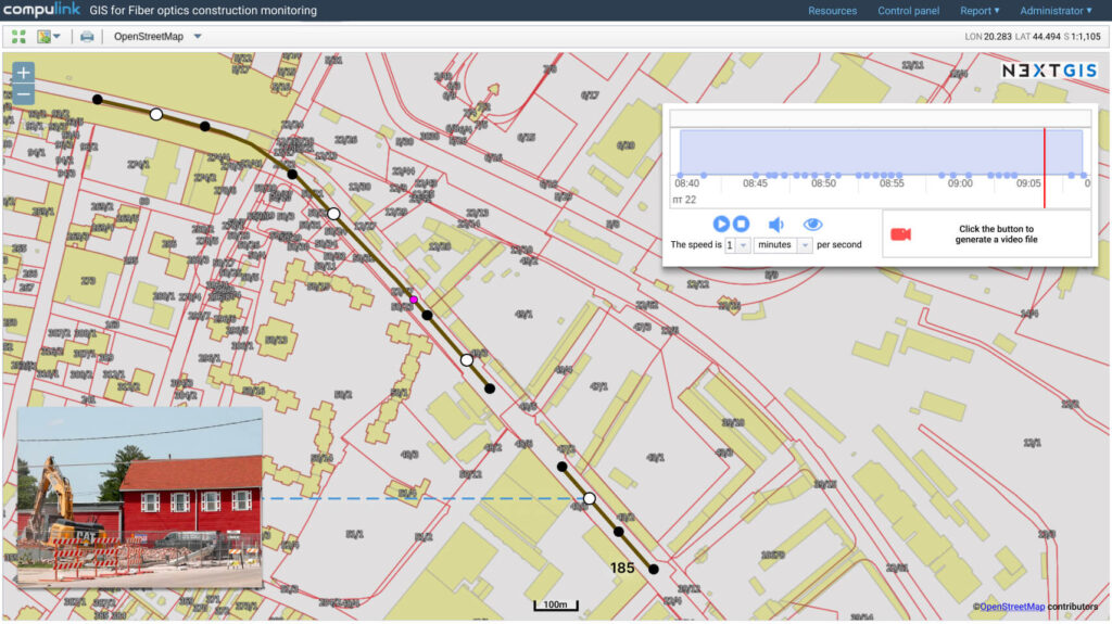
Recorder/player for construction process animation for a given time interval
As a special type of a report the system allows to record construction progress as animation, overlay photos, select period of time to record. This proved to be very handy for multi-stakeholder meetings and for discussing deviations from plans.
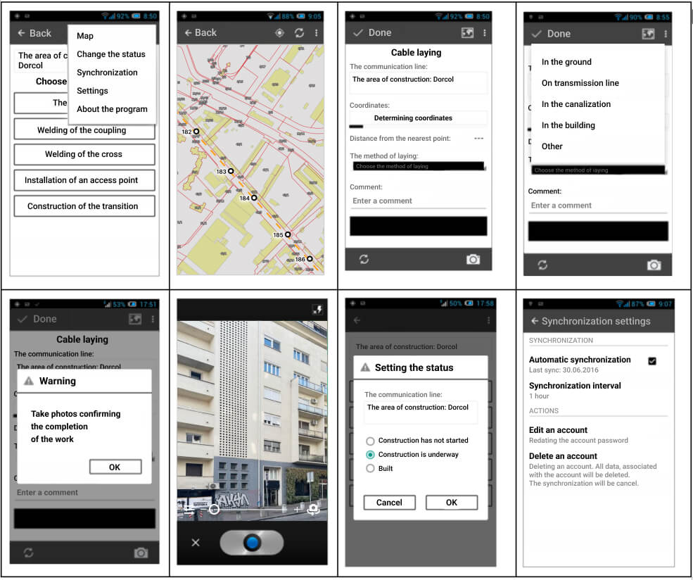
Field data collection is a big part of the system. Thanks to NextGIS Mobile we already had a framework for custom Android application building. Mobile tool is used by contractors employees to regularly record locations, type and status of work and attach photos confirming this information. Syncing of all data with the web component is done automatically as soon as mobile app is connected to internet.
Conclusion
This project captures extended capabilities of our software platform and illustrates well NextGIS day-to-day work. We are very interested in learning business processes of our clients and in building tools to make them more efficient, together with the clients.
If your organization needs similar GIS solution — contact us. We’ll be happy to help!


