The majority of NextGIS products are targeted to professionals in GIS. The ones who’ve already dived deep into map projections, data format types and numerous tools for geodata processing.
However, besides sophisticated issues world of GIS is able to solve plain tasks related to most of us. Such as “We need a fast and easy way to add comments to the map”.
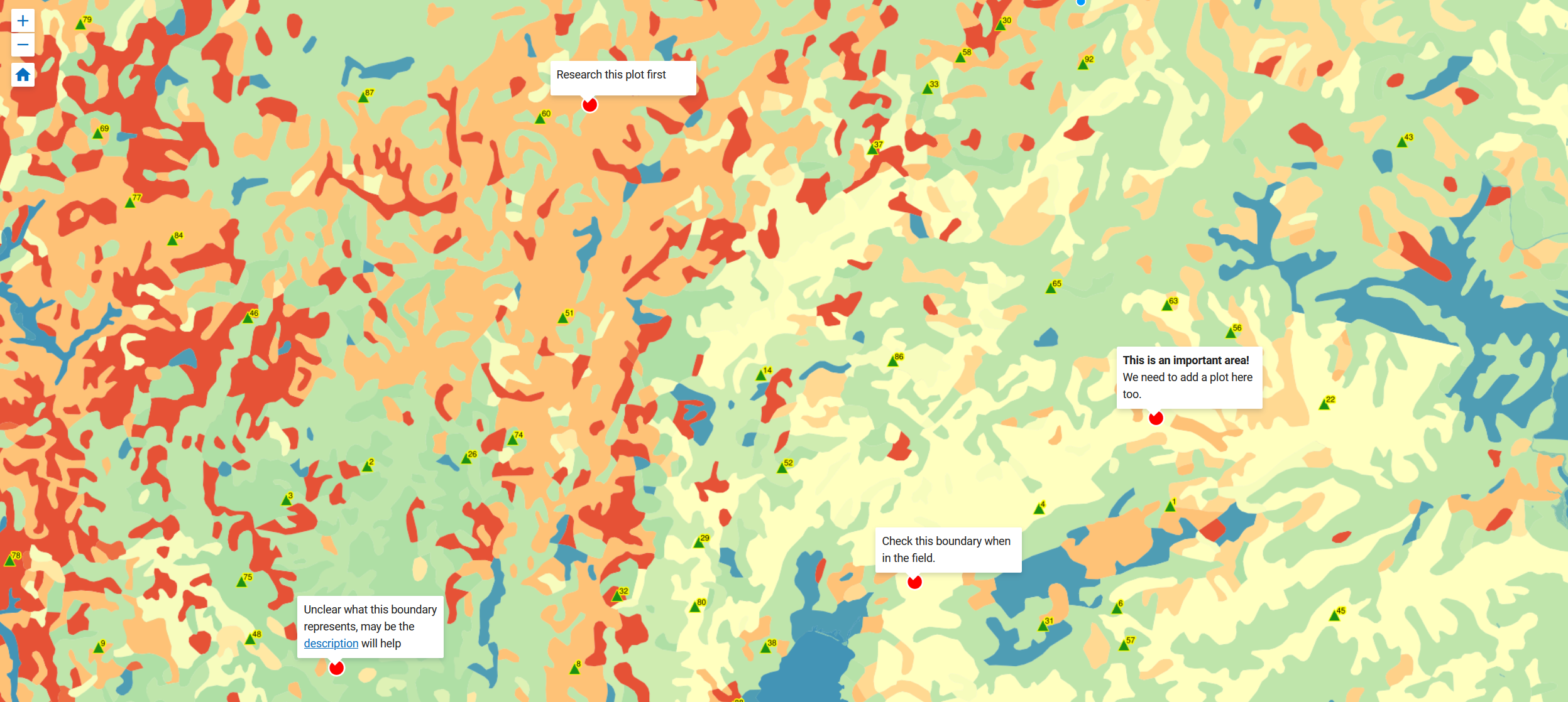
Here are several examples where such option would be appreciated:
Web map annotations are designed to help with this scenarios. Annotation lets you add a point to the map containing some message, a hint or a comment or a link.
If you are familiar with our Web GIS chances are you already tried Web maps. Web map is the main tool to visualize geographic data (more details here).
Now web map got new option – annotations.
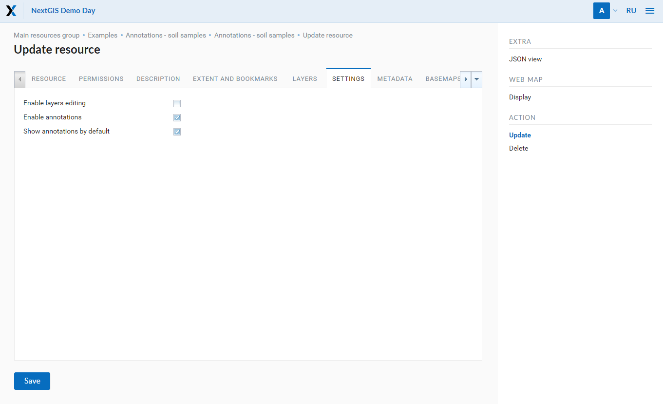
By default the annotations are switched off . To use them, activate responsible option in Web map settings. Select “Update” for web map and check two relevant boxes in “Settings” tab.
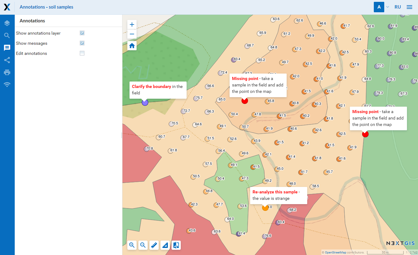
When annotations are active – a new icon will appear in left hand panel. Click this icon and annotations toolbar appears. Now you can add points with messages to the map, customize points’ color and outline. Built-in text editor allows to alter text style, insert links, change fonts etc.
The resulting map might look like this:
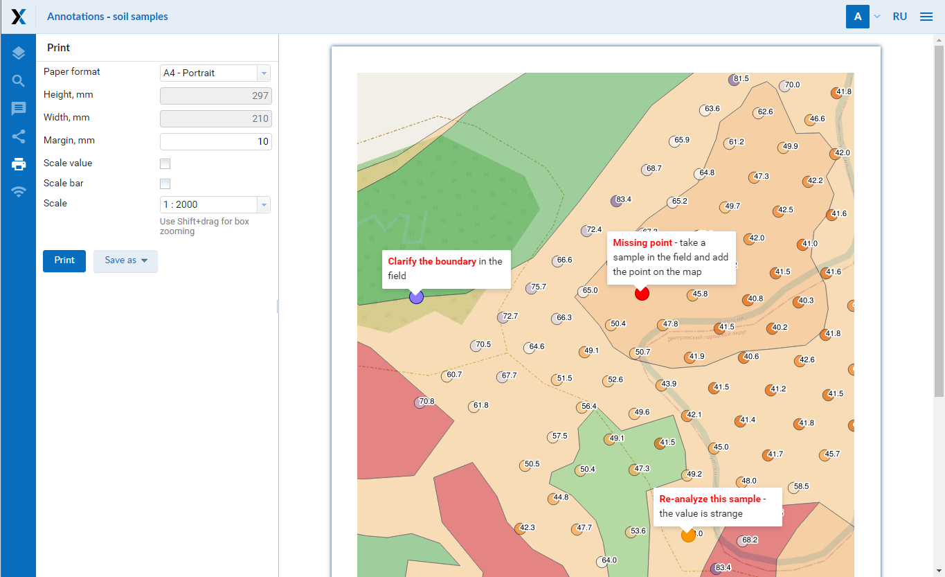
You can print web map with annotations (how to print a web map) and take it with you to in the field:
You can find a special section on annotations in our documentation:
You can also have a look at interactive maps, already using annotations:
Subscribe for Premium and start using annotations right away, support is included.


