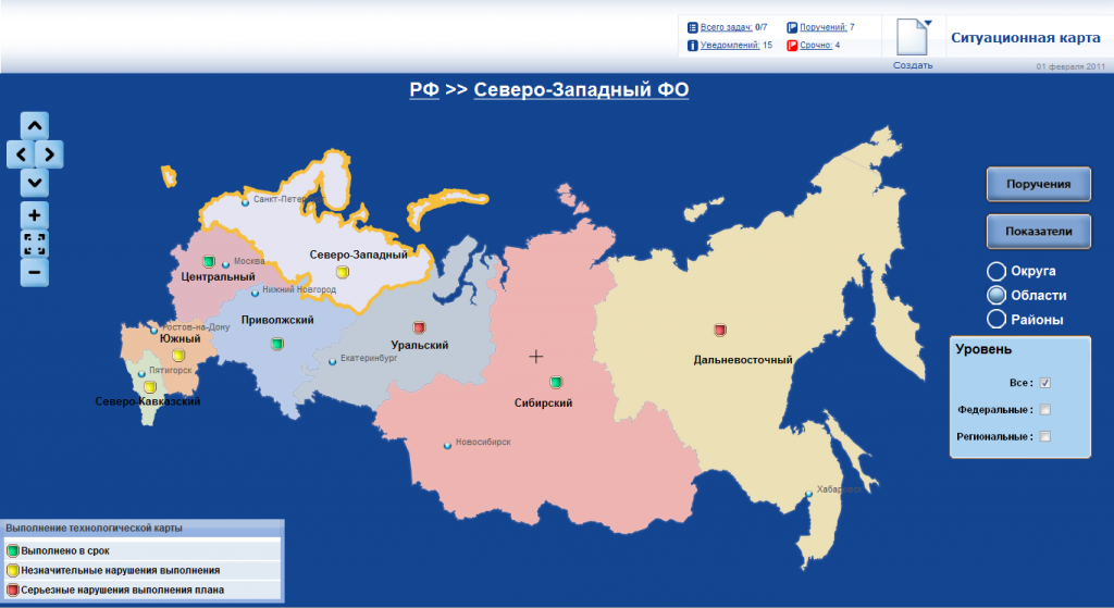
Built on OpenLayers, NextGIS has developed a custom cartographic application for Korus Consulting. This Situational Map application is a web-based system for displaying the administrative division of the Russian Federation and summary data about the progress of specific organizational activities.
The main element of the system is the three-level map of the territorial division of the Russian Federation that contains information about federal districts of Russian Federations, administrative regions (oblasts, krays, and republics), and regional subdivisions (rayons). Administrative centers of appropriate objects are displayed according to the chosen level.
Listed are some main features of the application:
• There is convenient navigation between levels. Switching to the next level is carried out by click on the necessary object.
• Tool tips are available.
• The possibility of placing database-driven graphic elements—indicators connected to district, region, and area.
• When switching between levels, the query sends the information to the application server to obtain the actual data about indicators.

