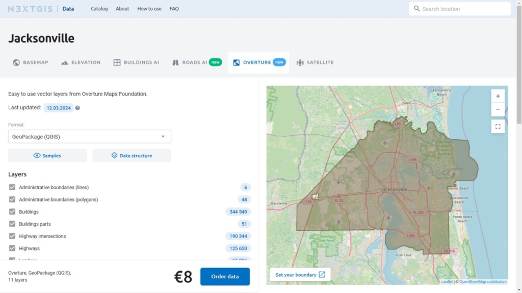
Overture basemaps are now available on NextGIS Data! The new dataset features more than a dozen layers, including:

New Sources
This unique data comes from OMF members: Amazon, Microsoft, TomTom, Esri.
Data Quality
It is validated and enriched using artificial intelligence.
Alternative to OpenStreetMap
It uses a global referencing system and a unified data schema.
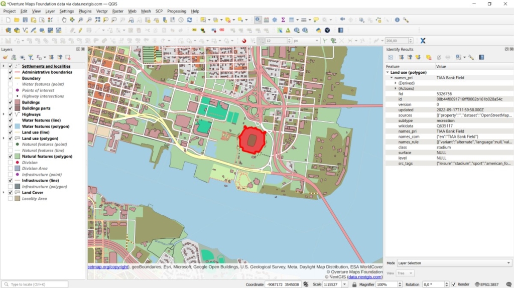
Vector layer sets showing land types, infrastructure, buildings, and other features are still in high demand for developing geographic information systems and creating mapping apps.
NextGIS Data now offers two types of basemaps – Overture and OpenStreetMap (OSM).
Here are the details about Overture data, its difference from OSM, and why you should consider ordering it via NextGIS Data.
The Linux Foundation introduced the Overture Maps Foundation (OMF) on December 15th, 2022. Founding members include companies like Amazon, TomTom, and Microsoft.
The idea behind OMF is to create and develop a unified public geodata set that integrates the best open sources: OSM, data from government agencies of different countries, participant company data, and results from neural network interpretation of high-resolution imagery.
The foundation is constantly seeking new high-quality data and ways to share it, as the web mapping field expands into more sectors every year. The use of an open data license encourages innovative projects in data visualization, logistics, navigation, autonomous driving, local search, and discovery.
The ultimate goal of OMF is to create the most complete and high-quality synthetic set of open geodata with a structure that supports integration into any modern information system.
When choosing geodata for your project, you might ask: which of these base sets is better to use and how do they differ? The answer depends on your goals and objectives. Here are some points to help you decide:
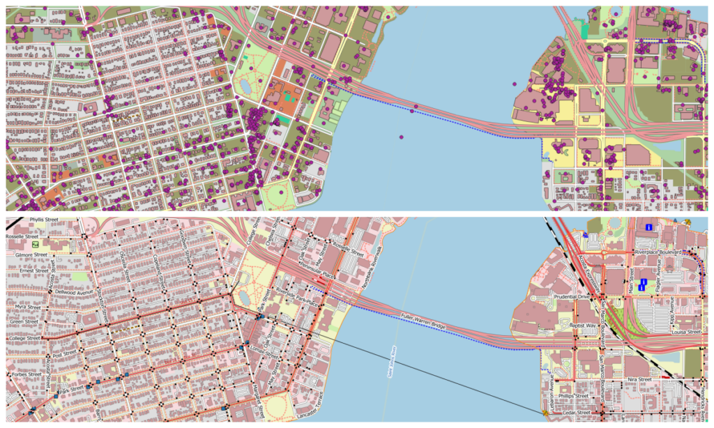
The comparison: Overture base data at the top and OSM at the bottom.