Since the start of the year, our platform has introduced many new features, and this message will highlight the most popular ones. Your feedback helps us develop new NextGIS functions based on our clients’ actual needs and workflows, so we’ll be grateful to hear from you. Now, let’s take a look at what’s new!
In the process of working with geodata, we often need to link Web Map features to organization’s information systems, like accounting, inventory etc. To help you do this, NextGIS Web can open auto-generated links to specific Web Map objects allowing easy and effective integration.
To begin using this function, the organization’s administrator needs to set up link generation in the organization’s primary system. Here is how
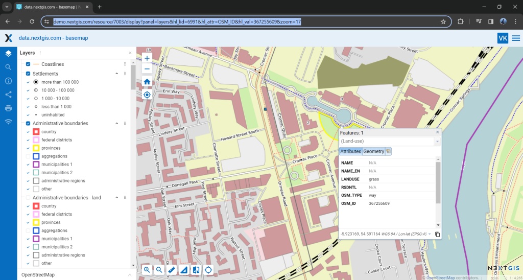
NextGIS web offers you the convenience of filtering objects in a table by highlighting them on the associated map.
On your Web Map, you can select groups of objects by drawing a circle, a line, or a polygon, and the platform will filter the objects in the corresponding table at the same time. After that, you can easily export the selected objects. Learn more
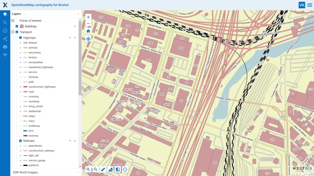
When working with your Web Maps, not only can you hide layers, but you can choose to hide specific layer elements – that is, legend items.
This is relevant for large mapping projects, where layers contain many objects with various values in a single column of the attribute table. For example, a road layer may include federal, regional, provincial, district, and local roads.
Choosing to hide specific legend items allows you to declutter the map, making it more readable for the intended task.
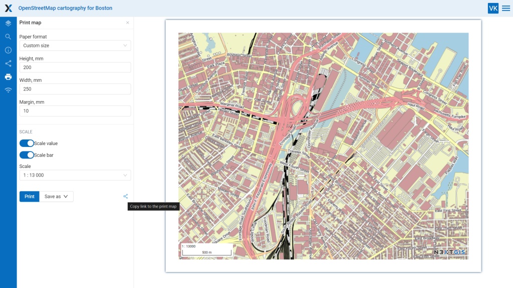
Let’s say you’ve configured a print layout for your map in NextGIS Web, but you want someone else to print it for you. Now, this is no longer an issue – simply send a link to the print layout you’ve set up.
As an example, here is a link to a layout we set up.
More than this, you can save your layout as an image.
Panoramas are a convenient way to explore the terrain. They allow to immerse explore new locations or find new details in familiar places. You can upload panoramic images to Web Maps and view them in NextGIS Web.
Panoramas are linked to specific features on the Web Map. To upload or view a panorama, click on the object and go to the “Attachments” section in the identification window. Learn more
Our Web GIS is designed to support your work with teams of colleagues. Since team members may have specific responsibilities, it’s essential to be able to manage permissions accordingly.
Setting more precise permissions for team members will allow you to designate a specific person or group to manage user permissions, edit coordinate systems, or adjust CORS settings.
Lookup tables are data repositories that can help fill attribute fields for objects on your maps. Needless to say, the ability to connect lookup tables to specific fields of particular layers is crucial.
With NextGIS Web, you can create a lookup table from scratch. After that, enter values manually or upload a ready-made CSV file – and connect the table to one or more fields in a layer. Learn more
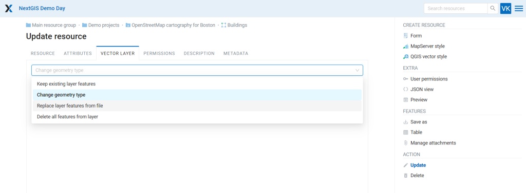
NextGIS Web allows you to delete or replace existing objects in a vector layer. It’s also possible to change the geometry type of a vector layer.
Look for new features in the editing menu of a specific vector layer under the “Vector Layer” tab.
You can convert all the vector layers or a specific folder of your Web GIS into a single GeoPackage file by using a new online tool from the NextGIS Toolbox collection.
In the tool settings, provide your Web GIS information and the folder from which you want to retrieve the vector data.
The NextGIS Connect module, which links NextGIS Web with the desktop NextGIS QGIS, supports working with multiple styles.
NextGIS Mobile has two major updates:
We have just completed a major update to the NextGIS Toolbox service. Out Toolbox is a collection of more than 70 geoprocessing tools that do not require desktop GIS software – a standard web browser is all you need.
Each tool in the NextGIS Toolbox is designed for a specific task. You can search tools by name or tag and create your own collection of essential tools by adding them to your Favorites. Learn more
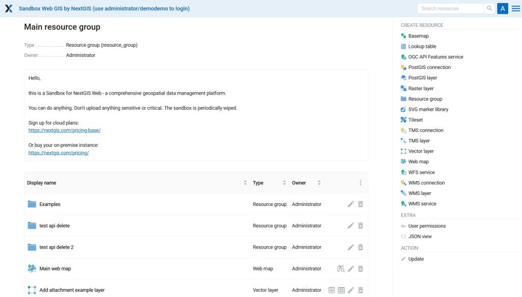
We are always in search of ways to help you learn and use the full potential of our platform. This is why we have created the NextGIS Sandbox. The Sandbox helps you explore NextGIS Web features before building your own Web GIS:
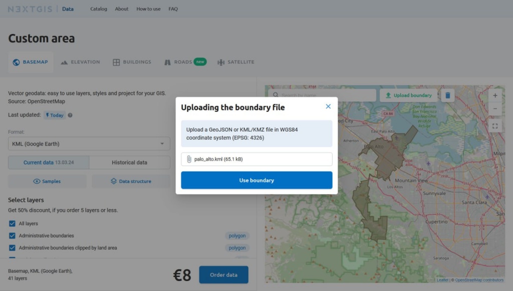
Now data.nextgis.com allows you to use KML/KMZ files to specify the boundaries for an order.
Additionally, any dataset you order can now be provided in the KML format.
Subscribe for €900/year and gain full access to all the features of the NextGIS platform.
You can find information about the NextGIS platform on our products and services pages. To discuss features, ask questions, or suggest improvements, please join our public chat on Telegram.


