It’s a busy spring, and we have a lot of updates in all of our components. Let’s talk about the new NextGIS Web features and NextGIS Toolbox tools.
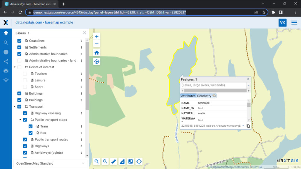
A new feature allows easy integration between your web maps and other systems. Generate links to specific objects on your web maps. Anyone who follows will open the full map centered on a described feature.
These links can be automatically generated within a system that you need to integrate with NextGIS Web.
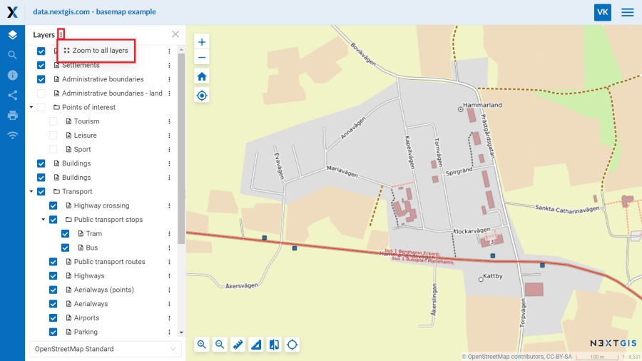
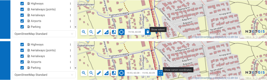
At any moment, while working with the web map, you can return to the default view, where all layers will be fully visible.
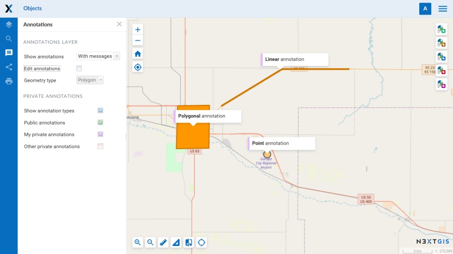
In addition to point annotations, you can now add linear and polygonal annotations on a web map.
Annotations are a convenient way to leave comments, remarks, or explanations on a web map, and they can be set as public or private.
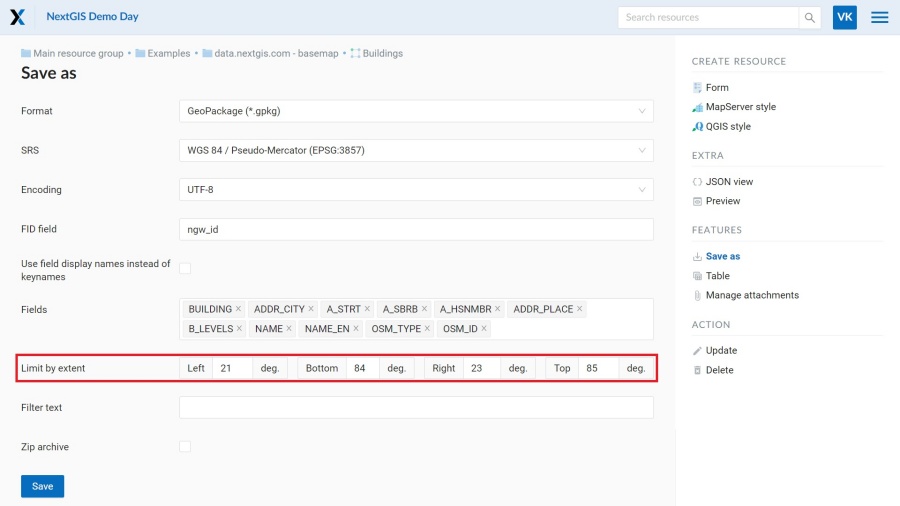
When saving a vector layer on your PC, you have the option to limit its extent. Extent should be specified in degrees.
Besides lines and polygons that are fully within the extent, objects that only intersect the extent boundary are also exported.
NextGIS has developed over 20 plugins for QGIS. We derive ideas for new plugins from conversations with our users, so feel free to join our Telegram community and chat about what bother you most.
To make it more convenient for you, we have created video guides for each of our plugins. You can find all the videos in a dedicated playlist on our YouTube channel.
The tool creates or updates a point layer based on data from a Google Sheets. The table must contain coordinates of the objects in the ‘lon’ and ‘lat’ fields in degrees. Output layer is saved to your Web GIS.
Try some more new tools:


