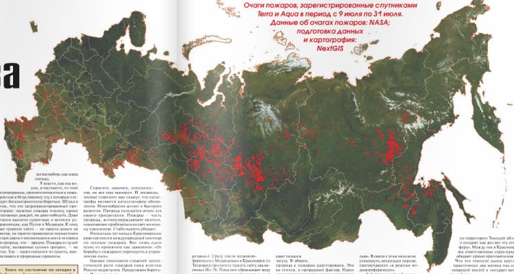
NextGIS has created a fire hotspots map, encompassing all of Russia for a recent 3-week period, that uses daily Terra and Aqua MODIS Thermal Anomalies and Fire Detection data (MOD14/MYD14).
The map uses data from a special service developed by NextGIS, amassing hotspots data into a PostGIS database, and storing them in ESRI Shape and CSV formats. The database contains data from the entire period of MODIS observations starting in 2000.
The map is published on the title page of the January 8th, 2012 edition of Novaya Gazeta. Read the full article here (in Russian).

