NextGIS has finished implementing NextGIS Web/Manager/QGIS based Geodata storage. This development is done together with Rekod Corp. in interest of Russian Federal Space Agency.
Geodata storage is based on NextGIS Web and allows to:
- upload and download geodata from file sources based on format (storage can deal with formats that include several file types for one data source)
- upload and download common files from file system (for example zip-archives)
- publish raster layers as WMS services
- publish vector layers as WMS/WFS services
- create web maps
- import NextGIS QGIS project file with settings as a web map
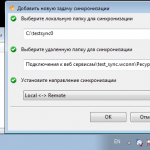
- syncronize (one- and bi-direction) folders in the file system with groups of resources in the storage
- manage access permissions
- search for geodata in storage
Besides storage itself, we also deleveloped:
- a set of specialized installers of Desktop GIS (based on NextGIS QGIS)
- desktop manager tool to work with Geodata storage (based on NextGIS Manager)
- tool to syncronize Geodata storage and local file system
Geodata Storage has both web interface and desktop client. Use of the desktop client adds the following capabilities:
- uploading geodata sources of unlimited size;
- metadata are extracted on upload and stored, it is possible to search through metadata later;
- uploaded geodata also acquire a preview, it makes it easier to select needed geodata from storage;
- on creation of raster and vector layer geodata can be processed to satisfy criteria imposed by Geodata Storage;
- drag’n’drop and copy/paste are supported
To prepare geodata for upload we also created special installers for desktop GIS NextGIS QGIS. Each installer is customized to serve for specific purposes of the customer:
- modified user interface to leave only needed
- added required plugins
- use special version of GDAL library
- specific calls for external software are grouped in a special panel using new Shortcut Manager plugin that allows to organize external application calls from NextGIS QGIS.
To improve handling of various types of satellite imagery, we impoved support of metadata structures for different types of satellite data in GDAL. In addition to already existing: Ikonos-2, QuickBird, GeoEye-1, WorldView-1, WorldView-2, OrbView we’ve added support for:
- ALOS
- EROS
- Formosat
- Kompsat
- Landsat
- Pleiades
- RapidEye
- Resurs DK
- Spot
-
-
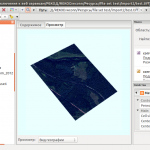
Пользовательский интерфейс хранилища
Management interface for Geodata Storage
-
-
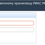
Аутентификация и брэндинг/Authentification and branding
-
-
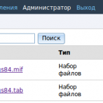
Поиск по ресурсам/Search for resources
-
-
Geosyncronizer
Работы выполнены для ОАО “НПК “РЕКОД” в интересах Федерального космического агентства (Роскосмос).


