Web-GIS for “Taimyrskiy” Nature Reserve
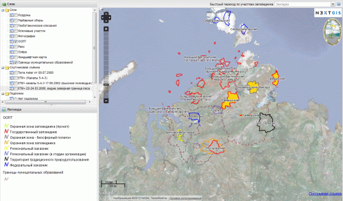
Web-GIS for the State Natural Biosphere Reserve “Taimyrskiy” is located at http://taimyr.info. This is the first of such systems among Federal level Protected Areas of Russia.
The system is aimed at tourists, students, researchers, conservation specialists. The goal of the system is to visualize the area of the reserve and surroundings, as well as give detailed information for some features.
Currently, the list of layers include: inspector huts, herbarium collections, geobotanical descriptions, key areas, protected areas, rivers, lakes, landscape map, boundaries of municipalities, photos. Layer are based on vector data and published via WMS, which allows use them not only in this Web-GIS, but in various other GIS applications. Another group of layers is based on raster data – satellite images for the area. Detailed information on the system is available at its help page.
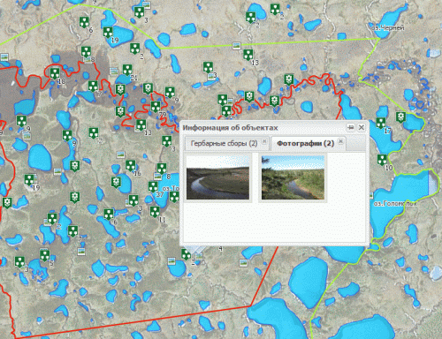
Some of the layers allow interaction. User can click on objects to fetch detailed information. Currently these are “Herbarium collections”, “Geobotanical descriptions”, “Photos” and landscape map of “Lukunsky” section.
It is possible to obtain a permalink that includes the state of layers (turned on or off) to further share or use in your own projects.
It should be noted that this project uses the possibility of server side points clustering, which first appeared in MapSever 6.0.
The system is built completely on opensource software: GDAL, MapServer, TileCache, OpenLayers, GeoExt and works in any modern web-browser without the need to install any additional software.


