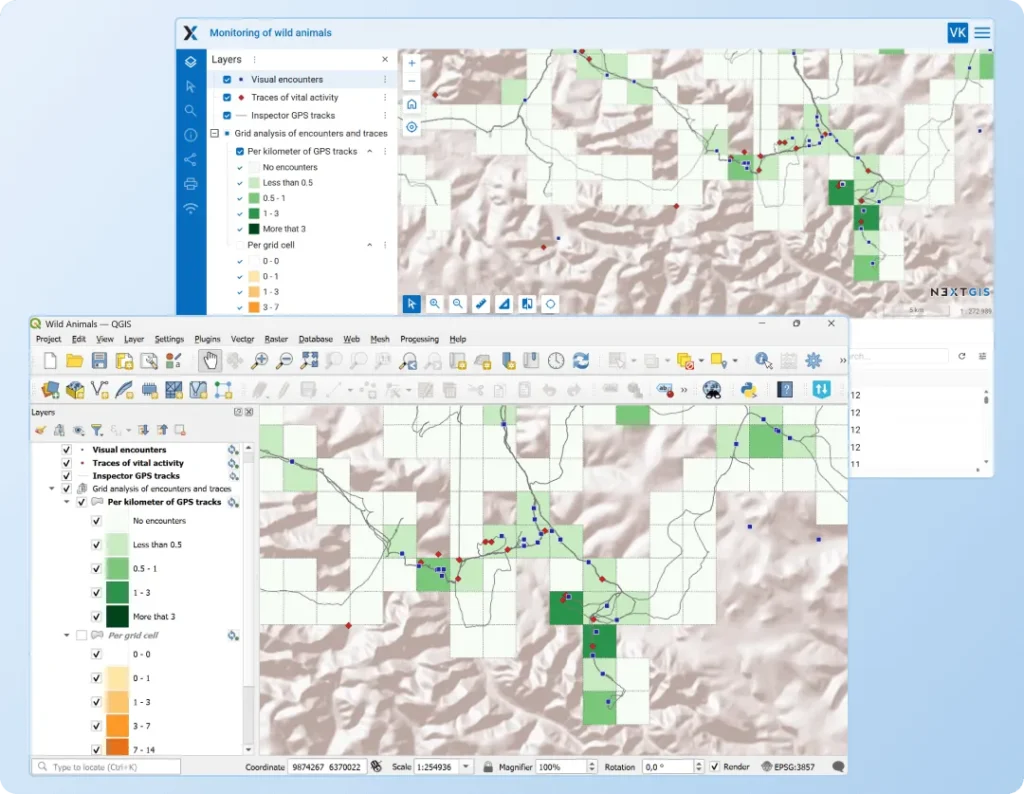
Publish and Manage Web Maps Directly from QGIS
NextGIS Connect is a QGIS plugin that bridges your desktop GIS work and web publishing, enabling seamless data and map management without leaving your familiar QGIS environment.
- Create interactive Web Maps from QGIS projects in just a few clicks
- Download maps from cloud or server GIS back into QGIS as editable projects
- Edit maps and data in QGIS with instant synchronization to your Web GIS

Simple Setup
Start publishing in under 10 minutes.
Create your Web GIS
Cloud-based | On-premise
Launch QGIS
on your desktop
Install NextGIS Connect
and connect to your Web GIS
Works with Your Existing Workflow
NextGIS Connect transforms your QGIS desktop into a powerful publishing and management tool for Web Maps:
- QGIS 3 compatible: installs from the official QGIS plugin repository
- No data conversion required: works with all common spatial data formats
- Preserve your styling: updates symbology for published layers without republishing
- Industry standards supported: creates WFS, WMS, and OGC API – Features services
Easy Layer Editing
You can edit vector layers from your Web GIS immediately after adding them to QGIS. Changes made in QGIS are instantly reflected on the web.
Editing is possible in offline mode, without an internet connection.
When you start editing a NextGIS Web layer in QGIS, a sync icon will appear next to it. Click on that link to check the update status of the layer.
As a result, now you can perform direct editing of your Web GIS data both through the WFS service (online) and also through the new NextGIS Connect functionality (online and offline).
Web Map → QGIS Project: the reverse process
Do any of your Web GIS maps need an update? Do you need to distribute a Web Map to colleagues for editing or offline browsing in QGIS?
You and your team can add an entire Web Map to QGIS! It will be presented as a project with layers, styles, and basemaps. Your colleagues can then save the map locally and edit it independently offline or edit the Web Map in real-time.
A Web Map in NextGIS Web is the equivalent of a QGIS project. It similarly contains layers, styles, and other settings.
Basemaps, TMS and PostGIS Layers → QGIS
You can add your Web GIS basemaps to your QGIS. The same applies to TMS and PostGIS layers.
Publish your maps and GIS data online
Install NextGIS Connect from the QGIS Plugin Repository and connect to the NextGIS cloud-based or on-premise GIS.


