The WFS protocol helps retrieve vector layer data from an external database, operating over HTTP/HTTPS. External databases, or WFS servers, can be hosted on various platforms, such as ArcGIS Server and GeoServer.
The WFS protocol provides developers and end-users with a universal interface for accessing vector data. With WFS, users do not need direct access to the data storage or additional skills to extract data.
The WFS acts as a layer between the database and the user/application. The service transmits vector geodata without styling, allowing styles to be configured on the client side.
Many platforms support deploying one’s own WFS service, and many offer WFS data retrieval. Now, NextGIS Web joins the ranks of platforms that offer both capabilities.
From the start, NextGIS Web GIS (both cloud and on-premise) could act as a WFS server, providing a layer between external databases and client applications. Now you can both create a WFS layer for distribution and display data retrieved via WFS on an interactive Web Map.
Data for retrieval via WFS may be obtained from:
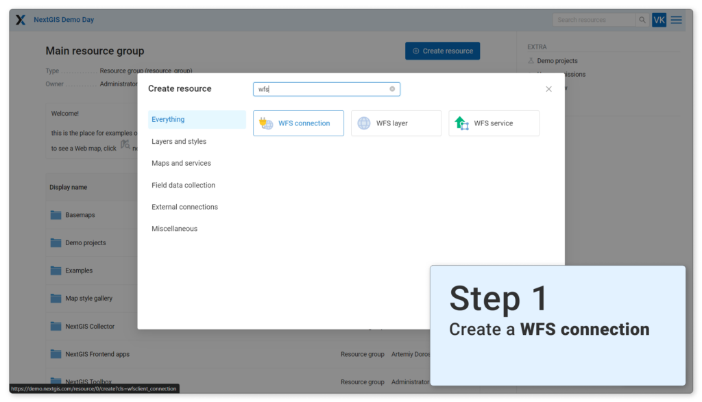
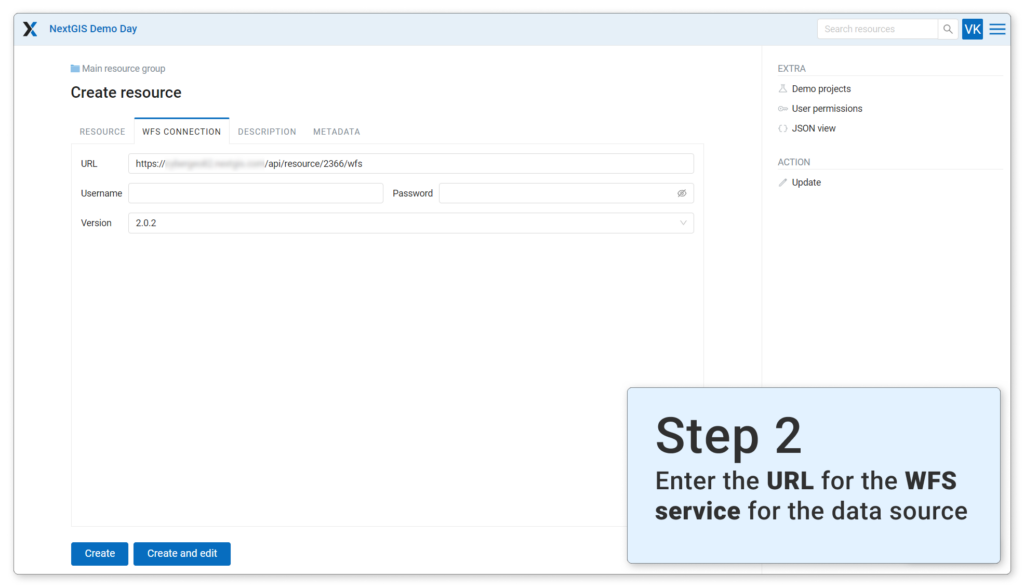
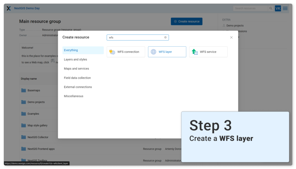
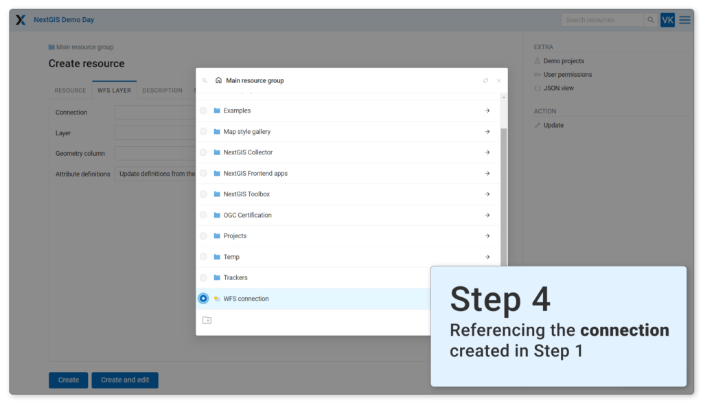
The process involves four resources:
WFS supports filtering objects by attribute, so there is no need for the local user to retrieve all objects. Therefore, filtering is performed based on the object’s location in the user’s region.
You can load your own style to the WFS layer and then add it to the map.
For the connection to work, the data source side must set up access permissions for the data and the WFS service for external systems.
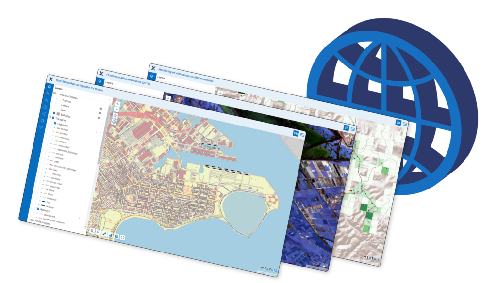
Team Collaboration. Visualization. Integration.