We are pleased to introduce a new dataset available through NextGIS Data – points of interest. Use this dataset to get insights for market analysis, site selection, planning and development.
Move, click, and zoom in and out
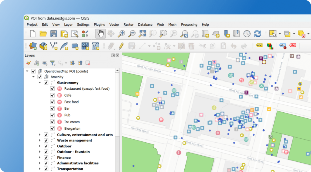
Points of Interest (POI) on data.nextgis.com is a comprehensive spatial dataset that includes information about a wide variety of locations: from cultural landmarks to popular recreation and business establishments. Each point contains detailed information – names, categories, precise addresses, and other important characteristics.
Our product contains continuously updated/refreshed information from three sources:
This approach ensures maximum completeness and accuracy of information.
Each point of interest contains:
Every location is precisely categorized, so you’ll never mistake a coffee shop for a restaurant or a bank branch for an ATM.
Imagine you need to identify the most advantageous location for a new restaurant. With this POI data you can not only count the total number of establishments, but also analyze them by category – from fastfood restaurants to fine dining. POI data analysis will help you make informed decisions about placing new businesses or choosing a neighborhood to live in.
Points of interest are available through our data.nextgis.com service. This product is an indispensable tool for anyone working with spatial data and making decisions based on geographic information.
Data for any territory is available in convenient formats for different geographic information systems and applications.


