Available in NextGIS Web Standard, Extended, and Enterprise 3.0.0 editions, and in the cloud version
Introducing NextGIS Web 5.2! From powerful new editing capabilities to enhanced performance, this release makes your mapping workflows faster and more intuitive.
Users of our on-premise GIS can update and try out the new features on their servers. Cloud Web GIS users already have access to the updates. If you have any questions, contact us via our Community Forum or in our Telegram chat.
We’ve redesigned the feature editing tools in NextGIS Web. All you need is your browser to create and modify points, lines, and polygons; cut holes in existing features; or move entire features on your map – shortening the learning curve for team members with limited or no QGIS experience.
Attribute editing is now more intuitive: switch to editing mode with one click, then simply click the feature you need to modify.
Another useful addition is snapping to vertices and segments when editing or creating features – especially valuable for tessellation and parcel alignment.
Don’t be afraid to experiment – any change can now be undone before you save your edits.
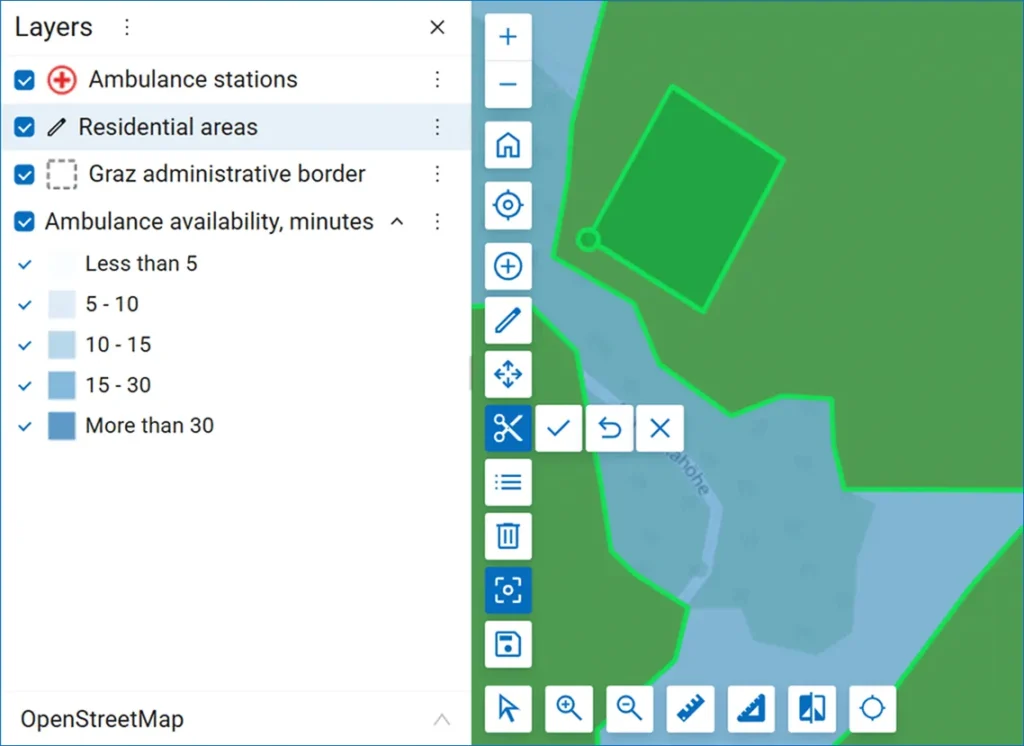
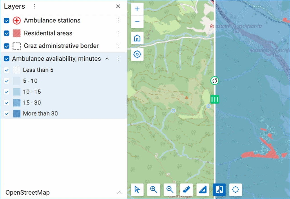
The swipe tool allows you to compare a selected layer with the rest of the map. Now you can move the swipe both horizontally and vertically – perfect for before/after comparisons and change detection.
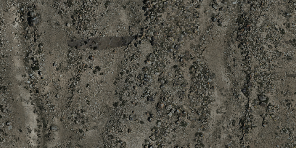
Now you can see even more detail on Web Maps! We’ve increased the maximum zoom level for Web Maps to 24. This gives you access to incredible detail: individual building features, infrastructure elements, and even ancient rock carvings on your high-resolution orthophotos.
Can you spot a deer carving on one of the rocks?
In NextGIS Web, you can draw a feature directly on your map – or open a layer’s attribute table and create the feature there. Now when entering data, you’ll see a “Geometry” tab where you can draw the feature on an embedded map. The same approach works for editing existing features as well.

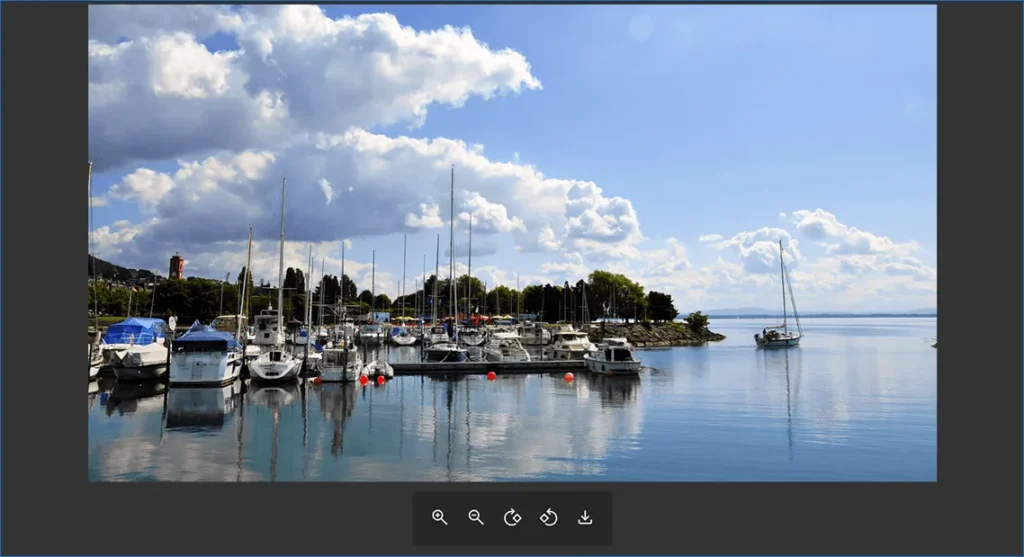
HEIF has become the default photo format on some smartphones. Now you can upload such photos to NextGIS Web as feature attachments – they’re automatically converted to JPEG and will display correctly. No more file conversion hassles!
We’ve enhanced the toolbar for viewing photos (attachments) of features on the map. We’ve also improved zooming – it’s now much more convenient to zoom into photos by simply scrolling the mouse wheel.
We continue developing layer versioning functionality, , allowing you to track who changed what and when. Previously, we added the ability to add and rename fields in versioned layers. Now field deletion is also supported.
We plan to make all layers in NextGIS Web versioned by default.
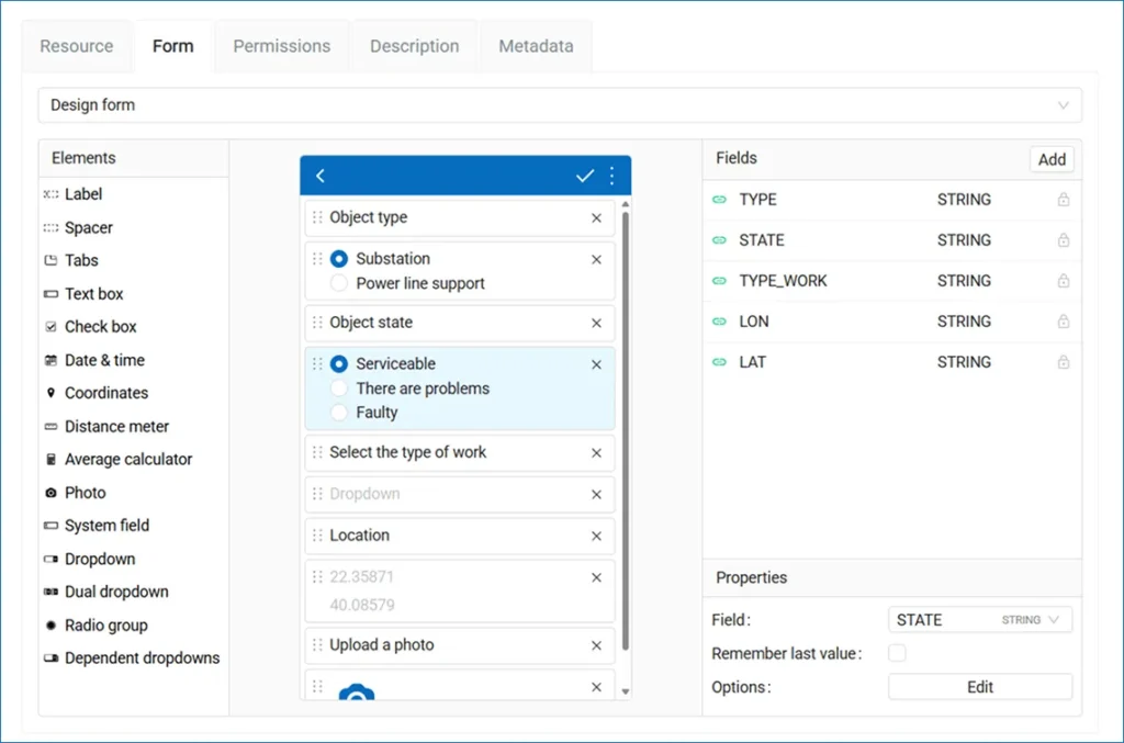
Mobile data collection forms for NextGIS Mobile and NextGIS Collector can be created not only in the NextGIS Formbuilder desktop application but also in the new form editor in NextGIS Web.
If you previously created forms in NextGIS Formbuilder, you can upload and edit them in NextGIS Web. Everything will work correctly in the new editor.
Web Map Tile Service (WMTS) is a standard protocol developed by the Open Geospatial Consortium for serving georeferenced map tiles. These tiles are loaded from the server in fixed sizes and zoom levels, which ensures fast and efficient map display.
WMTS is now supported in various widely-used geographic information systems, including QGIS. For better compatibility, we’ve added WMTS support (both KVP and REST) to NextGIS Web.

Another update related to improved compatibility is support for GeoPackage 1.4.
We’ve improved the performance of MVT generation. Layer previews have also been migrated to MVT and work faster now. This is especially relevant for layers with large numbers of features.
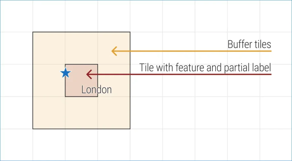
In tile adapter mode, layer tiles on the map are now rendered with a buffer. This means there will no longer be clipped legend symbols and labels.
Previously, if a label or large icon fell on the tile boundary, it would be clipped due to the subsequent overlay of the adjacent tile. Look at the diagram to understand how this works.
NextGIS Web maps feature a search function that covers your GIS data and additionally performs searches against the OpenStreetMap database via Nominatim.
For NextGIS Web deployed on a closed network, there’s now an option to connect your own Nominatim geocoding server, which also operates within the organization’s closed network. The key advantage is complete isolation: search will work within your local network without sending requests to the outside world.
is software that works with OpenStreetMap data, but its main feature is search and conversion of addresses and place names into geographic coordinates (and vice versa). Simply put, it’s a geocoding engine for OSM.

Our cloud customers already have access to these new features. No additional action is needed.
If you’re our on-premise client, write to support@nextgis.com to request an update of your NextGIS Web installation.
If you’re interested in our solutions, explore our products and services – and reach out to us at sales@nextgis.com.


