The latest version of NextGIS Web – 4.8.0 – is now available! In response to client requests, we have enhanced the cartographic features of the platform and introduced new data management functions. Let’s take a closer look at the most significant changes.
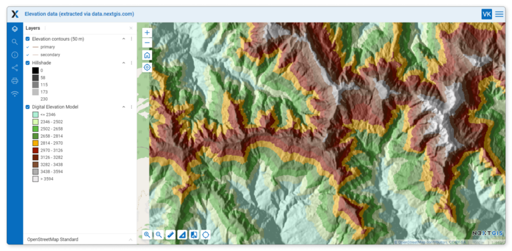
Web GIS now supports legends for raster layer styles. This enhancement improves your ability to display indicators such as vegetation cover and its density, surface relief, and more.
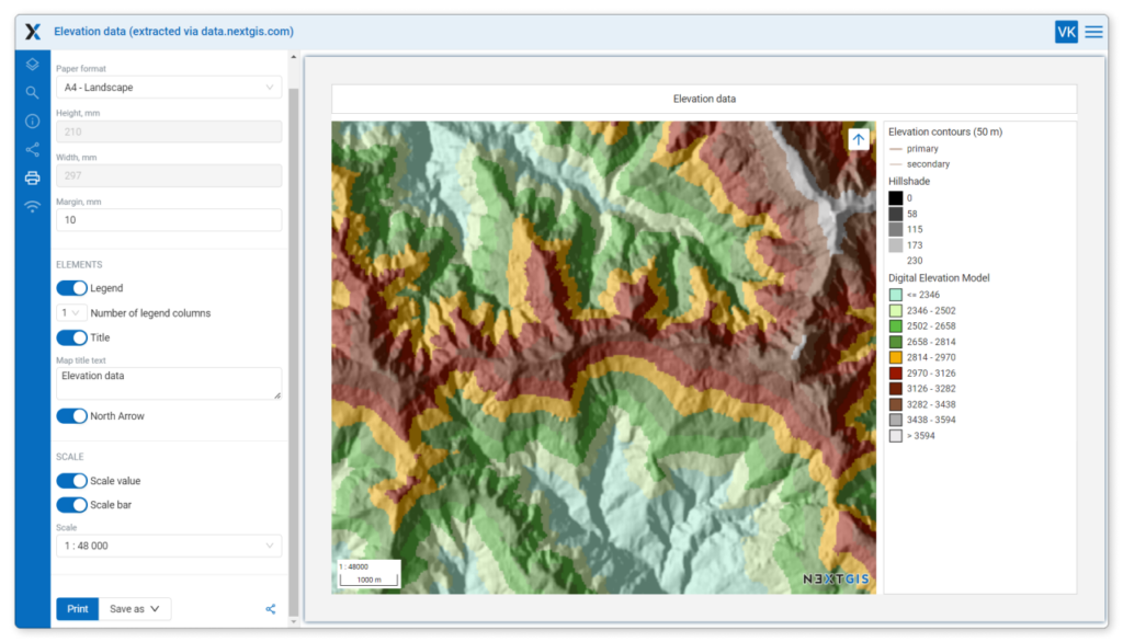
NextGIS Web makes it easy to prepare a map for printing. You can now add a legend, a title, and a north arrow to the layout. These elements can be moved and resized to make your print look perfect.
Create a group of layers and designate them as “Exclusive” to ensure that only one layer in the group is displayed at a time. For example, enabling the highways layer will automatically disable the railways layer. Similarly, showing the terrain layer will turn off the satellite imagery.
Do you store a lot of data in your Web GIS? Keep the most important items at your fingertips by using Favorites. You can add any resource or map to your Favorites. In fact, you can even favorite a map with a specific scope and layers enabled.
For easier measurements, you can now set a custom coordinate system for any of your web maps. The default coordinate system is set in the global settings of your Web GIS.
This feature is especially useful for those working with data across different regions and countries.
Enable version history for vector layers by going to the layer settings and checking the “Feature versioning” option.
Once enabled, the platform begins to track the complete history of changes made to the layer objects – including who made changes, when, and what was changed. This history is displayed in a separate column in the layer table.
This functionality will soon allow you to restore previous versions of layers, effectively “rolling back” edits.
Version history is maintained both when editing directly in NextGIS Web and when making edits in QGIS through the NextGIS Connect plugin.
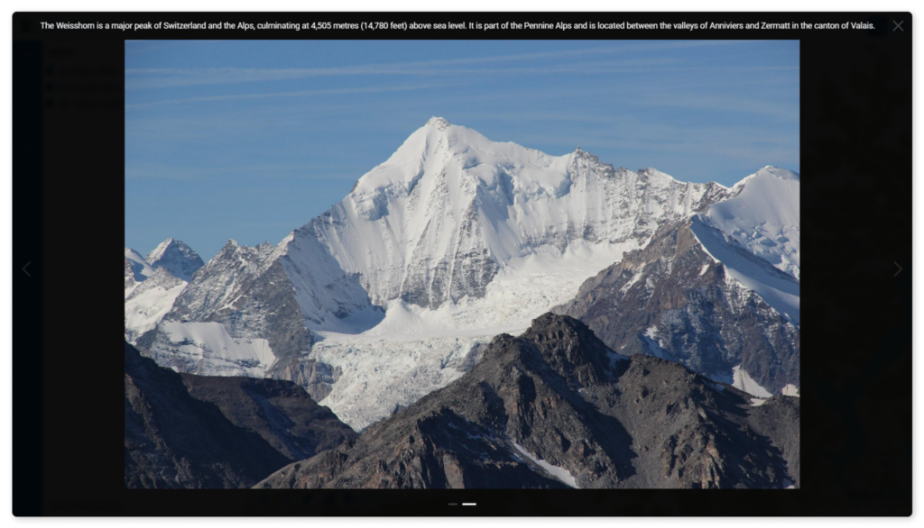
When viewing photos attached to an object on a map, you will now see a description of the photo as well. If there is no description, the filename is displayed.
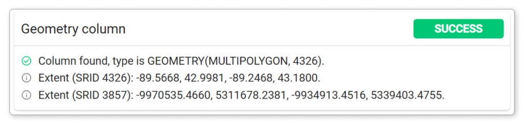
To find this information, navigate to the desired PostGIS layer, and then go to the “Diagnostics” menu.
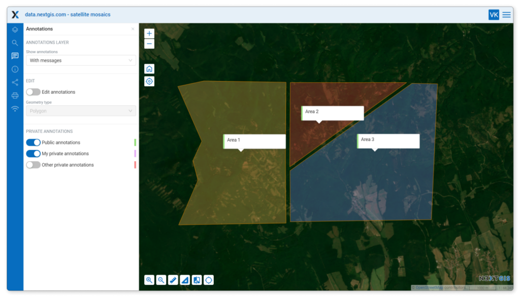
To improve presentation, polygonal annotations are now semi-transparent. This is particularly useful when a map contains many large annotations.
UPD: On August 13, 2024, a webinar on the NextGIS Web 4.8.0 updates for Eurasia and Africa was held. Here’s the recording. We also conducted a similar webinar for North and South America.


