Update: Check out the MOLUSCE webinar materials from April 14, 2026
Update: MOLUSCE is now available for QGIS 3 and 4. Check MOLUSCE page.
Together with Asia Air Survey we’ve developed MOLUSCE (Modules for Land Use Change Simulations) – a tool based on QGIS that allows to perform quick and convenient analysis of land use / land cover (LULC) changes.
A researcher who analyses changes in landscape through time often deals with questions like:
The answer for the first question can be obtained by visual estimation, but to answer other questions one will need to set hypothises, verify them, derive conclusions and see how they meet the reality.
MOLUSCE is a toolbox to partially automate the process of answering such questions.
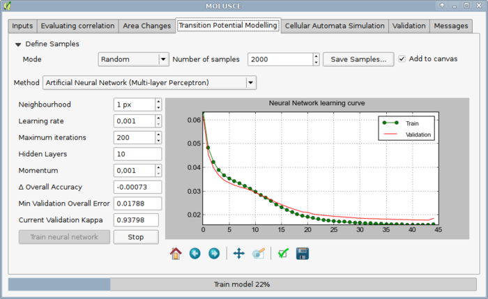
Briefly, the workflow consists of the following steps:


