NextGIS has developed a of fully functional GIS for the municipality of Krasnogorsk. After completing the first stage, the GIS now includes:
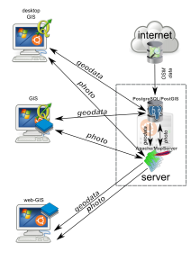
• Server-side (geodata storage and transmission for NextGIS clients)
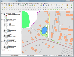
• Desktop client (geodata demonstration and preparation, including editing for internal use)
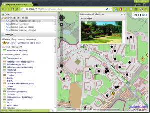
• Web client (geodata demonstration for end-users, currently available for the Intranet only)
The following architecture was suggested and implemented:

GIS prototype architecture
The GIS uses OpenStreetMap data as a base map. Two digital layers were also created and overlaid on top of the base map: green areas (lawns, parks, etc.) and public buildings. The base map is updated daily via the Internet.
During the project, several additional extensions targeted to the desktop client were developed:
• The plugin to upload object description and associated images to the database
• The plugin to create subsets of the database using object properties and create a report based on this subset
• The plugin to calculate areas and lenghts of polygonal objects
Developed GIS is multiuser friendly, with several levels of user accessibility available:
• Administrators — Have full access to the databases and software, allowing for the implementation of system changes
• Operators — Have access to read basemap and have full access to layers set by the administrators
• Users — Have access to read certain layers
• Visitors — Have access to Intranet maps with available functionality
GIS is built upon exclusively free (open-source) software. Access control and information access is managed via the means of operation system and DB.
Server-side is built upon:
- ОС Ubuntu 12.04 LTS
- PostgreSQL 9.1/PostGIS 2.0
- Mapserver 6.0
Desktop client is based on NextGIS-QGIS 1.9, web-client is developed with ExtJS 3.4, OpenLayers and GeoExt.


