


NextGIS Tracker:
Easy Location Recording and Synchronization
- Record GPS tracks
- Automatically synchronize with your storage (cloud or on-premise)
- Export to GPX
Location Recording
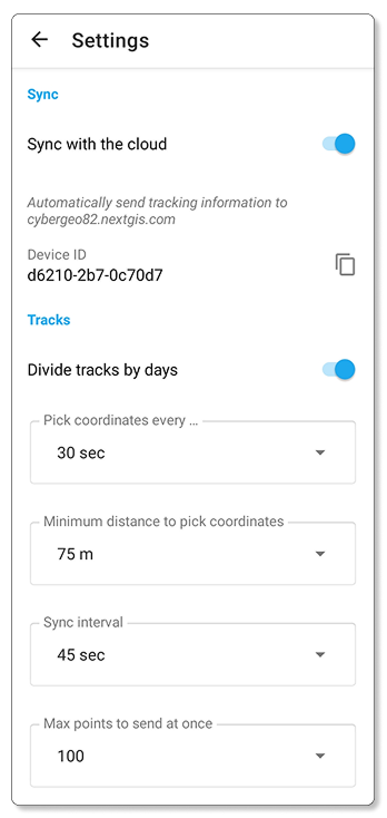
In NextGIS Tracker you can configure location recording parameters, including the minimum distance between track points. The smaller this value, the more detailed the recorded route will be.
Synchronization
Your location tracks are automatically sent to your storage. Create a cloud-based Web GIS or deploy NextGIS Web on your own server to act as a storage.
View data on interactive maps
Your movement information will be displayed on interactive maps in your Web GIS. Multiple users can send data. A convenient filter for date and time is available.
Complete control over interactive map content – your movement data can be put on top of any layers and basemaps added to the Web Map.
Discover a simple and convenient tool for recording and synchronizing movement data on interactive maps
NextGIS Tracker is available for smartphones and tablets on Android.