Presenting NextGIS Web 5.1! Server GIS users can update and try out new features on their servers. Cloud Web GIS users already have access to the updates.
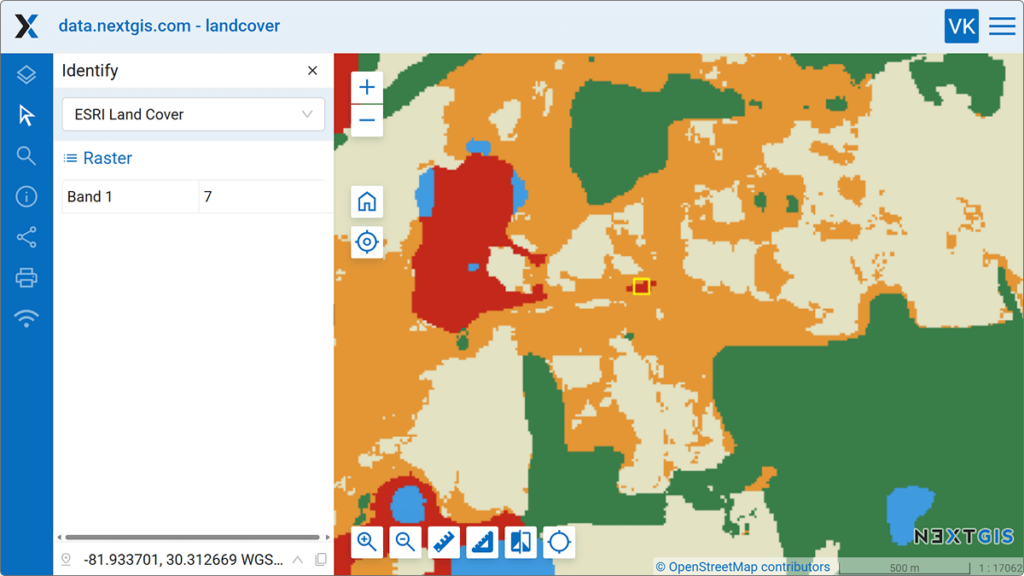
Now you can click on a raster layer in your Web Map and retrieve information about a specific pixel. This is especially useful when working with DEM processing results, meteorological datasets, and other data that are clustered or categorized by various indicators.
This functionality is going to be extended further. Soon, you will be able to see the values of the raster attribute table (RAT) as well as channel metadata directly in the Identify panel.
You can now collect data using NextGIS Collector and save it directly into your PostGIS database. This is convenient when you:
Simply add PostGIS layers to Collector projects in NextGIS Web — and the updated mobile app will work with them just like with regular vector layers. No more unnecessary conversion and duplication!
Update the Collector app in Google Play or download the new version from your NextGIS Account.
This release offers another option for customizing your maps. If you don’t need certain map tools, you can now disable them — for example, panels with trackers. You can also disable the display of attributes and geometry of identifiable map objects.
These settings can be configured for each map individually or globally for all maps.

We continue to improve the functionality of vector layer versioning, and the new release offers two enhancements:
Adding fields to versioned layers. You can now add new fields to versioned layers without having to disable versioning first.
Versioning info displayed on the Resource page. You can now see if a layer is versioned directly on the Resource page, without the need to enter Edit mode.
What is versioning? This feature logs edits made to vector layers, allowing you to see what changes were made, who made them and when — and to revert to previous states of the dataset if needed.
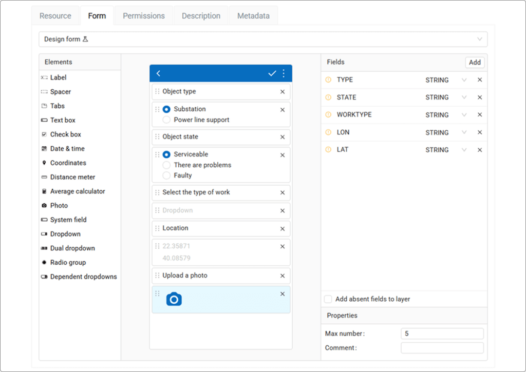
If you currently use the NextGIS Formbuilder desktop app to create data collection forms, we invite you to test the new web-based version of the Formbuilder.
With the web version, there is no need to export forms back and forth between your desktop and NextGIS Web for edits. This release has also allowed us to start updating some of the form elements available in the app.Try it out and send us your suggestions and feedback via our Community Forum or in our Telegram chat.
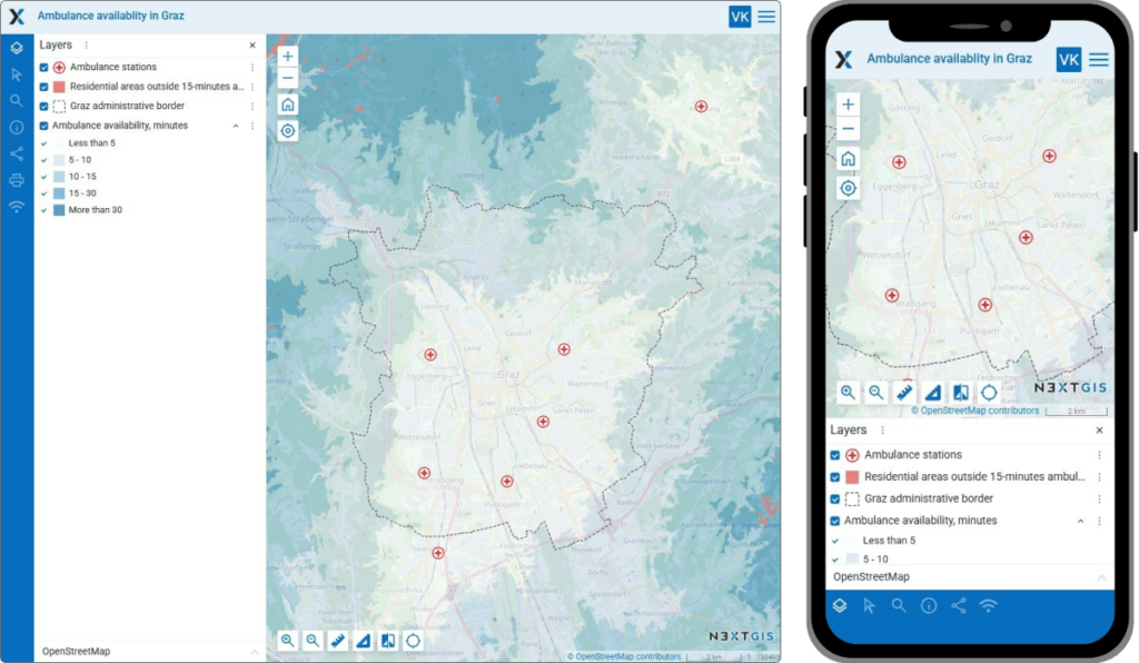
When you share a link to a Web Map, the URL now includes information about legend settings. This is especially helpful for maps containing a large number of layers.
For example, if your map has several legend categories, but your audience only needs some of them, you can turn off the unnecessary layers. The shared URL will then display only the relevant layers for your users. All other layers will appear turned off — just like you intended.
Important: for this to work, copy the link from the “Share” panel, not from the browser address bar.
We’ve introduced an experimental responsive layout for Web Maps on smartphones and tablets. Future plans include adding a responsive layout for the administrative interface. We will also continue to improve the mobile version of the Web Map interface.