In recent months, we rolled out several major updates across our platform: fundamental changes to the NextGIS Connect plugin, a new set of basemaps based on Overture data, a new version of NextGIS Web, and an update to the NextGIS Frontend website for developing mapping web applications.
Let’s dive in! If any of these topics interest you, use the menu below to jump directly to the relevant section.
The new, radically transformed version allows you to add a Web Map to QGIS in its entirety, easily and instantly edit vector layers, and use lookup tables when uploading and downloading layers.
Managing authentication through the QGIS authentication manager enhances your data security. In addition, NextGIS Connect now supports authentication through Keycloak, an identity management product from RedHat. More info

NextGIS Connect is a QGIS plugin that enables you to create an interactive Web Map from your QGIS project with just a few clicks. The tool allows you to manage your Web GIS data directly from your desktop software.
Major enhancements included in this version:
More info, examples, and tutorials
UPD: On August 13, 2024, a webinar on the NextGIS Web 4.8.0 updates for Eurasia and Africa was held. Here’s the recording. We also conducted a similar webinar for North and South America.
We are excited to introduce two significant new datasets: basemaps based on Overture data and road data from Microsoft.
By ordering Overture data, you will gain access to a selection of more than a dozen layers, including:
You will receive geodata compiled by Overture members, including Microsoft, TomTom, Esri, and Amazon. Validated and enriched using artificial intelligence, Overture basemaps provide an alternative to OSM. More info
If you need only the road network data for a specific area, NextGIS Data offers a set of three layers:
Combining Microsoft and OpenStreetMap data gives you a more complete picture. More info
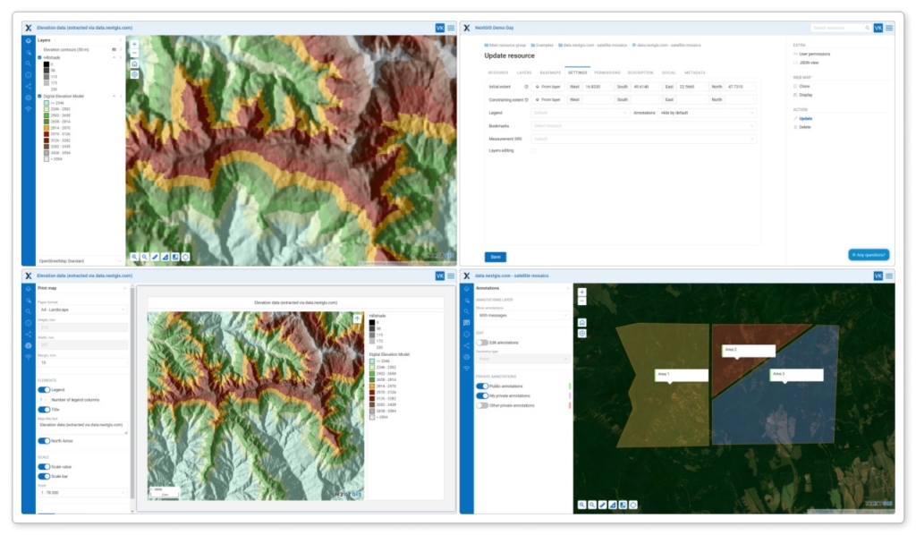
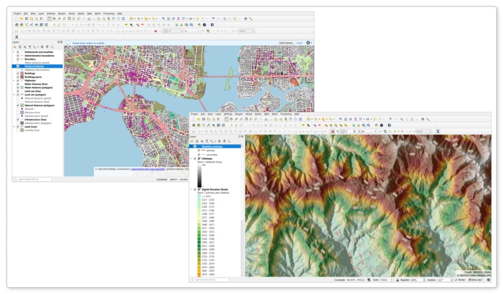
You cannot fully appreciate your geodata until you configure the styles, which enrich it with informational and aesthetic value.
So now, when you order a dataset in QGIS formats (Shape, GeoPackage, GeoJSON, etc.) from NextGIS Data, you also receive a fully-configured QGIS project.
For OSM or Overture data, you essentially get a beautiful set of base maps. If you order elevation data, you receive a fully-fledged hypsometric map. Order data
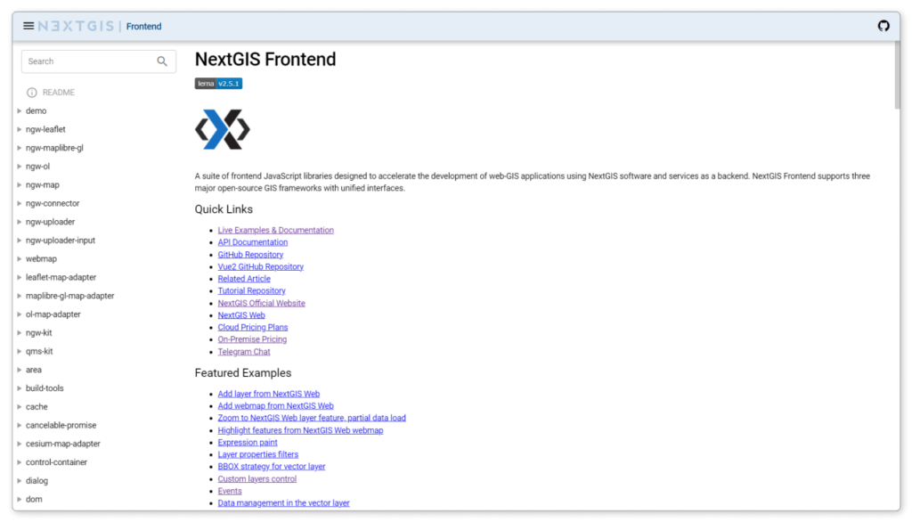
The NextGIS Frontend library website has been completely redeveloped. Now, you can modify the code of each example in the built-in editor and immediately see the changes on the map. The documentation section for developers has also been updated. More info
NextGIS Frontend is a set of components for developing mapping web applications based on NextGIS Web. It includes dozens of JavaScript libraries and usage examples tailored for your specific user interface needs.
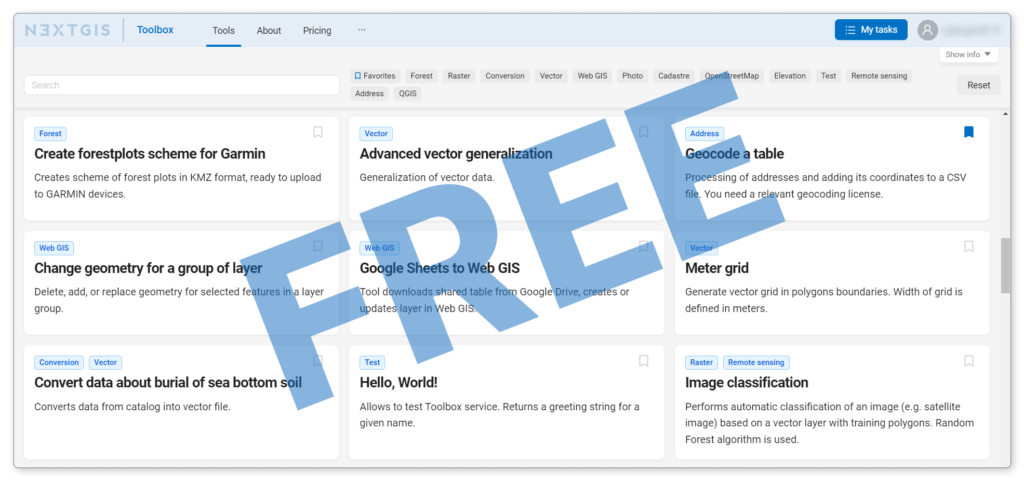
Great news! In addition to expanding our collection of online geoprocessing tools, we have made most of them free! To start using them, all you need to do is log in to your NextGIS account or sign up.
NextGIS Toolbox is a collection of online tools for geodata processing. Each tool performs a specific task, such as converting vector layers, processing raster layers, transforming various tables into geospatial data, and more.
Modern geodata formats often include Z and/or M coordinates in addition to the primary X/Y ones. Z coordinates store height data for a node/point, while M coordinates hold additional data about the node/point depending on the task.
Z/M coordinates:
However, not all software supports working with Z/M coordinates. Sometimes you need to remove them to avoid processing errors.
NextGIS Toolbox now includes an online tool to accomplish this task. Simply upload your layer into the designated field and run the tool. Within a minute, download the layer with Z/M coordinates removed.
If your CSV table contains a single cell with a full address, this cell can be split into several separate fields: region, city, street, house number, and postal code. Open the online tool to see how it works.
Data layers have a specific structure, permanent identifiers, styles, and other settings. What if you need to reset or update the layer data while retaining its structure, identifiers, and styles?
NextGIS Web provides a special tool for this purpose. This tool clears the contents of the layers while preserving the layer itself and all its settings, essentially creating a template that you can reuse for new data in the future.
Turn your Web Map into a complete data package and a ready-to-go QGIS project in just a couple of clicks.
Heading on a trip without internet access? Need to hand your data over to an outside contractor? With this new tool, you can do this quickly and easily. More info
Please update our mobile applications NextGIS Mobile and NextGIS Collector to try their new functionality.
NextGIS Mobile is a comprehensive mobile GIS that allows you to edit data stored in your Web GIS. NextGIS Collector is specifically designed for team collaboration.
When filling out the form to create an object, you can now add multiple photos at once. You can limit the number of photos that can be attached when setting up the form in NextGIS Formbuilder.
You can now enter large numbers through mobile forms, such as tax identification numbers (TINs), object serial numbers, or other identifiers. You can be sure that this data will be stored in the Web GIS exactly as you entered it.
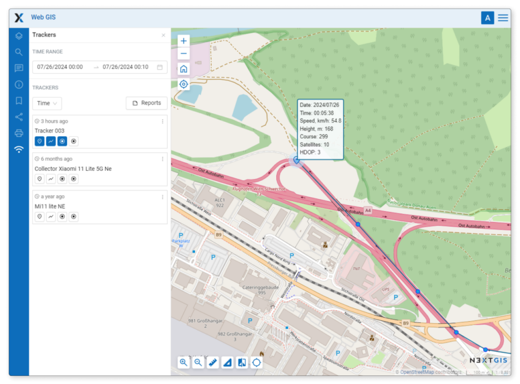
When working on a tracking project, the application now logs the direction along with the route. More info
You can now view the total number of satellites, HDOP values, and direction support – all recorded in the GPX track file. More info
Certain formats, such as MapInfo TAB or MIF/MID, have their own symbology. While QGIS supports these styles, it does not have a built-in way to view style descriptions directly.
To provide style descriptions in QGIS, we have developed a new plugin, NextGIS OGRStyle. With just one click, it displays the style description for your layer.
This description is a convenient tool for debugging and managing the display of such data in your projects.
Please reach out to us in any way that works for you. Join our Telegram community to stay updated on news and participate in discussions.


