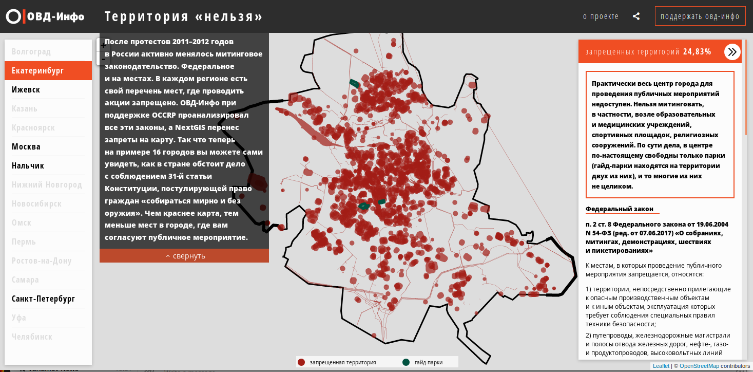
In a new project, together with OVD-info, we explore the official limits for public assembly space. 31 article of Constitution of Russia guarantees the right to assemble, but this right is limited by series of federal and regions legislation. The legislation varies from city to city and we’d like to see how the whole ‘assembly not allowed area’ looks like and calculate it’s size.
Jump to the result: “Territory of ‘Not Allowed’“
The project was conceived and initiated by OVD-info, it’s team also provided the analysis of legislation. NextGIS helped prepare the data and put it on the map. The project was supported by OCCRP.
Analytical results are available in a story by Kommersant.ru.
Here we will talk in a little more detail about technical side of things, detailed methodology is also available.
Preparation. The analysis of legislation allows to structure all restrictions as a list of types of objects. Each of them has a restricted zone around them.
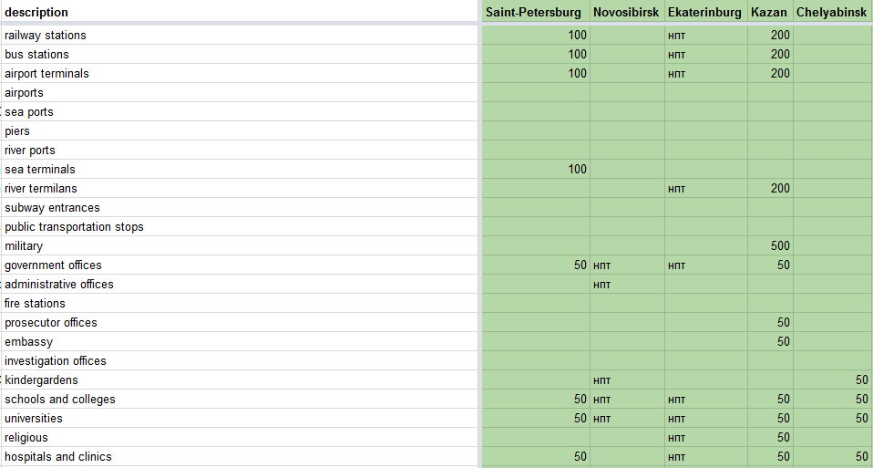
Each of 16 cities in the table is a column of values showing: a) does the restriction exist?, b) how big the restricted area is (if 0, the area equals object itself, if value > 0 then the object is buffered with a specified size, c) in a special case, when number is not specified, but “the restricted area surrounding the object” it is mentioned, the maximum value across all regions is used.
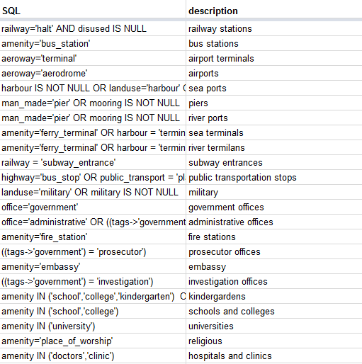
Each type of objects has also an associated SQL-query that allows to extract all features of this type from OpenStreetMap. OpenStreetMap is a global volunteer mapping project with very good detail that makes our project possible. We’re running a service that periodically extracts and structures OpenStreetMap data for later convenient queries.
Calculations. Number of Python scripts that:
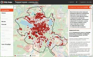
And finally publication. Given the high requirements we opted out to user vector tiles. A special package (Github) builds vector tiles set that are later uploaded to final “Territory of ‘Not Allowed’“ Web map.
Stay tuned for more updates. We’re planning to improve data, publish more cities and more.


