We released a new version 0.16 for QuickMapServices (QMS) – a QGIS plugin for simple adding and managing of basemaps as layers.
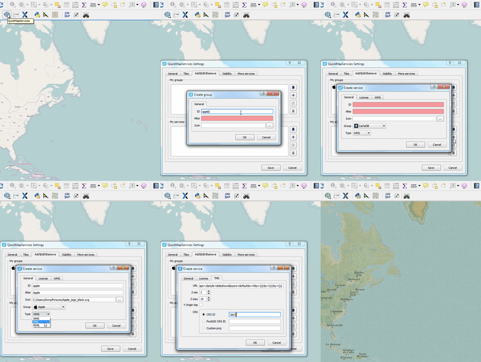
The main feature of the new version is the easy-to-use form for quick adding of your own groups and basemaps.
If you want to add a new group/basemap go to Settings -> Add\Edit\Remove. Here you can create a brand new basemap from the scratch, or use some of the existing ones as an example.

In case you want your basemap to appear in the public list of services, follow the steps described in this manual.
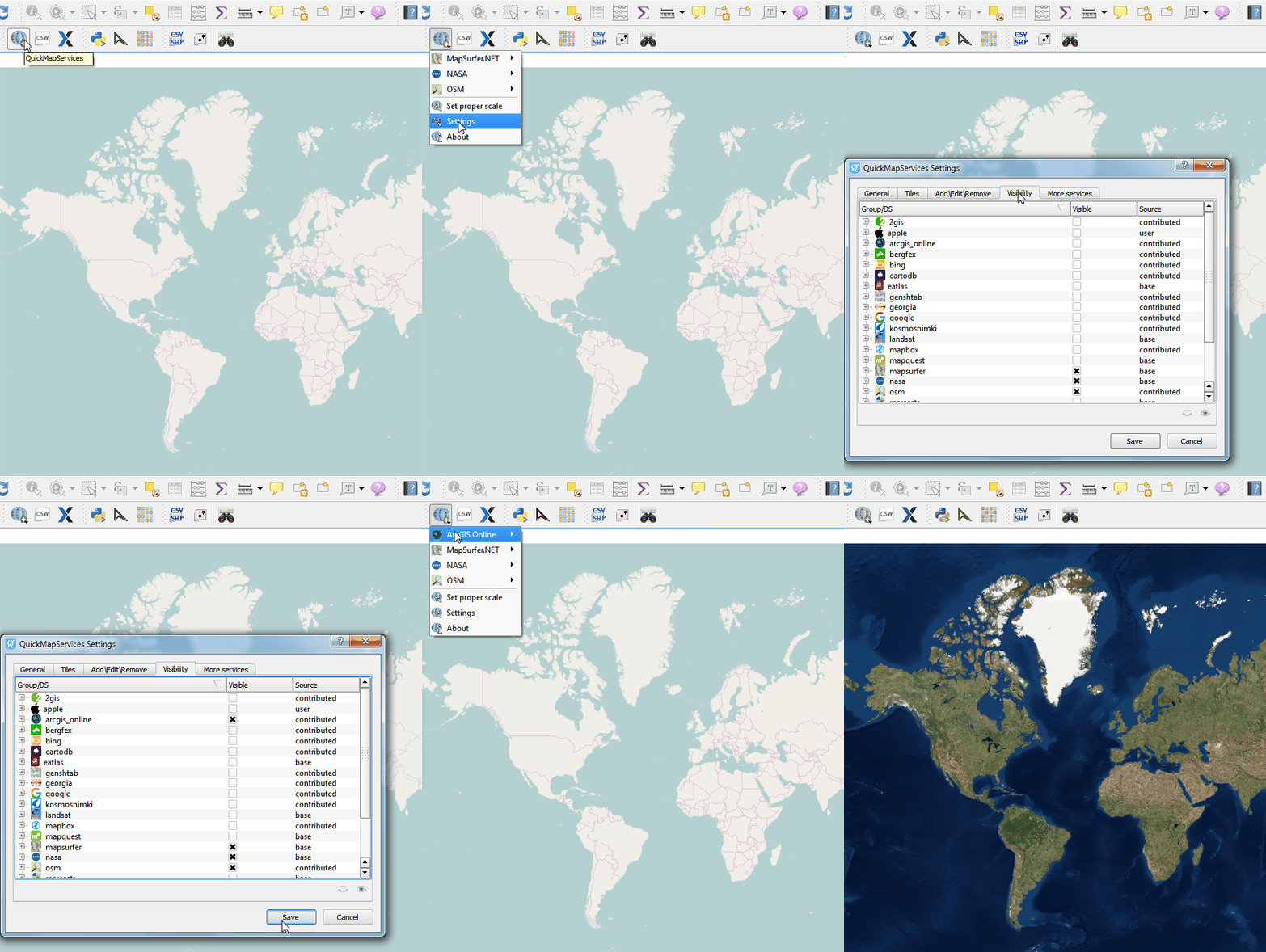
The second most important news about the new version of QMS is that now you can easily manage map services’ visibility, i.e. you can turn on/off any groups and basemaps. It became a necessity given the increased number of data sources added to QMS.

In the visibility dialog window you can also check which services are provided by plugin authors (Base), which are added by other QMS users (Contributed), and which are available only for you (User).
There are also some additions to the list of basemaps available from QuickMapServices:
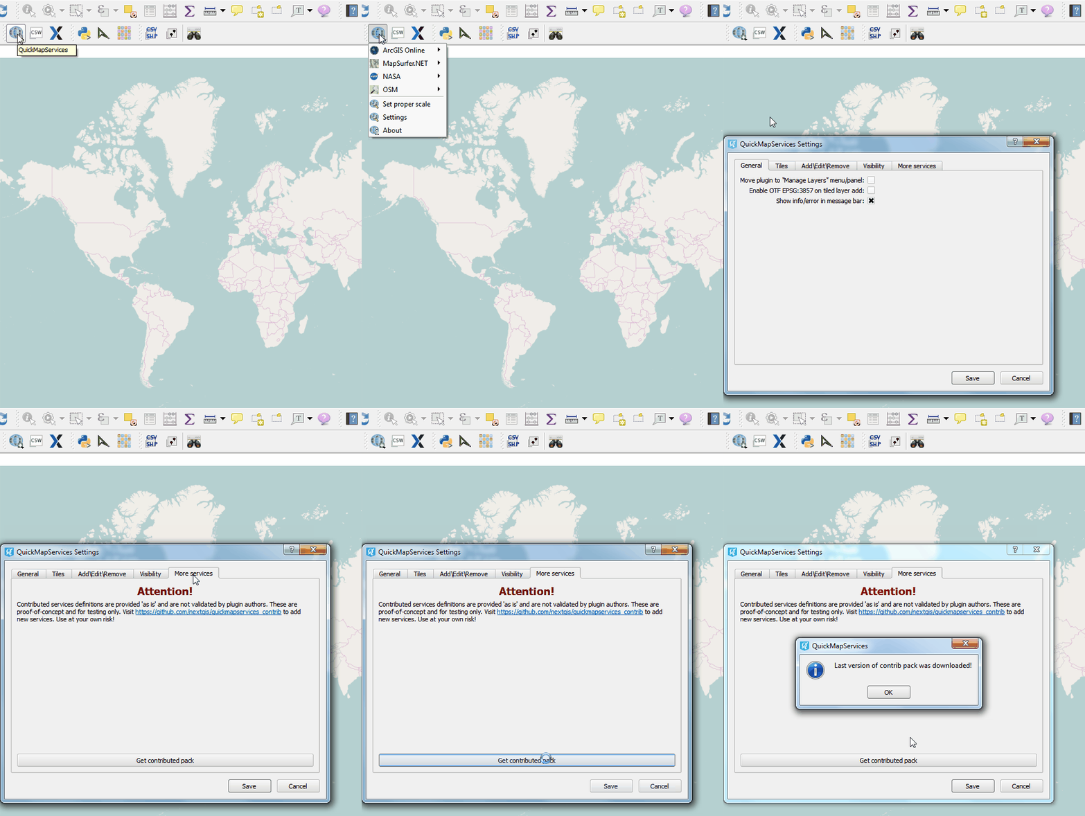
You can add many new services to your system by pressing “Get contributed pack” button in “Settings -> More services”.

New version also provides some bugfixes, including a loading error for users with non-ASCII characters in their names, and fix for a problem with getting contributed services for some of the Windows users.
Let us know what you think and keep sharing great basemaps!
2 Responses to QMS: simple basemaps management