QuickMapServices – from plugin to service for everyone

There are so many geodata services around. And we all want them to be available at the tip of our fingers, without having to memorize URLs, parameters, etc.

Almost two years ago we rolled out QuickMapServices (QMS) – a new handy QGIS plugin with a dozen preset basemaps, easily expandable to three times more by downloading a contributed pack.

QMS for QGIS was downloaded 130.000 times, but our vision for QMS has always been even more ambitious, so now we’re bringing you hundreds of geoservices! And not just basemaps but also WMS/WFS services and even simple server-hosted GeoJSON files.

Let’s take a closer look at what’s new.

qms.nextgis.com

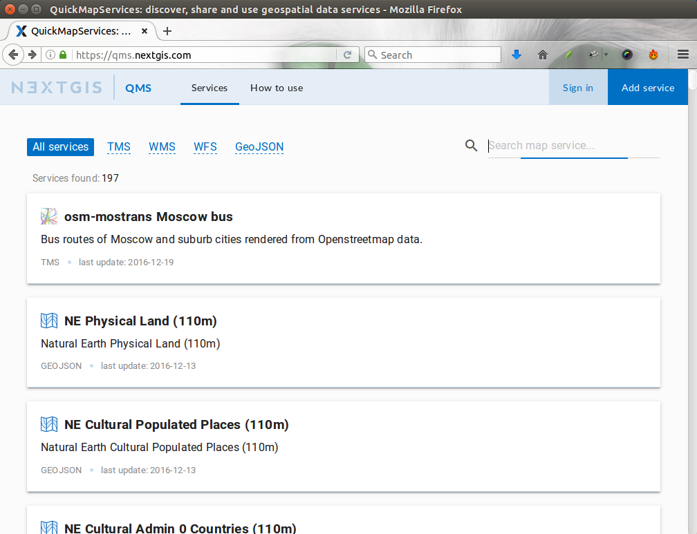
QMS now has its own website – qms.nextgis.com.

Here you can search for and browse through all available geoservices and check out their details, as well as add new ones and report problems. The website is a place to get important information about QMS.

But most importantly, the website is the place to ….

… add your service!

Github is not the best place to crowd-source data, and for a long time we wanted to simplify adding of new services.

From now on, to get your service available for everyone everywhere follow 2 simple steps:

  1. Register or log in
  2. Click ‘Add service‘ and fill a short form

That’s all! No waiting, no moderation. The service you’ve added will immediately become available wherever QMS API is supported (QGIS, NextGIS Mobile, nextgis.com, etc.).

New service will become ‘yours’ and you will be able to edit it in the future.

Public API

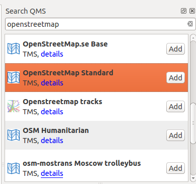
Do you develop applications where user would like to get access to dozens of different basemaps and/or other data services? QMS now has documented public API which provides access to all of its catalog.

For example, simple https://qms.nextgis.com/api/v1/geoservices/?type=tms request will get you all available basemaps.

QMS for QGIS

For a better support of new features we’re releasing next version of QuickMapServices QGIS plugin. This is a relatively minor release but it includes some important features:

  1. New tool for Search QMS
    qms
  2. New improved services search list
    qms-search
  3. While search bar is empty, last 5 used services will be shown for quick accessqms-last5
  4. Thanks to MatzFan, QMS now supports custom tiling grids. Note that this support is experimental and we will continue polishing it, taking into consideration new QGIS abilities to render XYZ.

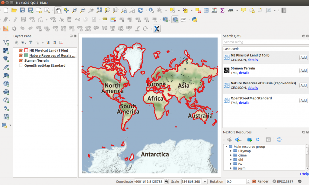
Check out the changelog for more information.

ArcQMS – QMS for ArcGIS

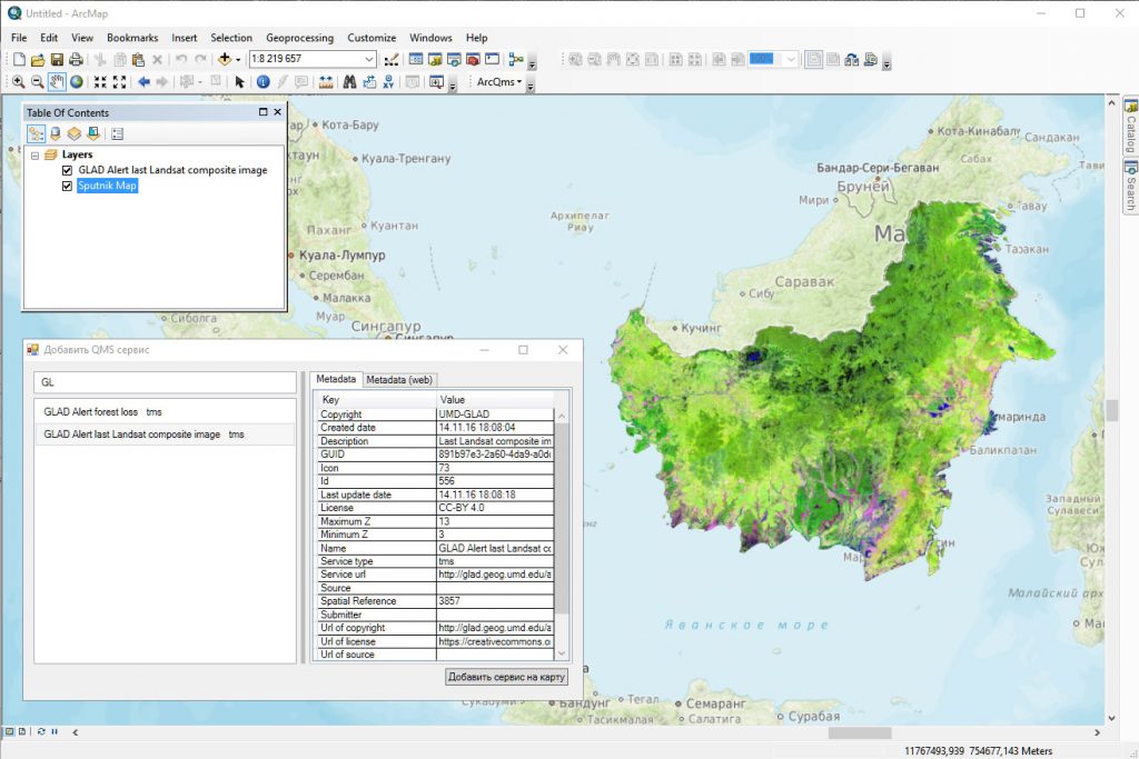
One of the question we’re often asked is how can we get something like QMS in Arc universe. Today we’re releasing ArcQMS – the plugin for ArcGIS that provides early support for some of QMS resources, namely TMS basemaps.

qms-arcqms

Overall, this is a big release for us and we hope you enjoy it.

Also, you can learn more about QuickMapServices from this presentation:

Let us know what you think and please contribute services!

12 responses to “QuickMapServices – from plugin to service for everyone”

  1. Zeev Stadler says:

    While most tile services provide base map tiles, which are not transparent by nature, some tile servers, such as ” Public Transport Lines – OV-Linien – openptmap.org” (https://qms.nextgis.com/geoservices/667/) provide transparent tiles.

    It would be useful to add information about tile transparency to the catalog and make this available using the API.

  2. louis says:

    Hi, is there a way to be able to use the code for google road map on a python plugin that loads layers as a basemap?

  3. Catalina Munteanu says:

    This plugin is great, thanks! I used it A LOT, and only now learned that it is NEXTGIS production 🙂
    One question: is there a way to find the date when the the imagery was aquired in Bing/Google/Yandex?
    Merci, Catalina

    • Hi Catalina, nice to hear from you. I’m glad QMS is working for you.

      Unfortunately QMS is not the tool to get image dates. It’s function is to connect user and services, it doesn’t know anything about actual content the service provides.

  4. Семен says:

    QuikMapservects не загружается . Выводит ошибку.Где скачать плагины?

  5. Soleiman says:

    Добрый день! как убрать из карты водяной знак API Key Required?
    Спасибо.

  6. Giuseppe Procino says:

    Hi,
    your plugin is wonderful. It’s work fine on qGIS 3.4 but I need it on ArcGIS too.
    I installed the plugin ArcQMS plugin on ArcGIS 10.2.2 and windows 10 but when I search and add a services the image of layer is always blank.
    Could you tell me please the sw requirement for use this plug-in? Which versions of ArcGIS and Windows are supported?

    thank you in advance.
    Giuseppe P.

  7. ZAAG says:

    I didn’t fin google satellite can you help me

  8. ZAAG says:

    I didn’t find google satellite can you help me plse